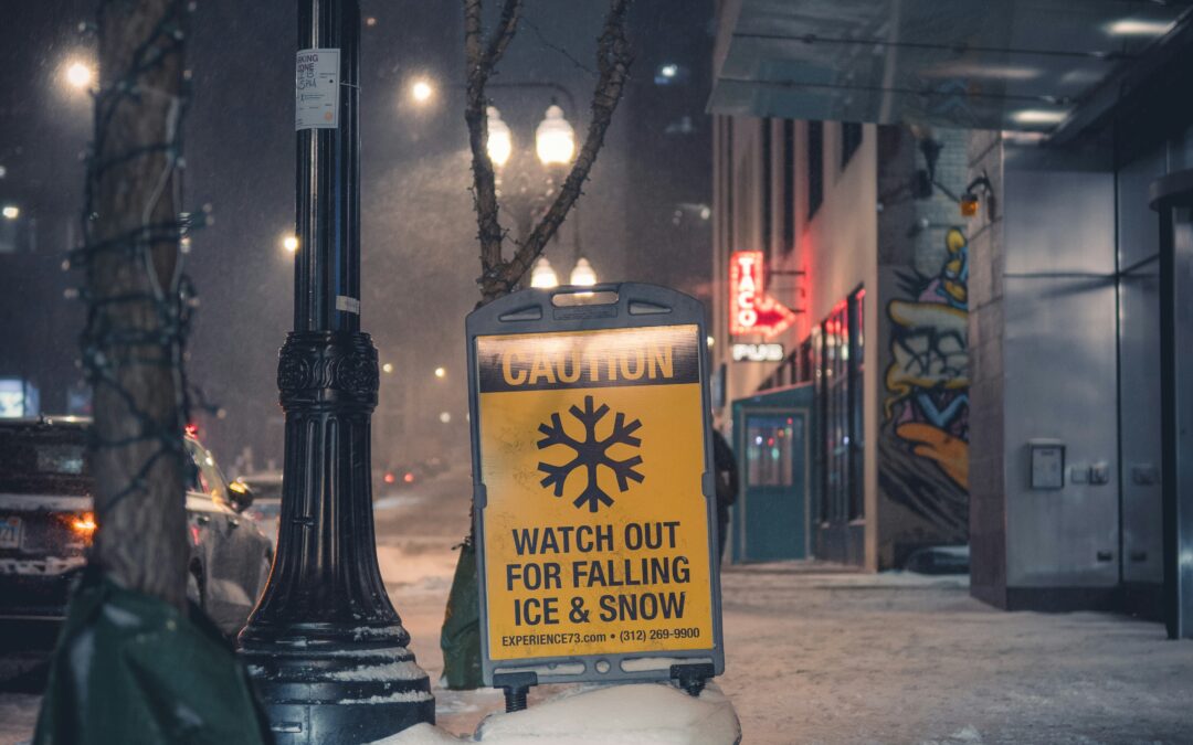
Meteorology Expert Witness Pennsylvania: Slip and Fall Weather Documentation
Summary: This technical reference covers forensic meteorology methods for reconstructing ice, snow, and freezing precipitation at Pennsylvania slip-and-fall incident sites. It explains how ASOS, NEXRAD radar, and COOP data are combined to produce courtroom-ready weather evidence for premises liability cases, with Pennsylvania-specific station tables, radar coverage details, and a step-by-step workflow for causation and duty-to-clear analysis.
Why This Page Is the Technical Companion to Pennsylvania Slip-and-Fall Legal Articles
This page is written by a forensic meteorologist and focuses on the meteorological evidence layer that supports or challenges allegations about ice, snow, and freezing precipitation at incident locations.
This Forensic Meteorology Page Covers:
- How to reconstruct precipitation type, intensity, and timing at an incident site
- How to quantify uncertainty for Pennsylvania-specific terrain and radar coverage
- How to turn NCEI-archived data into courtroom-ready exhibits and expert opinions
If you are an attorney, paralegal, or claims adjuster handling a Pennsylvania slip-and-fall claim, this page explains the meteorological evidence layer that supports or challenges allegations about ice, snow, and freezing precipitation at the incident location and time. No other page currently in search provides this level of Pennsylvania-specific forensic meteorology detail for slip-and-fall cases.
Pennsylvania-Specific ASOS/AWOS Station Network
Automated Surface Observing Systems (ASOS) and Automated Weather Observing Systems (AWOS) are the primary sources of surface weather data for forensic meteorology in Pennsylvania. These stations report temperature, dewpoint, wind speed and direction, precipitation type and amount, visibility, cloud cover, and barometric pressure at regular intervals (typically every 1 minute for ASOS, with official METAR reports every 20 minutes or hourly).
Key ASOS/AWOS Stations for Pennsylvania Slip-and-Fall Cases
| Station ID | Location | County | Type | Elevation (ft) | Reporting Interval |
|---|---|---|---|---|---|
| KPHL | Philadelphia International Airport | Philadelphia/Delaware | ASOS | 36 | 1-min / METAR 20-min |
| KPIT | Pittsburgh International Airport | Allegheny | ASOS | 1,204 | 1-min / METAR 20-min |
| KABE | Lehigh Valley International Airport | Lehigh | ASOS | 393 | 1-min / METAR 20-min |
| KMDT | Harrisburg International Airport | Dauphin | ASOS | 310 | 1-min / METAR 20-min |
| KAVP | Wilkes-Barre/Scranton International | Luzerne | ASOS | 962 | 1-min / METAR 20-min |
| KERI | Erie International Airport | Erie | ASOS | 732 | 1-min / METAR 20-min |
| KUNV | University Park Airport | Centre | ASOS | 1,239 | 1-min / METAR 20-min |
| KIPT | Williamsport Regional Airport | Lycoming | ASOS | 529 | 1-min / METAR 20-min |
| KAOO | Altoona-Blair County Airport | Blair | AWOS-3 | 1,503 | METAR hourly |
| KJST | Johnstown-Cambria County Airport | Cambria | AWOS-3 | 2,284 | METAR hourly |
| KLNS | Lancaster Airport | Lancaster | AWOS-3 | 403 | METAR hourly |
| KRDG | Reading Regional Airport | Berks | AWOS-3 | 344 | METAR hourly |
| KMUI | Muir Army Airfield | Dauphin | ASOS | 489 | 1-min / METAR 20-min |
| KNXX | Willow Grove NAS/JRB | Montgomery | ASOS | 358 | 1-min / METAR 20-min |
ASOS stations are the gold standard for surface weather observations in legal proceedings because they are federally maintained, regularly calibrated, and archived by NCEI (National Centers for Environmental Information). Their 1-minute data can pinpoint the exact minute precipitation began, changed type, or ended, which is critical for establishing the “time to clear” element in Pennsylvania premises liability.
ASOS stations are concentrated at airports, which means coverage gaps exist in rural and mountainous areas. A forensic meteorologist must account for the distance and elevation difference between the nearest station and the incident site. For areas more than 15 miles from the nearest ASOS, supplemental data from NEXRAD radar and COOP observers becomes essential.
NEXRAD Radar Coverage for Pennsylvania Slip-and-Fall Cases
Pennsylvania is covered by multiple WSR-88D (NEXRAD) radars that provide reflectivity, velocity, and dual-polarization data. These radars are critical for slip-and-fall cases because they can detect precipitation type and intensity at locations between surface stations.
Primary NEXRAD Radars Covering Pennsylvania
| Radar ID | Location | County/State | Lat | Lon | Elevation (ft) | Primary Coverage |
|---|---|---|---|---|---|---|
| KDIX | Fort Dix area, Ocean County, NJ | Ocean County, NJ | 39.947 | -74.411 | 149 | Southeast PA, Philadelphia metro |
| KPBZ | Coraopolis, PA | Allegheny County, PA | 40.532 | -80.218 | 1,185 | Western PA, Pittsburgh metro |
| KCCX | State College, PA | Centre County, PA | 40.923 | -78.004 | 2,405 | Central PA, State College area |
Supplemental NEXRAD Radars
| Radar ID | Location | Coverage Area |
|---|---|---|
| KBGM | Binghamton, NY | Northeast PA (Scranton/Wilkes-Barre) |
| KDOX | Dover AFB, DE | Extreme southeast PA |
| KLWX | Sterling, VA | South-central PA (Gettysburg, Chambersburg) |
| KCLE | Cleveland, OH | Northwest PA (Erie area) |
| KBUF | Buffalo, NY | Northwest PA (Erie area) |
Radar Scan Rates and Data Resolution
WSR-88D radars complete volume scans at different rates depending on the Volume Coverage Pattern (VCP) in use:
- Precipitation mode (VCP 212, 215): Volume scan every approximately 4 to 6 minutes
- Clear-air mode (VCP 31, 32): Volume scan every approximately 10 minutes
All NEXRAD radars completed the dual-pol upgrade by 2013. Dual-pol variables (differential reflectivity ZDR, correlation coefficient CC, specific differential phase KDP) allow forensic meteorologists to distinguish between rain, snow, sleet, freezing rain, and mixed precipitation, which is often the deciding factor in Pennsylvania slip-and-fall cases involving the question of whether a surface was iced over or just wet.
Radar data can establish what type of precipitation was falling at the incident site, even if the nearest ASOS station is 20 or more miles away. For example, KDIX radar in Ocean County, NJ can show whether freezing rain was occurring over a Philadelphia parking lot at the time of a fall, even though KPHL (the nearest ASOS) may not have reported freezing precipitation due to the urban heat island effect.
Cooperative Observer Program (COOP) Network in Pennsylvania
The NWS Cooperative Observer Program supplements ASOS data with daily observations from trained volunteers across Pennsylvania. COOP stations report:
- Daily maximum and minimum temperatures
- 24-hour precipitation totals (measured at a standard observation time, typically 7:00 AM local)
- Snowfall and snow depth
- Weather phenomena (fog, thunderstorms, ice, frost)
COOP Station Density in Pennsylvania
Pennsylvania has one of the denser COOP networks in the United States, with stations in nearly every county. Key benefits for slip-and-fall analysis:
- Stations are located in communities, not just at airports, which reduces the distance-to-incident issue.
- Daily snowfall and snow depth measurements can confirm or refute allegations about accumulation amounts.
- Observations are archived by NCEI under the Global Historical Climatology Network-Daily (GHCN-Daily) dataset.
COOP data is daily, not hourly or sub-hourly. A COOP report showing 4 inches of snowfall in the 24 hours ending at 7:00 AM cannot, by itself, establish the timing of that snowfall within the day. For timing, radar and ASOS data are required.
NWS Weather Forecast Offices Covering Pennsylvania
Three NWS Weather Forecast Offices (WFOs) provide forecast, warning, and observation services for Pennsylvania:
| WFO | Location | Pennsylvania Coverage |
|---|---|---|
| CTP (State College) | State College, PA | Central PA (largest geographic area) |
| PBZ (Pittsburgh) | Moon Township, PA | Western PA |
| PHI (Mt. Holly) | Mt. Holly, NJ | Eastern PA (Philadelphia metro, Lehigh Valley) |
WFO forecast discussions, hazardous weather outlooks, and winter storm warnings are archived and can be used to establish whether a property owner should have been aware of incoming weather. If WFO CTP issued a Winter Weather Advisory for Centre County 12 hours before a slip-and-fall incident, this supports the argument that the property owner had constructive notice of hazardous conditions.
Additional data source: Upper-air (rawinsonde) observations from KPBZ (Pittsburgh) and KLWX (Sterling, VA) provide vertical temperature profiles that are critical for determining precipitation type (rain, snow, sleet, freezing rain) at incident locations, particularly in transitional weather events common in Pennsylvania’s variable terrain.
Pennsylvania-Specific Weather Patterns Relevant to Slip-and-Fall Cases
Pennsylvania’s geography creates distinct weather patterns that a forensic meteorologist must understand when reconstructing conditions at an incident site.
Elevation and Temperature Gradients
- The Allegheny Plateau (western and central PA) sits 1,500 to 3,000 or more feet above sea level.
- The Delaware Valley (southeastern PA) sits below 200 feet.
- Temperature differences of 10 to 15 degrees Fahrenheit between Pittsburgh and Philadelphia are common during winter precipitation events, meaning rain in Philadelphia can be freezing rain or snow in the Poconos or Laurel Highlands.
Lake-Effect Snow
- Erie County and northwest PA receive lake-effect snow from Lake Erie.
- Lake-effect bands are narrow (sometimes 10 to 20 miles wide) and can produce heavy snowfall in one location while a town 15 miles away gets nothing. Radar data (KCLE, KBUF) is essential for documenting lake-effect events.
Freezing Rain and Ice Storms
- The I-81 corridor through central PA is particularly prone to freezing rain when warm air overruns cold air trapped in the valleys.
- Ice storms can produce surface icing with little or no measured precipitation at the nearest ASOS station if the station’s heated tipping bucket melts freezing rain on contact.
- Dual-pol radar variables (particularly ZDR and CC) are the best tools for identifying freezing rain at locations away from surface stations.
Nor’easters and Coastal Storms
- Eastern PA (Philadelphia metro, Lehigh Valley, Poconos) is affected by nor’easters that can produce heavy snow, sleet, and freezing rain.
- The rain/snow line in nor’easters often sets up across eastern PA, meaning precipitation type can change over short distances.
- NWS WFO PHI archives and KDIX radar data (Ocean County, NJ) are the primary evidence sources for these events.
- Find Services and Expert Meteorologist Witness Provide
Applying the Data: Causation and Duty-to-Clear Analysis
For a forensic meteorologist working a Pennsylvania slip-and-fall case, the analysis typically follows this workflow:
- Step 1: Establish the Weather Timeline
Using ASOS 1-minute data, NEXRAD radar, and COOP observations:- When did precipitation begin at the incident location?
- What type of precipitation was falling (rain, snow, sleet, freezing rain)?
- When did precipitation end?
- What were the temperature and dewpoint at the incident time?
- Was there a freeze/thaw cycle that could have produced black ice?
- Step 2: Determine Property Owner’s Notice Period
- How many hours before the incident did precipitation begin or temperatures drop below freezing?
- Were NWS warnings or advisories in effect?
- Was the weather event foreseeable based on publicly available forecasts?
- Step 3: Assess “Reasonable Time to Clear”
Pennsylvania municipalities have varying snow-removal ordinances. For example:- Philadelphia requires property owners to clear sidewalks within 6 hours after snowfall ends.
- Pittsburgh requires clearing within 24 hours.
- Allentown requires clearing within 10 hours.
A forensic meteorologist can establish when snowfall ended at the incident location, which starts the duty-to-clear clock.
- Step 4: Quantify Uncertainty
- Report the distance from the nearest observation point to the incident site.
- Account for elevation differences and their effect on precipitation type and temperature.
- State confidence levels (high, medium, low) based on data density and consistency.
Data Acquisition and Quality Control
Primary NCEI Data Products
- Integrated Surface Database (ISD): ASOS/AWOS METAR and 1-minute data
- GHCN-Daily: COOP station daily summaries
- NEXRAD Level-II and Level-III archive: Full-resolution radar data
- Local Storm Reports (LSR): NWS-verified reports of significant weather events
Quality Control Procedures
A forensic meteorologist must document:
- Station distance and elevation relative to incident site
- Data completeness (were there any missing observations during the relevant period?)
- Instrument maintenance records (if available)
- Cross-validation between independent data sources (e.g., does the ASOS temperature trend match the radar-indicated precipitation type?)
- Any corrections or adjustments applied to the data
Limitations and Uncertainty in Forensic Weather Reconstruction
No forensic weather reconstruction is perfect. Honest limitations include:
- Station vs. site conditions: ASOS stations measure conditions at the station, not at the incident site. Microclimates (urban heat islands, shaded areas, parking garage entrances) can produce conditions different from the nearest station.
- Radar beam height: At 50 or more miles from a radar, the beam may be sampling precipitation at 5,000 or more feet AGL, which may not represent what is reaching the ground (e.g., snow aloft melting to rain before reaching the surface).
- Observer-dependent COOP data: While NWS trains observers, human error in measurement is possible.
- Freezing-on-contact phenomenon: Supercooled rain hitting a surface below 32 degrees F cannot always be detected by instruments that measure air temperature, because surface temperatures may differ from air temperatures by several degrees.
These limitations do not invalidate the analysis. They require a qualified forensic meteorologist to quantify uncertainty and communicate it honestly to the trier of fact. Opposing counsel will probe these limitations, and a well-documented uncertainty framework strengthens rather than undermines the expert opinion.
Pennsylvania Modified Comparative Negligence and Weather Evidence
Pennsylvania follows a modified comparative negligence rule with a 51% bar. A plaintiff can recover damages as long as the plaintiff’s negligence is not greater than 50%. This means weather evidence is often decisive:
- If a forensic meteorologist can show that hazardous conditions existed for only 30 minutes before a fall, and the municipality’s ordinance allows 6 hours to clear, the property owner may have a strong defense that they acted reasonably.
- Conversely, if conditions existed for 12 or more hours with no clearance effort, the weather timeline supports the plaintiff’s case.
The forensic meteorology report directly informs the duty-to-clear analysis, the foreseeability argument, and the timeline of constructive notice. Precise weather documentation is therefore not merely background information; it is often the pivotal evidence that determines liability allocation.
ASCE 7-22 Standard for Weather-Related Structural Loads
While primarily relevant to structural engineering, ASCE 7-22 (Minimum Design Loads and Associated Criteria for Buildings and Other Structures) provides ground snow load data and ice thickness maps for Pennsylvania that can be relevant in slip-and-fall cases where structural ice or snow shedding from roofs contributes to hazardous walking conditions.
Forensic meteorologists reference ASCE 7-22 when the question is whether an accumulation on a walkway resulted from direct precipitation or from snow/ice sliding off an adjacent structure. This distinction affects how liability is allocated between the property owner, the building designer, and any snow-removal contractor.
Frequently Asked Questions: Forensic Meteorology for Pennsylvania Slip-and-Fall Cases
- What is the most important data source for a Pennsylvania slip-and-fall weather case?
- ASOS 1-minute data from the nearest station is typically the most important because it provides the highest temporal resolution for precipitation onset, type, and cessation. However, a complete analysis always combines ASOS, NEXRAD radar, and COOP data to cross-validate findings.
- How close does the nearest weather station need to be to the incident site?
- There is no fixed rule, but generally: ASOS data within 10 miles of the incident site is considered highly representative. Between 10 and 25 miles, the meteorologist must account for terrain and elevation differences. Beyond 25 miles, radar data and COOP stations become critical supplements. A qualified forensic meteorologist will always report the distance and explain how it affects confidence.
- Can radar data prove it was freezing rain and not just rain at a specific location?
- Yes, with caveats. NEXRAD dual-polarization variables (ZDR, CC, KDP) can distinguish between rain, snow, sleet, and freezing rain within the radar’s coverage area. However, radar shows what is happening in the atmosphere, not necessarily at ground level. The meteorologist must combine radar data with surface temperature observations to determine whether precipitation was freezing on contact with surfaces.
- How far back can weather data be retrieved for Pennsylvania locations?
- NCEI archives ASOS data going back to the 1990s for most Pennsylvania stations, with some records extending further. NEXRAD Level-II data is available from the mid-1990s. COOP records often extend back 50 to 100 or more years for established stations. For most slip-and-fall cases (which typically involve events within the last 2 to 5 years), complete data is readily available.
- What does a forensic meteorology report cost for a Pennsylvania slip-and-fall case?
- Costs vary by case complexity, but a typical slip-and-fall weather reconstruction involving one incident date and location generally ranges from $2,000 to $5,000 for a comprehensive written report. Expert witness testimony (deposition and trial) is billed at an hourly rate. Contact Weather and Climate Expert LLC for a case-specific estimate.
- Which NEXRAD radar covers the Philadelphia area?
- KDIX, located in the Fort Dix area of Ocean County, NJ, is the primary NEXRAD radar covering the Philadelphia metropolitan area and southeast Pennsylvania. Its proximity (approximately 30 miles northeast of Philadelphia) provides excellent low-level radar coverage for detecting precipitation type and intensity across the Philadelphia metro, Delaware Valley, and southern Lehigh Valley.
Request a Pennsylvania Slip-and-Fall Weather Reconstruction
For Pennsylvania-specific premises liability, slip-and-fall, or weather-related claims, attorneys and claims professionals can request a forensic meteorology consultation. Nationwide services available.
Phone: 901-283-3099
Email: [email protected]
Website: weatherandclimateexpert.com