Why Your Weather App Might Be Wrong: The Truth About Weather Forecasting
By John Bryant, AMS Certified Meteorologist | 30 years forecasting experience | Based in Memphis, TN | Available Nationwide
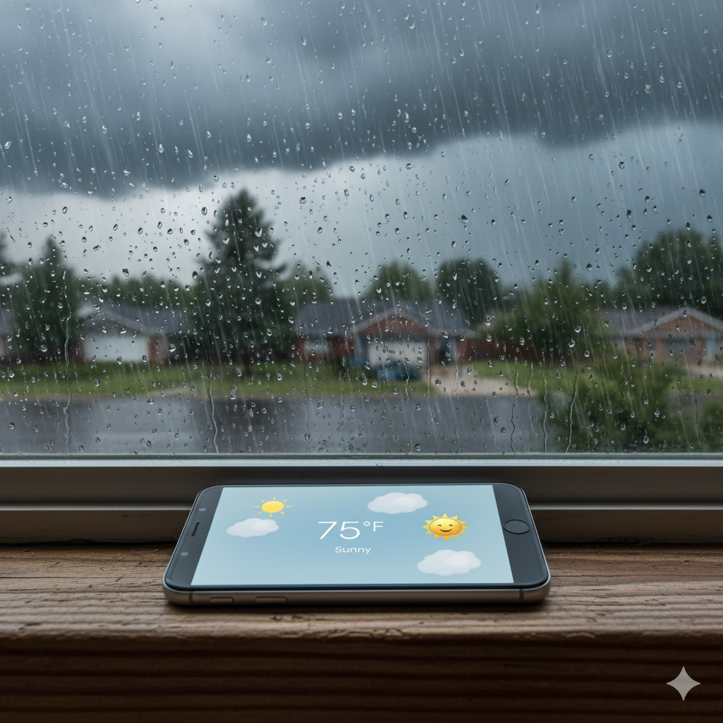
You check your weather app before heading out. It says clear skies all morning. Twenty minutes later, you’re caught in a downpour with no umbrella.
This happens to millions of Americans every single day. From New York to California, Florida to Washington, weather apps miss the mark far more often than most people realize. It’s a gap that can create significant liability in legal disputes.
So what’s going on? Why do these sophisticated apps get it wrong so often? And more importantly, how can you get forecasts you can actually trust?
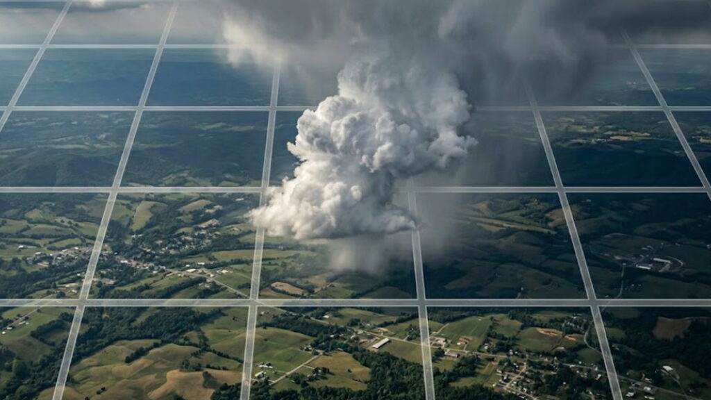
The Point-Forecast Problem: Why Apps Miss Your Location
NOAA data confirms that modern 5-day forecasts capture general regional patterns with approximately 90% accuracy. Seven-day forecasts achieve roughly 80% accuracy for predicting overall weather trends.
But this accuracy drops dramatically when zoomed in to a specific address at a specific time.
The gap lies in spatial resolution. Weather apps rely on interpolated data, smoothing out differences between weather stations that might be 10-20 miles apart.
PRO TIP! Why “Wrong” Apps Are a Legal Liability: If a weather app can’t get today’s forecast right, it certainly can’t be used to reconstruct a past event for a $10M lawsuit. In high-stakes cases like wildfire litigation, “close enough” is a losing strategy.
Read on to find out how fire weather reconstruction should be presented to attorneys.
For a user standing in a specific parking lot, the “30% chance of rain” prediction for the county doesn’t help if a pop-up thunderstorm is hovering directly overhead.
Professional meteorologists don’t just look at the smoothed average. We examine raw radar returns, individual station observations, and atmospheric soundings to see what’s happening between the grid points. That’s the fundamental difference between a general forecast and forensic weather reconstruction.
How Weather Apps Actually Work
To understand why apps fail at the local level, you need to know what’s happening behind the scenes.
Weather apps, at their core, rely on output from massive computer models that crunch data from satellites, ground stations, and radar systems. Some services layer on additional post-processing or human meteorologist adjustments, but the foundation is always automated model output.
These numerical weather prediction models process billions of data points. Satellites measure temperature and moisture levels. Ground stations track local conditions. Radar detects precipitation.
The challenge is that global forecast models run on fixed cycles. The GFS (Global Forecast System) and European model (ECMWF) both run four times daily at 00Z, 06Z, 12Z, and 18Z. However, not all runs are equal — the 00Z and 12Z cycles are the primary runs, producing full-length forecasts out to 10–16 days, while the 06Z and 18Z runs are shorter supplementary cycles extending only 3–6 days. The 00Z/12Z runs also tend to be more skillful because they incorporate more upper-air balloon observations. Each model run takes hours to complete and distribute. By the time the data reaches your app, the atmosphere may have already changed.
Different apps refresh at different intervals. Some pull from NOAA’s National Digital Forecast Database (NDFD) which can update as frequently as every 30 minutes for short-range forecasts, though longer-range elements update less often. Others may refresh every few hours depending on their data agreements and infrastructure. But regardless of refresh rate, all apps are fundamentally limited by the model cycle timing and the spatial resolution of the underlying forecast grids.
Weather apps prioritize broad coverage and automated delivery over pinpoint precision. They use smoothed model output rather than direct surface observations from specific weather stations. This works fine for deciding whether to bring an umbrella, but it’s inadequate when reconstructing conditions for a specific location and time, like determining whether ice was present at a building entrance at 6:47 AM on a particular date. Learn how forensic meteorologists use NOAA ASOS, METAR, and NCEI station data for court-admissible weather reconstruction.
Four Reasons Apps Get It Wrong
1. They Can’t Handle Sudden Changes
Weather models are sophisticated, but they struggle with rapid atmospheric shifts. A model might predict clear skies in Atlanta based on the 06Z model run. But if storm clouds roll in from the Gulf by 10 AM, the model won’t reflect that change until the next cycle completes and distributes.
The lag between observation, model processing, and app delivery means you’re often looking at a forecast that’s already outdated by the time you check it.
2. Model Resolution Limitations
Global models operate at varying resolutions. The GFS distributes output at approximately 28 km grid spacing (despite a finer 13 km native computational resolution), while the ECMWF high-resolution forecast runs at 9 km resolution. This means that weather features smaller than these grid spacings simply don’t exist in the model output. A thunderstorm cell 5 kilometers wide, for instance, wouldn’t show up in GFS output at all.
High-resolution regional models like HRRR (High-Resolution Rapid Refresh) run at 3-kilometer spacing and update hourly with 18-hour forecasts, plus extended 48-hour forecasts four times daily — capturing much finer detail. However, not all apps incorporate HRRR data, and even 3-kilometer resolution still smooths over neighborhood-scale variations.
For forensic reconstruction, we often need station-specific observations with sub-kilometer precision, not grid-averaged model output.
3. They Miss Microclimates
Even the best forecast models can’t capture hyperlocal effects. Your specific neighborhood might experience conditions that differ from what any model predicts for your general area.
Apps treat locations within a region similarly. They can’t account for:
- Valley temperature inversions
- Urban heat islands
- Coastal sea breezes
- Mountain wind patterns
- Lake effect zones
These hyperlocal factors can mean the difference between rain and sunshine at your exact address.
A weather app showing 0.1 inches of rain for “Memphis” might average data across a 10-mile radius. But in legal cases (insurance claims, accident reconstruction, construction disputes), you need to know conditions at a specific address at a specific time, not the general area.
4. No Human Judgment
Apps can only recognize statistical patterns they were trained on. When the atmosphere does something unusual or unexpected, apps can’t adapt.
A trained meteorologist would spot the signs of an unusual setup and adjust their forecast accordingly. An app just displays whatever the model output says, even when it doesn’t make sense given current conditions.
Apps give you data. They don’t interpret it. That’s the fundamental difference.
Where Apps Struggle Most: Regional Blind Spots
Automated algorithms struggle with complex terrain where microclimates rule. If your situation involves conditions in these regions, consider consulting professional meteorological analysis rather than relying solely on app data:
| Region | Common Forecast Challenges |
|---|---|
| Gulf Coast (FL, LA, TX, MS, AL) | Sea breeze thunderstorms develop in minutes, often invisible to global models until they appear on radar. Localized flooding happens faster than models predict. |
| Appalachia (WV, VA, NC, TN, KY) | Valleys and ridges create massive temperature variances over short distances that grid-based models smooth over. Mountain terrain causes huge differences between valleys and ridges. |
| Great Lakes (MI, OH, NY, PA, WI) | Lake-effect snow bands are incredibly narrow (often less than 5 miles wide). An app can show “cloudy” while you’re in a whiteout. Shoreline areas see wildly different conditions than inland locations. |
| Great Plains (KS, OK, NE, SD, ND) | Thunderstorm timing is notoriously difficult. Models often get the timing wrong by several hours even when they correctly predict storms will occur. |
| Mountain West (CO, WY, MT, ID, UT) | Elevation dictates precipitation type. One side of the street (upslope) can be raining while the other is dry. Downslope winds create rapid temperature changes models can’t capture. |
| Southwest Desert (AZ, NM, NV, Southern CA) | Monsoon thunderstorms develop quickly with little model warning. Dust storms (haboobs) appear with minutes of notice, developing faster than model cycle times can capture. |
If you live in a region with complex terrain or microclimates, it’s even more important to check multiple sources and understand your local weather patterns. Our Tennessee-based practice specializes in Mid-South weather patterns for legal cases across the region.
What Professional Meteorologists Do Differently
So how do human forecasters achieve superior location-specific accuracy when apps are limited by spatial resolution and model cycles?
They know their regions intimately. A meteorologist working in the Southeast understands how the Appalachian Mountains channel cold air. They know when sea breeze interactions will trigger afternoon thunderstorms. They’ve watched thousands of similar weather patterns unfold.
They use multiple data sources. Instead of relying on a single model, meteorologists compare output from 5-10 different models. They check radar, satellite imagery, and surface observations in real time. They look for agreement and understand where each model tends to excel or fail.
They recognize when models are wrong. Sometimes the current atmospheric setup doesn’t match what the models are predicting. An experienced meteorologist can spot these situations and adjust the forecast based on what the atmosphere is actually doing right now.
They communicate uncertainty. Instead of giving you a single temperature like “High: 78°F”, meteorologists explain confidence levels. They’ll tell you “Most likely 75-80°F, but could reach 82°F if clouds clear earlier than expected.”
This human element is impossible to automate. Apps can’t think. They can’t adapt. They just display model output. Unlike app algorithms, professional meteorologists hold certifications from the American Meteorological Society (AMS), understand atmospheric physics, and can provide expert testimony that meets court standards for scientific evidence.
How to Use Weather Apps Smarter
You don’t need to abandon weather apps completely. You just need to use them smarter.
Check Multiple Apps
Never rely on just one app. Compare forecasts from three different sources. Look for agreement. When all three apps show similar weather, you can be more confident. When they disagree significantly, be skeptical and check additional sources.
Use Apps with Human Input
The Weather Channel and AccuWeather employ professional meteorologists who adjust automated forecasts. These services tend to perform better than purely automated apps.
Local TV station apps can also be excellent because meteorologists at those stations understand your specific area’s weather patterns.
Understand Your Local Patterns
Pay attention to how weather actually behaves in your neighborhood. Do afternoon thunderstorms always develop over the same part of town? Does your valley stay foggy longer than surrounding areas? Does wind from a certain direction always bring rain?
Your observations over time become a valuable supplement to app forecasts.
Know What Apps Do Well
Apps work fine for:
- Current conditions
- General trends for the next few days
- Tracking large weather systems
- Rough planning for casual activities
Apps struggle with:
- Precise timing (within 1-2 hours)
- Exact locations (street-level accuracy)
- Rapidly changing conditions
- Microclimate effects
- Unusual atmospheric setups
The Historical Data Problem
Most weather apps only store 7-30 days of history. After that, the data is gone. For situations that emerge months or years after an event, you need permanent archives maintained by NOAA’s National Centers for Environmental Information (NCEI).
Weather apps typically can’t provide:
- Station metadata and equipment calibration records
- Quality control flags and data validation documentation
- Chain of custody documentation
- DOC-certified data with verifiable provenance
When You Need More Than an App
For everyday decisions, apps are fine. But some situations call for professional analysis.
For Everyday Planning:
- Planning outdoor events (weddings, parties)
- Scheduling construction work
- Making agricultural decisions (planting, spraying, harvesting)
- Planning extended outdoor activities (hiking, camping trips)
- Operating weather-sensitive business operations
For Legal & Insurance Matters:
Weather app screenshots face significant authentication and reliability challenges as evidence. While technically possible to authenticate in some circumstances, app data typically lacks the chain of custody, quality control documentation, and verifiable provenance that courts expect for scientific evidence.
Professional forensic meteorology provides:
- Slip-and-fall premises liability: Documented ice, standing water, or visibility conditions at specific times
- Vehicle accident reconstruction: Rain intensity, fog density, wind gusts verified by multiple stations
- Insurance claim disputes: Wind speeds, hail size, flood depths from certified observations
- Construction delay claims: Weather condition verification against contract thresholds
- Property damage verification: Storm intensity confirmation from multiple data sources
- Workplace exposure claims: Heat index, wind chill, or precipitation documentation
Professional weather reconstruction uses NOAA ASOS/AWOS stations, NCEI certified records, NWS radar data, and expert analysis that provides the documentation and scientific rigor typically required in legal proceedings.
Frequently Asked Questions About Weather App Accuracy
Why are weather apps often inaccurate?
Weather apps rely on automated computer models with inherent limitations in spatial resolution and update cycles. They can’t account for sudden weather changes, local microclimates, or unusual atmospheric conditions. Apps also treat all locations within a region similarly, missing street-level variations that affect actual conditions.
Which weather app is most accurate?
No single app is consistently most accurate across all situations. The Weather Channel and AccuWeather tend to perform well because they combine automated models with input from professional meteorologists. For best results, compare forecasts from 2-3 different apps and look for agreement.
How accurate are weather forecasts?
NOAA data shows 5-day regional forecasts achieve approximately 90% accuracy and 7-day forecasts reach 80% accuracy for general weather patterns. However, this accuracy drops significantly for point-specific forecasts at exact addresses, especially in areas with complex terrain or microclimates.
Should I trust my weather app?
Weather apps work well for general planning and current conditions. For critical decisions like outdoor events, travel safety, or construction scheduling, consult multiple sources and consider getting a professional meteorologist’s analysis for important situations.
Why do different weather apps show different forecasts?
Different apps use different weather models and data sources. The European Centre model (ECMWF) is widely regarded as the leading global forecast model across most time ranges. The United States excels with high-resolution regional models like HRRR (3-kilometer spacing, hourly updates) that capture local details better than global models. Apps that incorporate different model combinations will show different forecasts.
Are weather app screenshots reliable for legal matters?
Weather app screenshots face significant authentication challenges in legal proceedings. They typically lack chain of custody documentation, quality control records, and verifiable provenance. For legal matters, courts generally expect certified observations from NOAA/NCEI archives, METAR/ASOS station reports, and expert analysis with documented methodology.
The Bottom Line
Weather apps are convenient tools, but they’re far from perfect. Understanding their limitations helps you use them more effectively.
Remember that apps are showing you automated model output with inherent spatial and temporal limitations. They lag behind rapidly changing conditions, miss local effects, and can’t adapt when the atmosphere does something unusual.
For casual planning, apps work fine. For anything important, check multiple sources and consider the limitations we’ve discussed. And when precision matters, especially for legal documentation or critical business decisions, professional meteorological reconstruction provides the accuracy and documentation you need.
Weather forecasting is part science, part art. Apps handle the computational science well. But they miss the interpretive art, the local knowledge, and the ability to recognize when something doesn’t add up. That’s where human expertise makes all the difference.
About the Author
John Bryant is a forensic meteorologist with 30+ years of specialized experience in weather analysis, reconstruction, and expert witness testimony. He holds triple certification from the American Meteorological Society (AMS), the National Weather Association (NWA), and the Environmental Protection Agency (EPA) — one of the few meteorologists worldwide to hold all three concurrently.
Mr. Bryant holds a B.S. in Geosciences with an emphasis in Meteorology and Atmospheric Science from Mississippi State University. He previously served as Chief Meteorologist at an ABC affiliate station in Memphis for over a decade and has collaborated with a NOAA team to audit and refine AI-driven weather models.
Need Expert Weather Analysis for Your Case?
Use the contact form below or email me for a free case review.
Forensic Meteorology Resources
Weather Data & Research:
- National Oceanic and Atmospheric Administration (NOAA)
- National Weather Service
- National Centers for Environmental Information
Professional Organizations:
- American Meteorological Society
- AMS Professional Development
- National Weather Association
- SEAK Experts – Forensic Meteorology
Academic Programs:
About The Author
John Bryant is a distinguished forensic meteorologist with 30+ years of specialized experience in weather analysis and reconstruction, as well as expert witness testimony. He holds the rare global distinction of triple certification by the American Meteorological Society (AMS), the National Weather Association (NWA), and the Environmental Protection Agency (EPA). He is recognized as one of the few meteorologists worldwide to hold all three certifications concurrently, a credential that underscores his unmatched expertise in forensic weather reconstruction and regulatory compliance.
Mr. Bryant provides authoritative expert testimony and forensic weather reconstruction for high-stakes litigation on behalf of both defense and plaintiff. He has created meteorological reports used to support legal arguments at deposition and trial, and he has served as a pivotal expert in wrongful death and personal injury cases on both sides, where his foundational meteorological analysis shaped legal strategies and case outcomes. His expert report in a two-million-dollar case involving extreme weather conditions resulted in a favorable settlement for the client.
He consults closely with legal teams to translate complex atmospheric data into clear, accessible narratives that help judges and juries understand how weather conditions affected specific facts in a case. His ability to communicate technical weather science in plain language is central to the value he brings to litigation support.
Mr. Bryant holds a B.S. in Geosciences with an emphasis in Meteorology and Atmospheric Science from Mississippi State University. He previously served as Chief Meteorologist at an ABC affiliate station in Memphis for over a decade, where he directed a professional meteorological team and worked with regional emergency management services during severe weather events, including hurricanes, tornadoes, and winter storms. He has also collaborated with a NOAA team to audit and refine AI-driven weather models, conducting rigorous assessments of predictive technologies for weather sensitive sectors.