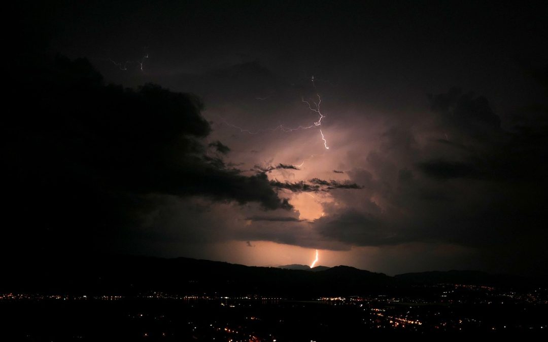
I have been watching the computer models today and a complex situation is developing in the Mid-South.
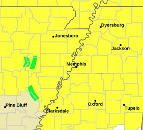
A TORNADO WATCH IS IN EFFECT FOR THE COUNTIES BELOW UNTIL 1 AM. IF YOU ARE HAVING TROUBLE SEEING THE MAP, IT’S ESSENTIALLY EVERY COUNTY IN THE MID-SOUTH.
TIMING: TWO ROUNDS OF STORMS
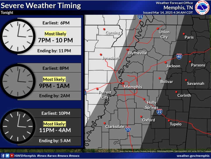
ROUND ONE: TONIGHT (FRIDAY)
- When: Developing after sunset and continuing overnight
- Where: Most likely across West Tennessee and Northeast Mississippi
- Threats: Tornadoes (some potentially strong), large hail, and damaging winds
- REMEMBER TORNADOES ARE RARE, IF YOU ARE PREPARED THERE IS NO NEED TO BE SCARED.
ROUND TWO: SATURDAY
- When: Starting in the morning and continuing through the afternoon
- Where: North Mississippi and West Tennessee
- Threats: All severe hazards (tornadoes, hail, winds) PLUS flash flooding
- Rainfall: 2-5 inches possible in some areas, with isolated higher amounts
WHAT MAKES THIS SITUATION DANGEROUS?
I’m concerned about several factors that make this storm system particularly threatening:
- Overnight Storms: The first round will occur after dark when tornadoes are more challenging to spot
- Powerful Wind Energy: Powerful winds at different levels of the atmosphere (what meteorologists call “wind shear”) will help storms organize and rotate
- Training Storms: Saturday’s storms may repeatedly move over the same areas (“training”), leading to flash flooding concerns
- Strong Surface Winds: Even outside of thunderstorms, winds could gust up to 40 mph along the Mississippi River
- Warm, Humid Air: Plenty of moisture and unstable air will fuel these storms
AREAS OF GREATEST CONCERN
The National Weather Service and Storm Prediction Center have placed parts of our region under elevated risk levels:
- Moderate Risk (Level 4 of 5): Parts of Northeast Mississippi for Saturday
- Enhanced Risk (Level 3 of 5): Much of the region for both Friday night and Saturday
HOW TO PREPARE
- Multiple Alert Methods: Ensure you have numerous ways to receive warnings, especially overnight (weather radio, phone alerts, local TV)
- Safe Place: Identify your safe place – a basement or interior room on the lowest floor away from windows
- Emergency Kit: Have flashlights, batteries, charged phones, and other essentials ready
- Travel Plans: Consider adjusting any travel plans, especially for Saturday
- Flooding: Remember – never drive through flooded roads! “Turn Around, Don’t Drown”
To find a meteorology expert witness for insurance and legal disputes, you can click here.
AFTER THE STORMS
Good news! Dry weather returns Sunday through Tuesday, with cooler temperatures Sunday before warming back to the low to mid-70s by Tuesday.
STAY UPDATED
This is a complex and potentially dangerous weather situation that could change. Pay attention to the skies and your mobile phones for alerts that could pop quickly. The best defense against severe weather is being prepared and staying informed!
You can also follow the National Weather Service on their website. https://www.weather.gov/meg/