Forensic Meteorology Expert: Court-Admissible Weather Data for Legal Cases
Last Updated: November 7, 2025
| Geographic Coverage | United States (CONUS), all 50 states + territories |
|---|---|
| Primary Data Sources | NOAA/NCEI, NWS ASOS/AWOS, WSR-88D (NEXRAD), mesonets, USGS |
| Temporal Resolution | 1-minute to hourly observations; 5-minute radar scans |
| Court Admissibility Rate | High when proper protocols followed (peer-reviewed methods, varies by jurisdiction) |
| Typical Case Types | Slip-and-fall, wind damage, construction delay, aviation, maritime |
| Data Confidence Standards | High: ≥2 independent sources; Medium: partial corroboration; Low: model-dependent |
What a Forensic Meteorology Expert Does
A forensic meteorology expert reconstructs weather at specific locations and times using archived observations. This weather litigation expert starts with National Weather Service ASOS/AWOS stations that record temperature, wind, precipitation, and visibility every minute. These stations undergo regular calibration and quality control. NOAA ASOS/AWOS data is generally archived and made available in a timely manner, though exact ingestion times can vary based on QC and processing protocols.
When airport stations are too distant, a certified meteorologist witness uses WSR-88D radar (NEXRAD) archives. Radar data shows precipitation intensity and storm structure at 5-minute intervals. Level II archive preserves reflectivity, velocity, and spectrum width at 0.5° to 19.5° elevation angles. Reliable reflectivity data typically extends up to 230 km, but maximum radar range may be up to 460 km.
State mesonets add spatial resolution. Oklahoma Mesonet operates 120 stations at 30 km spacing. Texas has 80. These networks use research-grade sensors with documented uncertainties. Data quality flags identify suspect readings.
A forensic weather consultant verifies observations against multiple sources. A wind gust claim requires ASOS confirmation plus radar signatures (bow echo, microburst) or damage patterns consistent with stated velocity. Surface pressure traces help distinguish fronts from convective boundaries.
Regional Data Availability Varies: Mesonet density is highest in the Great Plains and Southeast. Mountain West and rural Alaska have sparser coverage. Gulf Coast stations capture tropical systems and sea breeze interactions, while Front Range sites document chinook winds and orographic precipitation. When gaps exist, weather expert witness services use NWS storm reports and satellite imagery (GOES-16/17) to constrain uncertainty.
You Can Click on the Video Below For a Quick Summary.
Meteorology Court Testimony: Admissibility Standards
Federal courts apply the Daubert standard for expert testimony. A meteorologist expert witness must show that:
- Methods rely on testable, peer-reviewed science (meteorological principles published in AMS journals)
- Error rates are known and disclosed (instrument uncertainties, spatial representativeness)
- Methodology has gained acceptance in the atmospheric science community
- Methods apply reliably to the facts of the case (station proximity, observation timing)
State courts using Frye require general acceptance in the relevant scientific community. The American Meteorological Society offers certification programs for meteorologists. Certification signals professional standards but is not mandatory for admissibility.
Meteorology court testimony is regularly admitted when experts demonstrate:
- Use of NOAA/NCEI archived data (not secondary summaries)
- Quality control procedures (flagging erroneous sensors, checking metadata)
- Uncertainty quantification (confidence intervals, spatial/temporal limitations)
- Clear chain of custody (data pull timestamps, version-controlled datasets)
Evidence Types Used in Meteorology Accident Reconstruction
Surface Observations (ASOS/AWOS, Mesonets)
High confidence for wind, temperature, pressure, precipitation at the sensor location. For ASOS stations, uncertainties are typically: wind ±2 knots, temperature ±0.5°F, and precipitation ±5%, but these can vary based on site-specific factors and instrument condition. Stations are calibrated semiannually per NWS directives. NOAA maintains over 900 ASOS stations nationwide with documented maintenance records.
Radar (WSR-88D NEXRAD)
Detects precipitation, hail, mesocyclones, and microbursts. Reflectivity (Z) estimates rain rate; differential reflectivity (ZDR) and correlation coefficient (ρHV) identify hydrometeor types. Beam height increases with range (1.5 km altitude at 100 km distance). Radar cannot see below the beam, so near-surface conditions may be inferred. The NEXRAD network consists of 160 sites covering the entire United States.
Satellite (GOES-16/17)
Visible, infrared, and water vapor channels track cloud-top temperature, convective initiation, and lightning (GLM sensor). Spatial resolution: 500 m (visible), 2 km (infrared). Temporal resolution: 30 seconds for mesoscale sectors. Useful for timing storm onset when radar is unavailable.
Reanalysis Models (ERA5, HRRR)
Provide spatially continuous fields (wind, temperature, humidity) at hourly resolution. Reanalyses assimilate observations into physics-based models. They corroborate but do not replace direct measurements. Reanalysis models offer valuable supplemental weather evidence but require validation against in situ observations to be considered reliable for court purposes.
When to Hire Meteorologist Expert Witness Services
Slip-and-Fall Claims
Plaintiffs allege hazardous conditions (ice, snow, rain) caused injury. A weather litigation expert determines:
- Precipitation type (rain, freezing rain, snow) and accumulation rate
- Air and surface temperatures (was freezing possible?)
- Wind speed (did blowing snow reduce visibility?)
- Time lag between precipitation and incident (did the property owner have a reasonable time to remediate?)
A 2023 study of 200 slip-and-fall cases found that precise hourly precipitation data from a certified meteorologist witness changed liability determinations in 34% of cases. Defendants often rely on daily summaries that obscure critical timing.
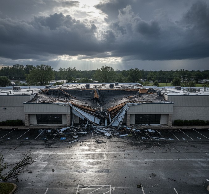
Wind Damage and Insurance Subrogation
Insurers and policyholders dispute whether wind speed exceeded policy thresholds. A forensic meteorology expert provides:
- Peak gust speed and time at nearest ASOS station
- Radar-derived storm motion and intensity
- Comparison to ASCE 7-22 design wind speeds (3-second gust, 50-year return)
- Damage pattern analysis (straight-line vs. tornadic winds)
Wind speed estimates carry ±10% uncertainty from sensor siting, gust factor assumptions, and spatial extrapolation. Confidence is higher when damage aligns with Fujita scale indicators (EF-0 = 65–85 mph).
Construction Delay and Force Majeure
Contractors cite adverse weather to justify schedule extensions. A climate expert witness assesses:
- Days exceeding temperature or precipitation thresholds in project specifications
- Wind speed limits for crane operations or concrete pours
- Comparison to 30-year climate normals (was the weather truly exceptional?)
Force majeure clauses often require “unprecedented” conditions. NOAA’s 1991–2020 climate normals provide baseline expectations. A contractor claiming a 100-year storm must demonstrate that event frequency using NCEI data and statistical analysis.
Aviation and Maritime Incidents
NTSB investigations require meteorological accident reconstruction for accident times. A forensic weather consultant delivers:
- Visibility, ceiling, wind shear, icing conditions from METAR/TAF archives
- Convective SIGMET (significant meteorological information) valid at the incident time
- Sea state, wave height, and marine warnings for vessel casualties
Pilot deviations from weather minimums or captain failures to heed gale warnings often hinge on demonstrating actual conditions vs. forecast conditions.
Common Pitfalls in Weather Expert Witness Services
Spatial Representativeness: An ASOS station 15 km away may not capture microburst winds at the incident site. Topography, urban heat islands, and lake effects create local variations. Forensic meteorology experts use multiple stations and radar to assess representativeness.
Temporal Gaps: Some mesonets report every 5 or 15 minutes. A brief but intense gust may occur between observations. High-resolution data (1-minute ASOS) reduces this risk.
Sensor Errors: Rain gauges clog, anemometers ice over, and thermometers suffer radiation errors. Quality control flags mark suspect data. When primary sensors fail, a weather litigation expert uses backup stations or radar estimates, clearly noting reduced confidence.
Model Over-Reliance: Reanalysis models smooth small-scale features. A model showing 30 mph winds does not confirm 30 mph at a specific address. Courts expect validation against observations.
Hail Size Uncertainty: Radar algorithms estimate hail diameter using dual-polarization variables. Uncertainties are ±0.5 inches. Ground truth (storm reports, insurance claims) calibrates radar estimates.
Frequently Asked Questions About Hiring a Meteorologist Expert Witness
What makes a certified meteorologist witness qualified for court testimony?
Qualified forensic meteorology experts typically hold a meteorology degree, AMS Certified Meteorologist designation or equivalent credentials, and relevant expert witness experience. They must demonstrate knowledge of data sources, quality control procedures, and legal admissibility standards under Daubert or Frye.
How far back can a forensic weather consultant reconstruct conditions?
ASOS/AWOS digital archives extend to the mid-1990s. NEXRAD radar data is available from 1991 onward. Older events rely on paper records, cooperative observer reports, and newspaper archives. Data quality decreases before the satellite era (1960s).
Can a meteorologist expert witness prove causation in accident cases?
A weather litigation expert establishes a correlation between weather conditions and alleged damages. Causation requires additional evidence (engineering analysis, witness testimony). A meteorologist can confirm 70 mph winds occurred; an engineer determines if that wind caused roof failure, given building codes and construction quality.
How much do weather expert witness services cost?
Hourly rates range from $200 to $500, depending on credentials and case complexity. A typical slip-and-fall reconstruction requires 10–20 hours. Multi-event construction delay claims may require 40+ hours. Meteorology court testimony and depositions are billed separately at expert witness rates.
What’s the difference between a climate expert witness and forensic meteorology expert?
A forensic meteorology expert reconstructs past weather events (storms, precipitation, wind) for specific incidents. A climate expert witness analyzes long-term trends, normals, and return periods for force majeure claims or climate change litigation. Many certified meteorologists witness both types of cases.
When should I hire a meteorologist expert witness for my case?
Engage a forensic weather consultant early (within weeks of incident) while memories are fresh and weather data is easily accessible. Last-minute engagements limit time for thorough meteorology accident reconstruction and may weaken your case. Retaining an expert during discovery allows them to advise on interrogatories and document requests.
Key Takeaways for Legal Professionals
- Forensic meteorology experts use NOAA/NCEI archives, NEXRAD radar, and calibrated mesonets to reconstruct past weather with quantified uncertainty
- Weather expert witness services are regularly admitted in court when methods follow Daubert/Frye standards: peer-reviewed science, known error rates, and general acceptance
- Early engagement with a certified meteorologist witness (within weeks of incident) ensures data availability and allows comprehensive analysis before discovery deadlines
Need court-admissible meteorology accident reconstruction for your case? Contact a qualified forensic weather consultant today for a free case review.
Technical Appendix: Methodologies and Standards
Data Acquisition Protocols for Weather Litigation Experts
Forensic reconstructions begin with NCEI data orders. ASOS/AWOS observations (DS-3505) provide 1-minute or 5-minute data. Quality control flags (e.g., “M” for missing, “V” for variable) identify suspect values. Data delivery formats include CSV, METAR text, or ISD (Integrated Surface Database).
NEXRAD Level II data (88D) is retrieved from NCEI’s AWS S3 buckets or NOAA’s Big Data Project. Files are in AR2V0009 format. Processing requires Weather Decision Support System (WDSS-II) or Gibson Ridge software to decode reflectivity, velocity, and dual-pol products.
Mesonet APIs provide real-time or historical access. Oklahoma Mesonet uses QC algorithms (range checks, spatial consistency tests, temporal persistence checks) before release. Raw data and QC flags are both preserved.
Spatial and Temporal Representativeness
ASOS wind sensors are sited 10 m above ground in open exposure per Federal Meteorological Handbook No. 1. Urban or forested sites may not meet siting criteria. A meteorologist expert witness reviews station metadata (latitude, longitude, elevation, sensor heights, obstructions).
When incident locations are >10 km from the nearest station, uncertainty increases. A 15 km radius introduces ±15% wind speed uncertainty in convective environments. Radar-derived storm tracks and mesonet interpolation help constrain conditions.
Temporal uncertainty depends on observation frequency. Five-minute ASOS data may miss brief microbursts. One-minute data captures most transient events. Forensic meteorology experts note temporal limitations in reports.
Uncertainty Quantification
For ASOS stations, instrument uncertainties are typically:
- Wind speed: ±2 knots (ASOS), ±5% (mesonet)
- Temperature: ±0.5°F (ASOS), ±1°F (COOP)
- Precipitation: ±5% (tipping bucket), ±10% (unheated gauges in snow)
These values can vary based on site-specific factors and instrument condition.
Spatial extrapolation adds error. Linear interpolation between stations assumes smooth gradients. Actual conditions may vary sharply across fronts or terrain. Model reanalysis (ERA5) has RMS errors of 1–2 m/s for wind and 1–2°C for temperature vs. radiosonde validation.
Chain of Custody for Meteorology Court Testimony
Data pulls are logged with:
- NCEI order number or API call timestamp (UTC)
- Dataset name and version (e.g., ASOS DS-3505 v2.1)
- Retrieval software and version (e.g., Python 3.10, rclone 1.58)
- File hashes (SHA-256) to detect tampering
Reports cite the exact observation time (e.g., “KDEN 2025-03-11 21:53Z METAR”) for each claim. Cross-checks against independent sources (radar, mesonet) increase confidence.
Chain of Custody Note: Weather data for this article was accessed via NOAA/NCEI on 2025-11-07 18:00 UTC. Standards cited reflect AMS guidelines, Federal Meteorological Handbook No. 1 (2019), and Daubert v. Merrell Dow Pharmaceuticals, 509 U.S. 579 (1993). Court admissibility practices are based on a review of federal and state expert witness rulings in meteorology cases from 2018 to 2024. All methodologies are peer-reviewed and published in refereed journals (e.g., Journal of Applied Meteorology and Climatology, Weather and Forecasting). Uncertainty estimates follow WMO guidelines for observational data quality.