How to Evaluate a Wind Damage Claim: A Forensic Meteorologist’s Methodology
A forensic meteorologist analyzing a wind damage claim uses radar, surface observations, and damage pattern review to evaluate whether the weather supports the alleged loss.
YOU CAN CHECK OUT FORENSIC METEOROLOGIST SERVICES HERE
How a Forensic Meteorologist Evaluates Wind Damage
| Analysis Element | Primary Data Source | Archive | Confidence |
|---|---|---|---|
| Surface wind reconstruction | ASOS and AWOS 1-min and 5-min observations | ncei.noaa.gov/access |
HIGH (when station representative) |
| Radar velocity aloft | WSR-88D Level II base and super-res velocity | ncei.noaa.gov/products/radar/next-generation-weather-radar |
HIGH (aloft); MEDIUM (surface inference) |
| Storm environment and shear | RAOB upper-air soundings (00Z and 12Z) | spc.noaa.gov/exper/soundings |
HIGH |
| Independent storm reports | NWS Storm Events Database and Local Storm Reports | ncei.noaa.gov/stormevents |
MEDIUM (spotter-dependent) |
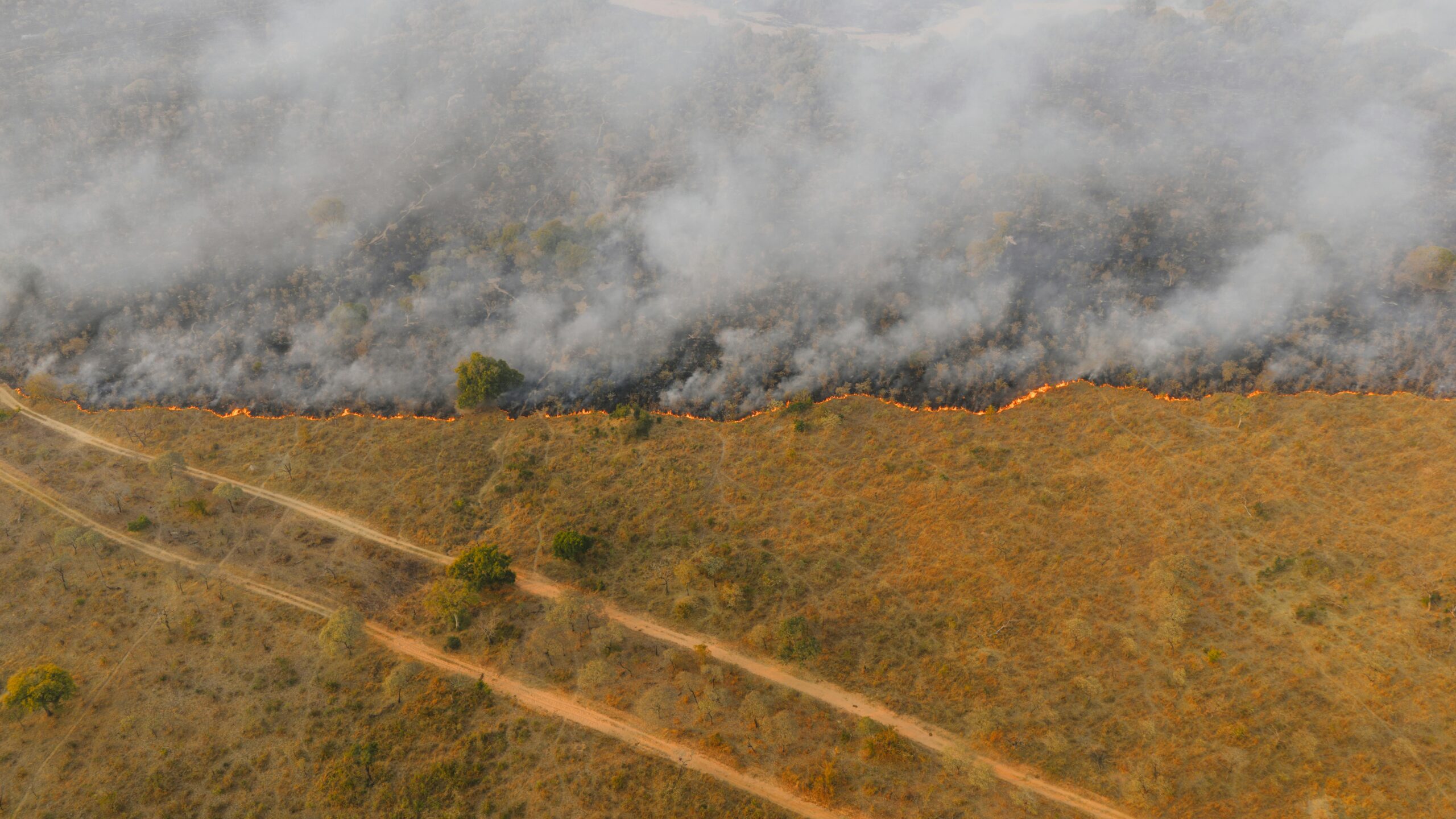
Wind damage claims present a persistent challenge in the property insurance market for one structural reason. Wind itself cannot be seen, preserved, or directly sampled at the point of loss after the fact. The atmosphere does not leave a fingerprint on the structure the way a fire or a flood does. Instead, the meteorologist must rely on the public meteorological record, which includes quality-controlled surface observations, calibrated Doppler radar, upper-air soundings, and post-event surveys, to reconstruct what the wind environment most likely looked like at the address and time in question.
This guide describes the structured methodology a qualified forensic meteorologist follows to evaluate wind damage claims for insurance professionals, attorneys, and adjusters. The methods reflect accepted forensic meteorology practice and have been presented in state and federal proceedings governed by Federal Rule of Evidence 702 and the Daubert trilogy.
The objective is not advocacy. The objective is to determine whether the meteorological record, integrated with the physical observations available from the site, supports or does not support a wind-related cause of loss. Mixed causation is common. Wind may be one factor among several, or the meteorological evidence may not support a wind-driven explanation at all. Coverage decisions remain a legal and contractual matter outside the meteorologist’s scope of opinion.
What a Forensic Meteorologist Provides, and What We Do Not
A forensic meteorologist’s role in a wind damage matter is bounded by atmospheric science. The work answers questions about what the weather was, where, and when. It does not extend to engineering questions about how a specific material or assembly should have performed under those conditions.
What the meteorologist provides
- A reconstruction of sustained wind and peak gust magnitudes at the loss address during a defined time window.
- Wind direction and the timing of major shifts, including front passage, gust-front arrival, and downburst impingement.
- Documented storm type and structure (squall line, supercell, mesocyclone, downburst, tropical system).
- Storm motion vector and the spatial footprint of the event.
- An uncertainty range tied to the available data and its representativeness for the address.
- A defensible chain of custody from the NOAA and NCEI archives to the final report.
What the meteorologist does not provide
- Opinions on manufacturer specifications or product ratings.
- Opinions on installation quality, workmanship, or maintenance.
- Engineering analysis of wind loads, fastener pull-through, or structural capacity.
- Opinions on whether the building code in effect was followed or sufficient.
- Coverage determinations under the policy.
This delineation matters in deposition and at trial. A forensic meteorologist who strays into engineering or coverage opinions invites a successful challenge under Federal Rule of Evidence 702. Keeping each expert in his or her own lane strengthens the case as a whole and protects the credibility of every opinion offered.
A Step-by-Step Methodology for Evaluating Wind Claims
The following workflow reflects accepted forensic meteorology practice and is designed to be transparent, reproducible, and defensible under cross-examination. Each step generates a documented work product that supports the eventual opinion.
-
Gather high-quality, representative meteorological data.
Begin with the most reliable and representative weather observations available for the loss area and time period. The goal is to assemble independent data streams that, when integrated, tell a consistent story about the wind environment.
- NWS ASOS and AWOS surface observations, including 1-minute and 5-minute archives where available.
- State mesonets and quality-controlled private weather stations within and surrounding the loss area.
- WSR-88D Level II data from the nearest NEXRAD site, including reflectivity, base velocity, spectrum width, and dual-polarimetric variables.
- NWS upper-air soundings from the nearest 00Z or 12Z launch site for environmental shear, instability, and storm-relative helicity.
- NWS Storm Events Database, Local Storm Reports, and Damage Assessment Toolkit surveys, where available.
ASOS station-placement caveat. ASOS stations are located at airports and may sit several miles from the loss site. In convective events with strong spatial gradients, such as rear-flank downdraft surges, microbursts, and narrow squall-line winds, that distance can be the difference between a representative reading and an unrepresentative one. The meteorologist must assess station exposure, distance, surface-roughness category, and timing before treating any observation as “the wind at the property.”
-
Reconstruct the wind field at the loss location.
Develop the best-supported estimate of wind conditions that affected the property during the claimed event. A defensible reconstruction integrates multiple independent data streams rather than relying on a single source.
- Integrate surface observations, radar signatures, and storm reports into a coherent timeline.
- Account for terrain, surface roughness category, building exposure, and shielding at the address.
- Estimate the most-likely range of sustained winds and peak gusts near the structure, with uncertainty stated.
- Document storm motion, gust-front passage timing, and any localized enhancements such as channeling or downdraft impingement.
Radar caveat. The WSR-88D measures radial velocities aloft, not at the surface. At a typical 0.5-degree elevation, beam center height above radar level is on the order of several hundred to several thousand feet at the relevant range from the radar, depending on geometry. Radar velocity data therefore cannot be read directly as “the wind at the property.” When properly combined with surface observations, storm-structure knowledge, and the radar beam-height equation, radar velocity can identify areas of stronger winds aloft and support the overall wind-field reconstruction.
In some cases, reconstructed winds at the property are materially lower than the alleged severity of the event. The magnitude of any such difference depends entirely on the event, storm type, terrain, and the availability and quality of nearby data. No general percentage should be assumed in advance.
-
Place the wind field alongside the documented physical evidence.
Meteorological analysis is most useful when presented next to the physical evidence observed at the site. The integrated review should:
- Compare the direction and distribution of damage to the documented wind field azimuth.
- Identify damage patterns that are difficult to reconcile with the storm’s timing, direction, or intensity.
- Note the presence or absence of typical wind-related indicators, such as debris transport direction and progressive failure along exposed surfaces.
- Flag patterns the meteorologist cannot tie to any documented atmospheric feature during the alleged loss window for separate engineering evaluation.
The goal is not to prove fraud or decide coverage. The goal is to determine whether the observed damage is consistent or inconsistent with the reconstructed wind environment. Mixed causation is common. Wind may be one factor among several, or the meteorological evidence may not support a wind-driven explanation at all.
Indicators That a Wind Claim May Not Be Supported by the Meteorology
Contested wind claims often share certain meteorological inconsistencies. These do not automatically imply fraud. Many contested claims arise from genuine ambiguity about causation. Each of the following warrants careful, individualized investigation rather than a categorical conclusion.
Meteorological inconsistencies
- Reconstructed wind speeds at the site are inconsistent with the alleged severity of the event. For example, surface observations and radar may show only routine gusts of 30 to 40 mph during a period the claim describes as a severe windstorm.
- The timing of significant meteorological features, such as cold fronts, squall lines, or mesocyclones, does not align with the alleged time of loss.
- Radar and surface data show minimal or no significant wind event at or near the address during the claimed period.
Pattern observations the meteorologist may flag
- Damage distribution that is difficult to reconcile with the documented wind direction or storm evolution.
- Highly selective damage where adjacent, similarly exposed surfaces show little or no impact.
- Patterns the meteorologist cannot tie to any documented atmospheric feature during the alleged loss window. Evaluation by an engineer or building science expert may be warranted.
Important. Complex storm environments, such as rotating winds, shifting gust fronts, downburst impingement, and channeling around terrain or large structures, can produce unusual damage patterns that are still meteorologically explainable. “Unusual” does not automatically mean “inconsistent.”
Timing and documentation concerns
- Claims filed long after the event with limited contemporaneous documentation of weather or damage.
- Inconsistent narratives about when damage was first observed relative to known weather events in the area.
Evidence Needed for a Defensible Wind Claim Evaluation
Meteorological documentation
Robust meteorological documentation is the foundation of any forensic wind analysis:
- NWS and other quality-controlled surface observations with timestamps.
- Doppler radar imagery and base velocity products for the event period.
- Atmospheric sounding data for storm environment, instability, and shear.
- NWS storm reports and Damage Assessment Toolkit surveys, accessible at
ncei.noaa.gov/stormevents.
Multiple independent data sources that tell a consistent story carry considerably more weight than any single station or radar product alone.
Site documentation provided by counsel or the claim file
The meteorologist presents the wind field alongside the physical record provided by the file:
- Before-and-after imagery where available, including aerial, satellite, or contemporaneous ground-level photographs.
- Clear, high-resolution photographs of damage and debris distribution.
- Documentation of when damage was first observed relative to known weather events.
The meteorologist addresses the weather component. Engineers, roofing contractors, and building science experts address material performance and installation. A coordinated approach across the right disciplines produces the most complete and defensible evaluation.
The expert analysis report
A well-prepared forensic meteorology report should:
- Describe data sources, methods, and limitations explicitly.
- Present a clear reconstruction of weather conditions at the site, with stated uncertainty.
- Provide a defensible statement of sustained wind, peak gust, wind direction, and timing during the alleged loss window.
- State whether the meteorological evidence supports or does not support a wind-driven explanation for the loss.
Coverage decisions and material-performance opinions remain outside the meteorologist’s scope. Engineers, building scientists, and counsel address those questions.
Application by Claim Type and Legal Context
Property insurance claims
For homeowners and commercial property policies, meteorological analysis can help determine whether wind conditions were plausibly present at the location and time alleged, distinguish between damage with a contemporaneous atmospheric explanation and damage without one, and establish a weather-event timeline relative to reported observations of damage.
Commercial and multi-location disputes
In larger commercial or multi-location claims, a forensic meteorologist can evaluate whether claimed losses at different sites are consistent with the storm’s documented spatial footprint, assess business-interruption claims tied to specific weather events, and identify locations where the meteorological record does not support the timing or scale of the claimed event.
Legal proceedings
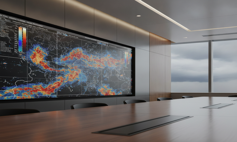
In litigation, the forensic meteorologist provides testimony grounded in sufficient facts or data, derived from reliable principles and methods, and reliably applied to the facts of the case. The December 2023 amendment to Federal Rule of Evidence 702 reinforced that the proponent of expert testimony bears the burden of demonstrating admissibility by a preponderance of the evidence. A transparent, well-documented, and reproducible forensic meteorology methodology supports that foundation. Demonstrative exhibits such as radar loops, surface observation plots, and storm timelines help communicate complex weather information to a court in clear, non-technical terms.
Common Pitfalls in Wind Claim Evaluation
Relying solely on distant or unrepresentative data. Using weather observations from distant airports without assessing their representativeness for the loss site undermines credibility. ASOS stations are airport-based and may not capture localized convective conditions affecting the property.
Ignoring terrain, exposure, and shielding effects. Wind speeds vary based on elevation, vegetation, surrounding building density, and nearby structures. Generic wind-speed comparisons without site-specific surface-roughness analysis appear incomplete and weaken the opinion.
Crossing into engineering opinions. The meteorologist’s lane is the atmosphere. Opinions about whether a specific roof, wall, or material should have failed at a given wind speed are engineering opinions and should be left to qualified engineers and building scientists. A meteorologist who opines on material performance invites a Daubert challenge.
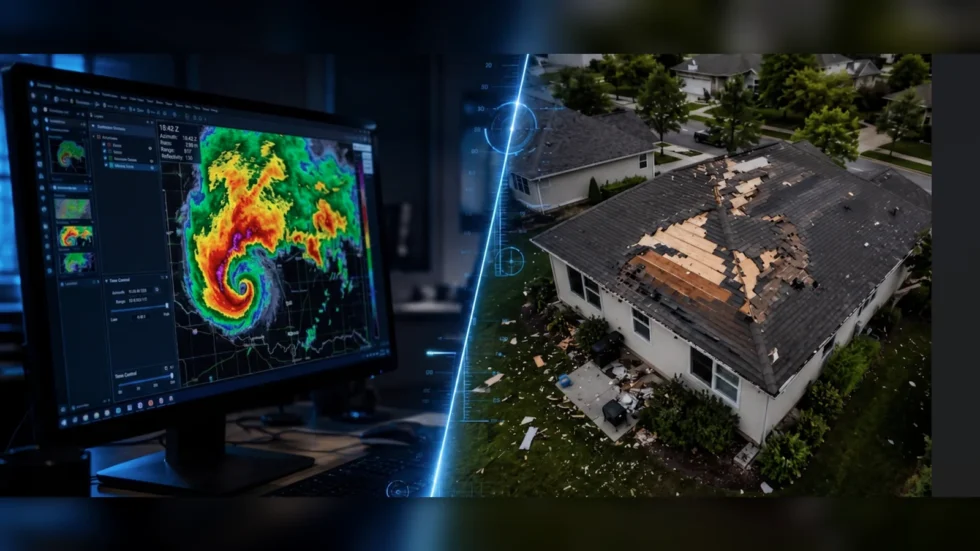
Treating radar velocity as a surface measurement. WSR-88D base velocity is a radial measurement aloft, not a surface wind. Reading radar velocity directly as “the wind at the property” is a methodological error that opposing experts will identify on cross-examination.
Stating opinions in absolute terms. Atmospheric reconstruction is inherently probabilistic. Opinions framed in absolute language, such as “definitively,” “could not have,” or “impossible,” are vulnerable to cross-examination. Confidence should be expressed in calibrated, defensible terms.
When to Engage a Forensic Meteorology Expert Witness
Large, complex, or disputed wind damage claims benefit from early expert involvement. Early engagement is particularly valuable when the reported damage appears severe relative to known weather in the area, when multiple storms or weather events could be implicated, or when there are significant inconsistencies between the claimed damage and the available meteorological record.
Early consultation, ideally within the first 30 days of the loss, supports better evidence preservation. It also allows the expert to evaluate real-time data products and ancillary records before some archival windows close. WSR-88D Level II data is archived long-term at NCEI, but certain real-time supplemental products and private network records have shorter retention.
Frequently Asked Questions
What evidence is most important when evaluating a wind damage claim?
Strong evaluations rely on a combination of high-quality meteorological data, clear documentation of the damage, and structured expert analysis. Weather data should be as local and representative as reasonably possible. Damage photography and records should allow the expert to relate the observed impacts to the reconstructed wind field. Multiple independent data sources that tell a consistent story carry the most weight.
How does a forensic meteorologist analyze a wind damage claim?
The process involves examining radar, surface observations, atmospheric soundings, and storm reports to reconstruct likely wind conditions at the specific location and time. The deliverable is an objective statement of sustained wind, peak gust, wind direction, and timing during the loss window. Whether those conditions were sufficient to damage a specific material is an engineering question evaluated by qualified engineers or building scientists.
What can a forensic meteorologist actually say about the wind speed at my property?
A forensic meteorologist can provide the most likely range of sustained winds and peak gusts at the address during the loss window, with stated uncertainty. The estimate is built from ASOS and AWOS observations, NEXRAD Level II radar, upper-air soundings, and the NCEI Storm Events Database. The meteorologist does not opine on whether those winds were sufficient to damage any specific material. That comparison is for engineers and building scientists.
Can a forensic meteorologist prove that wind damage did not occur?
A forensic meteorologist can determine whether the available weather evidence supports or undermines a claimed wind-related cause of loss. When the meteorological record shows no significant wind event at or near the address during the alleged time, or when the timing and direction documented in the data are inconsistent with the claimed damage, the meteorological evidence may not support the claim as presented. Meteorological analysis addresses the weather component and does not by itself resolve all legal or factual issues in a dispute.
What makes damage patterns inconsistent with the weather record?
Wind from a documented storm has a known direction, intensity range, and arrival time. Damage that is difficult to reconcile with that direction, intensity, or timing may not match the meteorological record for the alleged event. Complex storm environments can produce atypical patterns that remain meteorologically explainable, so each case requires individualized analysis.
Is radar data alone enough to establish surface wind speed at a property?
No. The WSR-88D measures radial velocities aloft, not at the surface. Beam center height increases with range, so even at the lowest 0.5-degree elevation tilt the radar samples the atmosphere hundreds to thousands of feet above the property at typical distances from the radar. Radar velocity is a powerful diagnostic when integrated with surface observations, storm-structure analysis, and the beam-height equation, but it is not a direct substitute for a near-site anemometer.
Technical Appendix: Data Sources
Surface observation networks (NOAA and NWS)
- ASOS and AWOS. Airport-based automated surface observing stations. 1-minute and 5-minute data archived at NCEI:
ncei.noaa.gov/access/search/data-search/global-hourly - NWS Cooperative Observer Program (COOP). Daily precipitation, temperature, and snowfall:
ncei.noaa.gov/products/land-based-station/cooperative-observer-network - State mesonets, including the Oklahoma Mesonet, West Texas Mesonet, and Iowa Environmental Mesonet:
mesonet.agron.iastate.edu
NEXRAD WSR-88D radar coverage examples
KNQA. Memphis, TN (Millington).KOHX. Nashville, TN (Old Hickory).KLZK. Little Rock, AR.KTLX. Oklahoma City, OK.KDGX. Jackson, MS (Brandon).KFWS. Dallas and Fort Worth, TX.- Level II archive:
ncei.noaa.gov/products/radar/next-generation-weather-radar
Upper-air sounding sites (RAOB)
72340. Little Rock, AR (LZK).72235. Jackson, MS (JAN).72357. Norman, OK (OUN).72327. Nashville, TN (BNA).- Archive:
spc.noaa.gov/exper/soundingsandweather.uwyo.edu/upperair/sounding.html
Legal standards
- Federal Rule of Evidence 702 (as amended December 1, 2023). Admissibility of expert testimony. The proponent bears the burden by a preponderance of the evidence.
- Daubert v. Merrell Dow Pharmaceuticals, Inc., 509 U.S. 579 (1993); General Electric Co. v. Joiner, 522 U.S. 136 (1997); Kumho Tire Co. v. Carmichael, 526 U.S. 137 (1999).
Chain of Custody: How a Forensic Meteorology Work Product Is Built
A defensible forensic meteorology opinion is built on a documented chain of custody from public data to final report. Each step is reproducible by another qualified meteorologist working from the same archived sources.
- Define the loss event window. Establish the date, address, and a defensible time bracket around the alleged loss.
- Identify representative observing assets. Locate the nearest ASOS or AWOS, mesonet, COOP, and WSR-88D site, with a station-representativeness assessment for each.
- Pull archived data. Retrieve NCEI Level II radar, ASOS 1-minute and 5-minute data, RAOB soundings, and NWS Storm Events records, with timestamps and access dates logged.
- Reconstruct the wind field. Integrate surface, radar, and sounding data with terrain and surface-roughness considerations.
- Place the wind field alongside the site evidence. Note alignment or non-alignment between the documented atmospheric conditions and the physical observations available from the file.
- Quantify uncertainty. State the most-likely range of sustained winds and peak gusts at the address, with rationale.
- Report and preserve work product. Archive data files, analysis worksheets, and graphics in a form available for production in discovery.
Top 3 Verified Facts
Fact 1.
A defensible forensic wind reconstruction integrates four NOAA data streams: ASOS and AWOS surface observations archived at the National Centers for Environmental Information, WSR-88D NEXRAD Level II radar, NWS upper-air soundings, and the NCEI Storm Events Database. All four are publicly archived and independently verifiable by another qualified meteorologist.
Fact 2.
The WSR-88D NEXRAD radar measures radial velocity aloft, not surface wind. At the standard 0.5-degree elevation tilt, beam center height increases with range due to Earth curvature and standard atmospheric refraction. Radar base velocity therefore requires integration with surface observations before it can support an inference about wind at a specific street address.
Fact 3.
The December 1, 2023 amendment to Federal Rule of Evidence 702 clarified that the proponent of expert testimony must demonstrate, by a preponderance of the evidence, that the proffered opinion meets the rule’s reliability requirements. The amendment was promulgated by the U.S. Supreme Court and went into effect under the Rules Enabling Act process.
Need help evaluating a wind damage claim?
Forensic meteorology analysis provides an objective, scientifically grounded assessment of the weather conditions relevant to your case, with experience presenting findings in litigation and complex claim environments. John H. Bryant serves plaintiff and defense counsel nationwide.
John H. Bryant, Forensic Meteorologist
☎ 901-283-3099
✉ [email protected]
weatherandclimateexpert.com