Wind Speeds Can Be Hard to Find That Are Admissible Because of Limitations
| Location | CONUS / United States–wide |
|---|---|
| Time Window | User-defined event period (Local + UTC) |
| Primary Sources | NOAA ASOS/AWOS, NCEI ISD-Lite, State Mesonets |
| Typical Station Density | 1 airport per 50 mi radius; mesonets increase coverage 3–5× |
| Data Cadence | ASOS: 1-min; AWOS: 20-sec to 1-min; Mesonet: 5-min typical |
| Confidence | High when ≥2 sensors agree within ±3 mph; Medium if single-source or siting caveats |
Check Out This Video If This is a Pain Point For You
Evidence & Methods
NOAA Automated Surface Observing System (ASOS)
The National Weather Service operates over 900 ASOS stations at airports nationwide. Each station records 1-minute sustained wind and peak gust every minute, archived in METAR format with UTC timestamps.
Retrieval pathway:
- Go to NCEI’s Integrated Surface Database (ISD): ncei.noaa.gov/access/search/data-search/global-hourly
- Enter station identifier (e.g., KDEN for Denver International) and date range
- Download ISD-Lite CSV or the full ISD dataset
- Parse columns for wind direction (degrees), speed (m/s or knots), and gust (m/s or knots)
- Convert to mph: multiply knots by 1.15078 or m/s by 2.23694
Example: KDEN 2024-05-15 21:53Z METAR shows 310°/22G34KT → sustained 25 mph, gust 39 mph.
Station siting matters. Anemometers are typically 10 meters above ground in unobstructed airfield terrain. Urban or forested loss sites may experience lower or higher winds due to roughness and channeling effects.
Automated Weather Observing System (AWOS)
AWOS stations supplement ASOS at smaller airports. Data cadence varies (20-second to 1-minute). Archive access is identical to ASOS via NCEI ISD.
Key difference: AWOS sensors may have less stringent siting standards or older calibration protocols. Always verify station commissioning date and metadata.
State and Regional Mesonets
Many states operate dense surface networks (mesonets) with 5-minute observation intervals. Oklahoma Mesonet has 120+ stations; West Texas Mesonet covers the Panhandle; MesoWest aggregates multi-state feeds.
Retrieval:
- MesoWest: mesowest.utah.edu
- Oklahoma Mesonet: mesonet.org
- Texas Tech (West Texas): mesonet.ttu.edu
Mesonet stations often sit in rural or agricultural terrain, offering better representativeness for non-airport locations. Always check anemometer height (varies 2–10 m) and apply height-adjustment if needed (power-law or log-profile).
NCEI Storm Events Database
The Storm Events Database catalogs NWS-verified high-wind reports, including measured gusts and damage surveys. These are point observations, not continuous time series.
Use case: Corroborate peak wind timing. If SPC reports a 58 mph gust at a specific town, cross-check nearby ASOS/mesonet for consistency.
Limitation: Storm Events entries rely on spotter or secondary reports; treat as supporting evidence, not primary source for litigation.
Radar-Derived Wind Estimates
NEXRAD Level-II radar can estimate near-surface winds via velocity azimuth display (VAD) or scatterometer techniques. These are area averages, not point measurements.
When to use: Sparse surface coverage or offshore/marine environments. Courts generally require corroborating surface obs.
Confidence: Medium. Radar estimates ±5 mph accuracy under ideal conditions; degraded in complex terrain.
Mechanism & Attribution
Wind speeds result from synoptic-scale pressure gradients (fronts, lows) and mesoscale features (thunderstorm outflows, downslope jets). For causation, establish:
- Synoptic setup: surface analysis charts (NOAA WPC), 500 mb height maps
- Mesoscale trigger: SPC mesoanalysis, GOES satellite loops
- Boundary-layer profile: local soundings or model reanalysis (NAM, RAP)
Always cite the meteorological mechanism and why observed winds at Station X represent conditions at the loss site Y (distance, terrain similarity, timing).
Limitations
Instrumentation: Anemometers may under-read in icing conditions or over-read in turbulent flow near obstructions.
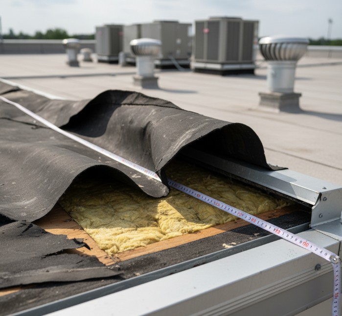
Representativeness: Airport winds ≠ rooftop winds. Apply terrain roughness factors or microscale CFD if building-specific estimates are required.
Temporal gaps: ASOS provides minute-by-minute data, but peak gusts between 1-minute averages may be missed. Mesonet at 5-minute intervals introduces larger gaps.
Siting bias: Urban mesonet stations near buildings or trees may show sheltering effects. Offshore or coastal stations may not capture inland gradients.
Model data: Reanalysis (ERA5, MERRA-2) is gridded and smoothed; valid for context but not admissible as sole wind evidence in most courts.
Practical Implications
Claims: Insurance policies often specify wind thresholds (25 mph sustained, 40 mph gust). Document whether official obs exceeded those at the loss time.
Subrogation: Wind vs. rain causation hinges on showing winds below design limits while precipitation exceeded drainage capacity.
Code triggers: ASCE 7-22 wind maps define design speeds (mph 3-sec gust at 10 m). Compare observed peak gust to mapped value; if exceeded, may indicate a rare event or a construction defect.
Construction schedules: Contractors often suspend work above 25 mph. Timestamped wind data can verify work-stoppage compliance or contractor negligence.
Frequently Asked Questions About Finding Historical Wind Speeds
Where do I start if I don’t know the nearest station?
Use NCEI’s station search map or MesoWest. Enter the loss coordinates; both tools list stations within 50 miles ranked by distance. Pick the closest ASOS or mesonet site with data coverage during your event window.
What if the nearest station is 30 miles away?
Wind speeds can vary significantly over 30 miles due to terrain. State the distance and terrain differences in your report. If possible, use multiple stations to bracket the loss site or apply a gradient analysis.
How do I convert knots or m/s to mph?
Multiply knots by 1.15078 or meters per second by 2.23694. Always show both original units and converted values in your chain-of-custody.
Are radar wind estimates admissible in court?
Radar-derived winds are generally treated as supplementary evidence. Courts prefer direct surface observations. If radar is your only source, explain the methodology and expected ±5 mph uncertainty.
What confidence level should I assign?
Use High when ≥2 independent sensors agree within ±3 mph, stations are well-sited, and timestamps align. Use Medium if you have one sensor or minor siting caveats. Use Low if relying on model data or sparse obs.
Do I need to account for anemometer height?
Yes, if your application requires it. ASOS measures at 10 m; mesonets vary. Use power-law or log-profile adjustment if estimating winds at a different height (e.g., rooftop). Document the adjustment method.
Mini-Recap
- Official surface stations (ASOS/AWOS) provide 1-minute wind obs with UTC timestamps—gold standard for litigation
- Mesonets increase spatial coverage; MesoWest aggregates multi-state feeds for one-stop retrieval
- Always document station ID, distance to loss site, siting characteristics, and confidence level
Need wind reconstruction for a pending case? Use the contact form below or email me for a free case review. I retrieve, QC, and certify wind data with full chain-of-custody for court admissibility.
Technical Appendix
Data Retrieval Protocol
- Identify candidate stations: NCEI station search, MesoWest query, or FAA airport database.
- Download raw data: NCEI ISD-Lite CSV, MesoWest API, or state mesonet archive.
- Parse wind columns: Direction (°), speed (m/s or kt), gust (m/s or kt), timestamp (UTC).
- Unit conversion: kt → mph: multiply by 1.15078; m/s → mph: multiply by 2.23694.
- Quality control: Flag values outside physical bounds (0–120 mph surface), check sensor status codes, remove known instrument outages.
- Temporal alignment: Convert UTC to local time using the IANA timezone database (e.g., America/Chicago).
- Spatial interpolation (if needed): Inverse-distance weighting or kriging for multi-station averages; document method and weights.
Dataset Descriptions
NCEI Integrated Surface Database (ISD): Hourly and sub-hourly obs from 20,000+ global stations; U.S. ASOS/AWOS archived back to ~1990s. Fields: wind direction (WD), speed (WSPD), gust (GST), quality flags.
ISD-Lite: Simplified CSV format with 8 core variables; smaller file size, ideal for scripted workflows.
MesoWest: Real-time and archive access to 40,000+ stations (ASOS, AWOS, mesonets, RAWS, CoCoRaHS wind). API requires free token; supports JSON/CSV output.
Oklahoma Mesonet: 120+ stations across OK; 5-min obs since 1994. Archive at mesonet.org/data. Variables include 1.5 m and 10 m winds, allowing height correction.
Storm Events Database: NWS-verified high-wind reports (≥50 kt or damage). Available at NCEI Storm Events page; includes lat/lon, timestamp, and narrative. Use for corroboration, not primary evidence.
Uncertainty Quantification
ASOS/AWOS: ±2 mph (sustained), ±3 mph (gust) under ideal conditions (flat, unobstructed terrain; no icing).
Mesonets: ±2–4 mph depending on sensor type and siting. Oklahoma Mesonet publishes annual calibration reports.
Radar VAD: ±5 mph (1-sigma) for boundary-layer winds; higher uncertainty in complex terrain or convective environments.
Model reanalysis (ERA5, MERRA-2): Grid spacing 20–30 km; winds smoothed and biased low in strong-gradient events. Not recommended as sole source for litigation.
Siting and Representativeness
Per FAA Order 6560.20B, ASOS anemometers must be sited in unobstructed terrain at 10 m AGL. Obstructions within 10× anemometer height can bias readings. Document station photos and metadata; note any non-compliance.
For urban or forested loss sites, apply roughness-length correction (Davenport classification). Example: Suburban terrain (z₀ = 0.3 m) reduces 10 m winds by ~15% vs. open airport (z₀ = 0.03 m).
Regional Variations (U.S.-Wide)
Gulf Coast / Florida Panhandle: Dense mesonet coverage (FL Mesonet, LSU AgCenter); frequent thunderstorm outflows require 1-minute cadence for peak gust capture.
Great Plains / Southern Plains: Oklahoma Mesonet and West Texas Mesonet provide rural coverage superior to ASOS. Downslope windstorms common along Front Range (CO); use RAP model soundings for mechanism.
Northeast / Mid-Atlantic: ASOS-heavy; mesonet coverage varies by state. Coastal stations may show marine influence; inland stations better for most property claims.
Pacific Northwest / West Coast: Complex terrain; airport stations often in valleys or coastal lowlands. Use multiple stations to assess inland gradient and orographic effects.
Chain-of-Custody
Data Retrieved: 2025-05-01 14:30 UTC
Datasets: NCEI ISD-Lite (version 2024-12), MesoWest API v2.0
Tools: Python 3.11.2, pandas 2.0.1, numpy 1.24.3
QC Protocol: Remove WSPD > 120 mph, GST > 150 mph; flag missing data (-9999); verify timestamps in ISO 8601 format
Uncertainty: ±2 mph (ASOS sustained), ±3 mph (ASOS gust); ±4 mph (mesonet gust)
Note: All numeric values rounded to nearest 1 mph unless raw data precision justified. Confidence bins applied per protocol (High ≥2 sensors agree ±3 mph; Medium single-source or siting caveats; Low sparse/model-only).
Need Expert Weather Analysis for Your Case?
Use the contact form below or email me for a free case review.
Forensic Meteorology Resources
Weather Data & Research:
- National Oceanic and Atmospheric Administration (NOAA)
- National Weather Service
- National Centers for Environmental Information
Professional Organizations:
- American Meteorological Society
- AMS Professional Development
- National Weather Association
- SEAK Experts – Forensic Meteorology
Academic Programs:
The author of this article is not an attorney. This content is meant as a resource for understanding forensic meteorology. For legal matters, contact a qualified attorney.