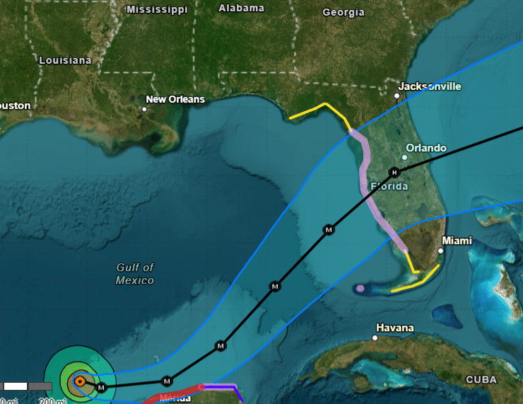
Hurricane Milton continues to intensify at a frightening pace in the Gulf of Mexico. Recent data from NOAA and Air Force Hurricane Hunter aircraft show that Milton has become much stronger, with maximum sustained winds reaching 125 mph (110 knots). In just 24 hours, winds could reach a devastating 155 mph, making Milton a very dangerous Category 4 hurricane.
What’s New with Hurricane Milton?
The pressure inside Milton has dropped significantly, down to 945 mb, which indicates that the storm is rapidly gaining strength. This is a huge concern for areas in Milton’s path, including Florida’s Gulf Coast and now parts of the Yucatan Peninsula in Mexico.
New Path and Warnings are Issued.
The storm’s track has shifted slightly south, and hurricane force winds are now expected to hit the northern coast of the Yucatan Peninsula.
Milton is expected to bring storm surge heights of 3 to 5 feet above ground level in these areas, along with destructive waves that could flood coastal homes and businesses. Yucatan is now under high alert.
Florida Still at High Risk
The forecast for Florida’s west coast remains alarming. Storm surges and hurricane watches are in effect, and dangerous winds and storm surges are expected by Tuesday night or early Wednesday. The National Hurricane Center (NHC) warns that coastal flooding and damage to infrastructure are likely. With winds potentially reaching 155 mph, Milton could cause significant destruction at landfall.
Florida’s Gulf Coast residents should remain vigilant, follow evacuation orders, and complete storm preparations immediately.
Heavy Rainfall is Ahead with Milton.
Even before Milton’s core arrives, Florida could experience heavy rain starting today, which could lead to flash flooding. As the hurricane moves closer, more intense rain and flooding are expected Tuesday through Wednesday, increasing the risk of river flooding and widespread urban flooding.
Critical Takeaways for Those in Milton’s Path:
- Dangerous Winds: Hurricane-force winds are expected to strike parts of the northern Yucatan Peninsula and Florida’s west coast, capable of causing widespread damage.
- Life Threatening Storm Surge: Coastal flooding could reach 3 to 5 feet in the Yucatan Peninsula, and a significant storm surge is expected in Florida. Residents should move to higher ground if ordered.
- Rainfall and Flooding: Heavy rain could trigger flash floods and significant river flooding across Florida. Urban areas may experience street flooding, and residents should be cautious when traveling or evacuating.
You know I will keep an eye out for you. Check out some other graphics from the National Hurricane Center.