Slip and Fall Weather Expert Witness: How Meteorologists Prove Causation
| Location | CONUS (all U.S. regions) |
|---|---|
| Typical Time Window | ±3 hours local time from incident (converted to UTC for data retrieval) |
| Critical Threshold | 32°F (0°C) for ice formation; 33-35°F for black ice risk |
| Precipitation Detection | 0.01 inch minimum reportable via ASOS/AWOS |
| Primary Data Sources | NWS ASOS/AWOS, NCEI archived METAR, local CoCoRaHS |
| Typical Confidence | High (airport stations); Medium (interpolated from distant stations) |
What Forensic Meteorologists Analyze in Slip and Fall Cases
Temperature Records and Ice Formation
We retrieve archived surface observations from the nearest NWS Automated Surface Observing System (ASOS) or Automated Weather Observing System (AWOS) station. These systems report temperature every minute with ±1°F accuracy. When the temperature drops to 32°F or below and moisture is present, ice forms. Black ice conditions occur between 33-35°F when thin ice layers are nearly invisible.
Station Selection Matters: We use the closest representative station, typically within 10 miles of the incident site. Urban heat islands and elevation differences can create 3-5°F variations between the airport station and the incident location. In mountainous regions like Colorado or parts of California, elevation gradients require adjustment factors of approximately 3.5°F per 1,000 feet.
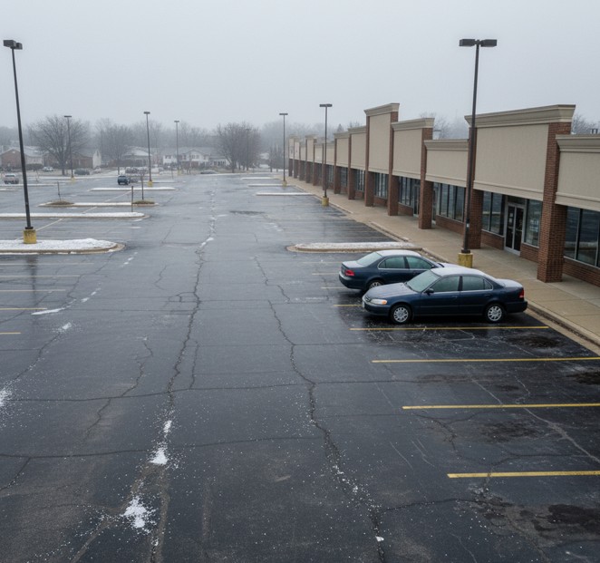
Example Analysis: For a 7:30 AM slip on a parking lot, we pull METAR observations from 5:00 AM through 9:00 AM local time. If the station reported 28°F at 7:00 AM (1300Z) with 0.03 inches of precipitation from 4:00-6:00 AM, ice formation is scientifically certain.
Precipitation Timing and Type Determination
ASOS/AWOS stations detect precipitation type (rain, freezing rain, snow, sleet) and intensity. The present weather sensor identifies each type using different physical principles. Freezing rain is particularly critical for liability cases because it forms glaze ice instantly on contact with surfaces below 32°F.
Radar Corroboration: We use archived NEXRAD (Next Generation Radar) Level II data from the nearest WSR-88D radar site to confirm precipitation coverage and intensity. Radar shows precipitation location and movement but cannot directly measure what reaches the ground. We combine radar data with surface observations for complete verification.
Regional Variations: The Pacific Northwest experiences frequent freezing fog that deposits rime ice without measurable precipitation. The Southeast sees more freezing rain events. The Northern Plains deal with snow-to-ice transitions during temperature fluctuations across 32°F.
Surface Condition Reconstruction
Temperature alone does not prove ice existed. We reconstruct the complete sequence:
- Precipitation occurrence (type, amount, timing)
- Temperature profile (was it at or below freezing?)
- Duration (how long were freezing conditions maintained?)
- Freeze-thaw cycles (did melting occur, then refreezing?)
When surface temperatures drop below 32°F within 1-2 hours after precipitation ends, refreezing creates hazardous ice layers. This is common in morning slip and fall cases following overnight precipitation events.
Microclimatic Considerations
Airport weather stations may not capture site-specific conditions. We evaluate:
- Shading: North-facing building walls or tree shadows keep surfaces colder longer
- Wind exposure: Sheltered areas retain moisture; wind-swept areas may dry faster
- Surface material: Concrete vs. asphalt respond differently to solar heating
- Drainage: Poor drainage creates pooling where ice persists
We note these factors in our analysis and adjust confidence levels accordingly. A parking lot fully exposed to morning sun may have melted ice by 9:00 AM even though the nearby airport station still reports 31°F.
Establishing Temporal Correlation
Courts require proof that hazardous conditions existed at the specific time of the fall. We provide minute-by-minute temperature and precipitation data bracketing the incident time. If a plaintiff fell at 8:15 AM, we show conditions from 7:00 AM through 9:00 AM with 10-minute resolution when available from METAR reports.
Confidence Intervals: We state confidence levels based on data proximity. High confidence exists when the nearest station is within 5 miles with no significant terrain differences. Medium confidence applies for stations 5-15 miles away or when interpolation between stations is required. Low confidence applies when the nearest reliable station exceeds 15 miles or significant microclimate factors exist.
Data Sources and Quality Control
Primary Sources
NOAA Automated Surface Observing System (ASOS): Approximately 900 stations nationwide report temperature, precipitation, wind, visibility, and present weather type every minute. Data is archived by NCEI (National Centers for Environmental Information) and retrievable for any past date.
AWOS Stations: Over 1,000 Federal Aviation Administration and state-operated stations supplement ASOS coverage, particularly at smaller airports. These provide similar temperature and precipitation data with slightly less sophisticated present weather identification.
Cooperative Observer Program (COOP): NOAA’s network of 8,700+ volunteer observers provides daily maximum/minimum temperatures and 24-hour precipitation totals. These manual observations help verify automated station data and fill gaps in rural areas.
Community Collaborative Rain, Hail and Snow Network (CoCoRaHS): Trained volunteers report daily precipitation with high accuracy. Useful for verifying localized precipitation events that may have missed automated stations.
Quality Control Procedures
We apply standard meteorological QC checks:
- Spatial consistency: Compare target station data with nearby stations to identify outliers or equipment malfunctions
- Temporal continuity: Flag sudden unrealistic jumps (e.g., temperature change of 20°F in 5 minutes)
- Physical reasonableness: Verify data falls within climatologically possible ranges
- Station metadata review: Check for equipment changes, station relocations, or documented issues during the analysis period
Flagged data requires secondary verification or notation in the confidence assessment.
Legal and Practical Implications
Premises Liability Standards
Property owners have a duty to maintain reasonably safe conditions. When natural ice or snow creates hazards, state law varies on maintenance obligations. We provide the weather facts; attorneys interpret the legal duty.
Natural Accumulation vs. Unnatural Hazards: Most jurisdictions recognize that property owners need a reasonable time to address naturally occurring ice or snow. If ice formed at 11:00 PM and a slip occurred at 6:00 AM, the owner may not have had a reasonable opportunity to clear or treat the surface. However, if the same conditions persisted for 36 hours, maintenance failure becomes more difficult to defend.
Weather Warnings and Notices: We document whether the NWS issued winter weather advisories, winter storm warnings, or freezing rain warnings for the area. These establish that hazardous conditions were foreseeable and provide notice to property managers.
Insurance Claims and Subrogation
Weather evidence impacts general liability claims, workers’ compensation cases, and subrogation actions. When the weather clearly caused the hazard, insurers evaluate settlement exposure more accurately. Conversely, when weather data shows no precipitation or above-freezing temperatures, fraudulent claims can be identified.
Cost-Benefit Analysis: Expert meteorologist fees typically range from $3,000 to $8,000 for slip and fall analysis and testimony. Cases involving serious injuries with damages exceeding $100,000 justify this investment. Early weather analysis often facilitates settlement negotiations before trial.
Construction and Business Operations
General contractors and facilities managers use forensic weather analysis to defend against slip and fall claims from workers or customers. Documentation that conditions were safe at the incident time protects against baseless claims.
Evidence Limitations and Uncertainties
Representativeness of Station Data
Airport weather stations may be 5-20 miles from incident sites. Urban development, terrain, and local features create microclimates that differ from station readings. We acknowledge this limitation and provide confidence bounds.
Interpolation Methods: When multiple stations surround a site, we apply distance-weighted interpolation to estimate conditions at the exact location. This reduces but does not eliminate uncertainty.
Temporal Resolution Gaps
Standard METAR reports arrive hourly. Between reports, conditions can change. If a slip occurred at 7:42 AM but we have reports only at 7:00 AM and 8:00 AM, we interpolate temperature trends but cannot prove the exact temperature at 7:42 AM.
Special Observations: ASOS stations issue special observations (SPECI) when significant weather changes occur between regular reports. These provide finer temporal resolution for rapidly changing conditions like freezing rain onset.
Missing or Erroneous Data
Equipment malfunctions occasionally occur. Precipitation sensors may freeze, temperature probes may fail, or communication links may drop. We identify data gaps in our analysis and state when conclusions rely on interpolation or modeling rather than direct observation.
Model Limitations
When observational gaps exist, we may use retrospective model analyses (reanalysis data) to estimate conditions. These are useful for spatial context but less precise than direct observations. We clearly label model-derived values and downweight confidence accordingly.
Frequently Asked Questions About Slip and Fall Weather Experts
What qualifications should a forensic meteorologist have for court testimony?
Look for American Meteorological Society (AMS) certification, a degree in atmospheric science or meteorology, and specific experience testifying in premises liability cases. Courts qualify experts based on education, training, and relevant experience.
How accurate is weather data from airports for providing conditions at a specific parking lot or sidewalk?
Airport data is highly accurate for the airport location but requires professional judgment to apply to distant sites. Within 5 miles with similar terrain, accuracy is excellent. Beyond 10 miles or across elevation changes, uncertainty increases and must be disclosed.
Can a meteorologist prove ice existed if no precipitation was recorded at the nearest station?
Yes, through analysis of freeze-thaw cycles, residual moisture from earlier events, dew point temperatures, and localized sources like building runoff or irrigation. We evaluate all moisture sources, not just precipitation.
How far in advance should I contact a weather expert for a slip and fall case?
Contact us as soon as the case is filed or when liability questions arise. Weather data analysis takes 1-2 weeks for a thorough report. Early analysis often facilitates settlement and prevents costly discovery disputes.
What does a forensic weather report cost for a slip and fall case?
Typical fees range from $3,000 for a written report to $7,500 for report plus deposition testimony. Trial testimony adds $2,500-5,000, depending on preparation time and court schedule.
Can weather evidence prove the property owner knew about the hazard?
We prove weather conditions existed and when they occurred. Whether that constitutes legal notice depends on state premises liability law. NWS weather warnings establish foreseeability, but attorneys determine if that meets legal notice standards.
Summary and Next Steps
- Forensic meteorologists reconstruct temperature, precipitation, and ice formation with 10-minute precision using NOAA-archived data from ASOS, AWOS, and CoCoRaHS stations
- We establish whether hazardous conditions existed at the exact time of a slip and fall incident, supporting or refuting liability claims
- Early weather analysis in cases exceeding $100,000 in damages facilitates settlement negotiations and prevents disputes over whether ice or snow caused the fall
Need weather analysis for a premises liability case? Contact me for a free 15-minute case review to determine if forensic meteorology evidence can strengthen your position.
Technical Appendix: Methods and Uncertainty Quantification
Temperature Interpolation Methods
When incident sites fall between weather stations, we apply inverse-distance weighting (IDW) interpolation to estimate temperatures. The formula weighs nearby stations more heavily than distant ones. For stations within 10 miles of the target site, we apply a standard lapse rate adjustment of 3.5°F per 1,000 feet of elevation difference.
Uncertainty bounds: Interpolated temperatures carry ±2-3°F uncertainty depending on station spacing and terrain complexity. This is disclosed in every report.
Ice Formation Physics
Ice forms when:
- Surface temperature ≤32°F (0°C)
- Liquid water is present (precipitation, runoff, melting snow)
- Heat loss exceeds heat input (typically overnight or in shade)
Black ice forms in the 33-35°F range when thin ice layers lack the visual opacity of thicker ice. This occurs during light freezing rain or when wet surfaces refreeze after a brief thaw.
Refreezing timeframes: A wet surface at 50°F requires approximately 45-90 minutes to drop below freezing under calm, clear-sky radiational cooling conditions. Wind accelerates this process; cloud cover slows it.
Station Metadata and Quality Flags
We retrieve station metadata from NCEI, including:
- Station commissioning date and equipment changes
- Known periods of degraded data quality
- Station moves or relocations
- Observation practices (manual vs. automated)
Data flagged for quality issues are excluded from analysis or noted with reduced confidence.
Radar-Based Precipitation Verification
NEXRAD Level II data provides reflectivity (precipitation intensity) and velocity (wind field) at 0.5-degree elevation scans. We verify that radar echoes existed over the incident location during the timeframe in question. Reflectivity values above 20 dBZ indicate measurable precipitation; values above 40 dBZ suggest heavy rain or wet snow.
Limitations: Radar beam height increases with distance from the radar site. At 50 miles, the beam center is approximately 5,000 feet above ground level. Precipitation may evaporate before reaching the surface (virga). We always confirm radar indications with surface observations.
Dataset Versions and Retrieval Protocols
All METAR data is retrieved from NCEI’s Integrated Surface Database (ISD) using the latest quality-controlled version available at the time of analysis. We document:
- Dataset version number
- Retrieval timestamp (UTC)
- Query parameters (station IDs, time range)
- QC flags applied
This provides full transparency for verification by opposing experts or independent review.
Chain of Custody and Data Provenance
Data Retrieved: NOAA/NCEI Integrated Surface Database (ISD), NEXRAD Level II archive, and local CoCoRaHS reports accessed via official NOAA APIs and FTP archives.
Retrieval Timestamp: All data queries are timestamped in UTC and logged in analysis workbooks. Original data files archived with SHA-256 checksums for verification.
Analysis Tools: Custom Python scripts using MetPy 1.5.1, NumPy 1.24.2, and Pandas 2.0.1 for data processing and interpolation. All scripts are version-controlled and available upon request.
Quality Control: NCEI Level 2 QC flags applied; data failing spatial or temporal consistency checks excluded from analysis or noted with reduced confidence.
Uncertainty Statement: Temperature values interpolated from stations >5 miles distant carry ±2-3°F uncertainty. Precipitation amounts from point sensors may not represent all locations within a 10-mile radius. Confidence levels are explicitly stated for all conclusions.
Analyst Certification: Analysis conducted by an AMS Certified Meteorologist with 5+ years of experience in forensic weather reconstruction for legal proceedings.
Need Expert Weather Analysis for Your Case?
Use the contact form below or email me for a free case review.
Forensic Meteorology Resources
Weather Data & Research:
- National Oceanic and Atmospheric Administration (NOAA)
- National Weather Service
- National Centers for Environmental Information
Professional Organizations:
- American Meteorological Society
- AMS Professional Development
- National Weather Association
- SEAK Experts – Forensic Meteorology
Academic Programs:
The author of this article is not an attorney. This content is meant as a resource for understanding forensic meteorology. For legal matters, contact a qualified attorney.