How to Find Accurate Weather Data for Insurance and Legal Disputes
Need Weather Data Tied to a Specific Loss Location?
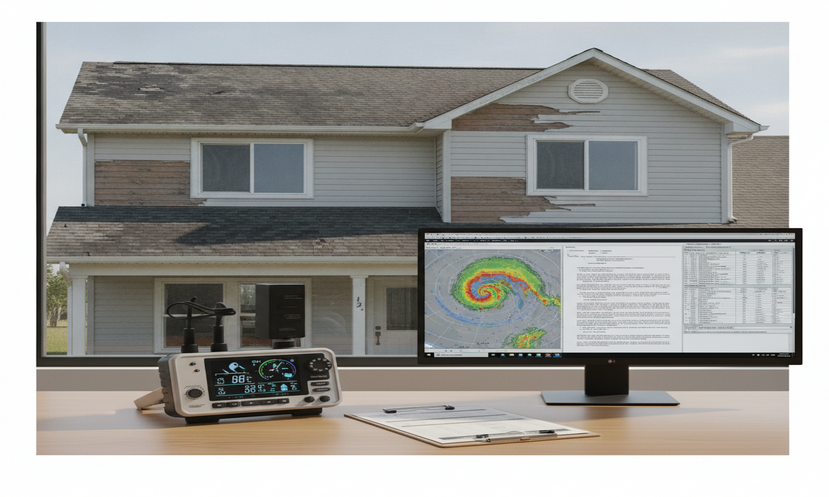
Weather and Climate LLC provides forensic meteorology analysis for attorneys, insurers, adjusters, and claims professionals who need a defensible reconstruction of historical weather conditions.
Typical disputes include: wind damage, hail claims, flooding, slip-and-fall ice formation, snow and ice timelines, construction delays, wildfire weather, and visibility-related incidents.
Direct Answer: Where Should You Find Accurate Weather Data for a Legal or Insurance Dispute?
The best starting point is official NOAA and NCEI weather data, not a consumer weather app. For most insurance and litigation matters, the first records to evaluate are NCEI Climate Data Online, Local Climatological Data, ASOS/AWOS observations, certified NCEI records, and archived NEXRAD Level II radar data when storm timing or storm location matters.
The correct source depends on the question being asked. A wind claim may require hourly observations, one-minute ASOS data, radar velocity data, storm reports, and nearby station metadata. A slip-and-fall case may require hourly temperature, dew point, precipitation type, snow depth, radar precipitation timing, solar exposure, and an analysis of meltwater refreezing. A flooding case may require rainfall intensity, antecedent soil moisture context, radar-estimated precipitation, stream-gage data, and drainage-area considerations.
The central issue is not simply whether weather occurred somewhere in the region. The key question is whether reliable meteorological evidence can reconstruct what conditions existed at the specific site and time relevant to the claim.
Key Facts About Weather Data for Legal Disputes
| Question | Forensic Meteorology Answer |
|---|---|
| Best first source | NOAA/NCEI historical weather records, including Climate Data Online and Local Climatological Data. |
| Best source for certified records | NCEI certified weather records when formal documentation is needed for legal or insurance use. |
| Best source for surface observations | ASOS/AWOS stations, METAR observations, LCD reports, and ISD data, reviewed with station metadata and representativeness in mind. |
| Best source for storm path and timing | NEXRAD Level II radar data, interpreted with attention to beam height, radar distance, precipitation type, and storm structure. |
| Weakest source if used alone | Consumer weather apps, generalized online summaries, unsupported screenshots, and undocumented private station data. |
| Most common mistake | Assuming the nearest airport perfectly represents the loss site without evaluating distance, elevation, terrain, exposure, and microclimate differences. |
Why Accurate Weather Data Matters in Insurance and Litigation
Direct Answer: Accurate weather data matters because claim decisions, expert opinions, and litigation strategies should be based on traceable observations, reliable methods, and a defensible reconstruction of the relevant weather conditions.
A report that rain occurred at a nearby airport does not, by itself, prove that water intrusion at a building was caused by wind-driven rain. A thunderstorm report in the county does not prove that wind at the insured property reached damaging intensity. A temperature reading above freezing at an airport does not automatically rule out localized ice in a shaded, low-lying, or poorly drained area.
Forensic meteorology separates general weather occurrence from site-specific weather reconstruction. That distinction is critical in claims involving:
- Wind damage to roofs, siding, fences, signs, trees, and structures.
- Hail impact disputes.
- Slip-and-fall ice or snow claims.
- Flooding and heavy rainfall claims.
- Construction delay disputes.
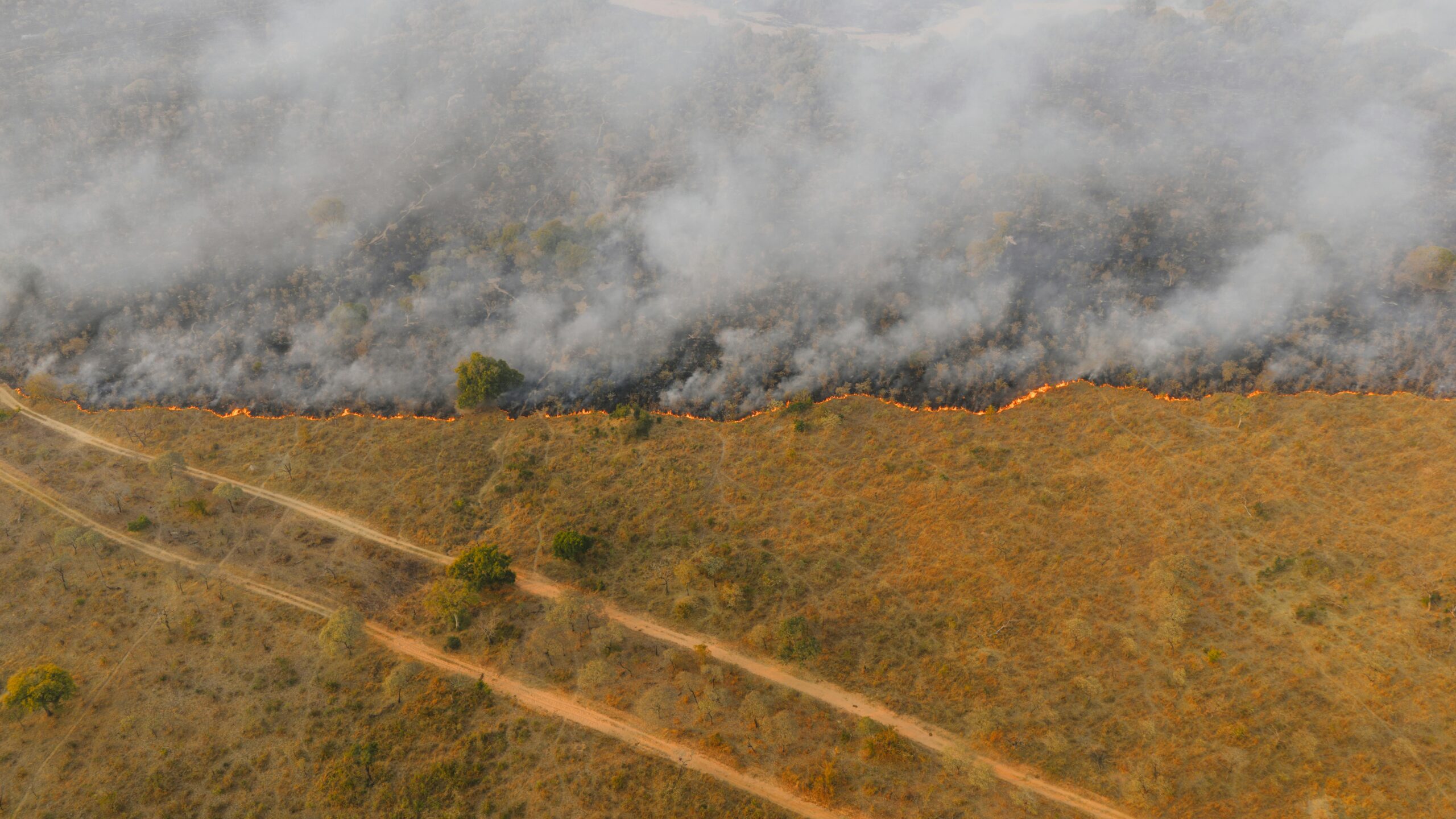
- Wildfire weather, red flag conditions, and wind-driven fire spread.
- Fog, visibility, sun glare, and transportation incidents.
In each case, the weather record must be tied to the correct location, correct time zone, correct observation type, and correct physical mechanism.
The Best Weather Data Sources for Legal and Insurance Disputes
Direct Answer: The strongest weather evidence usually comes from official NOAA/NCEI records, surface weather observations, radar archives, and certified datasets when formal documentation is needed. Supplemental sources may be useful, but they should not replace official records unless the limitations are clearly explained.
1. NOAA/NCEI Climate Data Online
NOAA’s National Centers for Environmental Information maintains Climate Data Online, which provides access to historical weather and climate records. This is usually one of the first places to search when an attorney, adjuster, or expert needs official historical weather data.
NCEI data can help identify:
- Daily precipitation totals.
- Hourly temperature and dew point trends.
- Wind speed and wind direction observations.
- Snowfall and snow depth records where available.
- Station histories and metadata.
- Certified records when ordered through the appropriate NCEI process.
2. Local Climatological Data
Local Climatological Data, often called LCD or LCDv2, provides monthly summaries of weather station observations. These records can include hourly, daily, and monthly station data such as temperature, precipitation, humidity, wind, and common weather observations.
LCD records are especially useful when a case requires a chronological review of conditions before, during, and after a reported loss. For example, in a slip-and-fall case, LCD data may help evaluate whether air temperatures remained below freezing, whether precipitation occurred before the incident, and whether a freeze-thaw sequence was meteorologically plausible.
For more detail on winter premises claims, see weather data for your slip-and-fall case.
3. ASOS/AWOS and METAR Observations
ASOS and AWOS stations provide standardized surface weather observations from airports and other observing sites. These observations commonly report temperature, dew point, wind speed, wind direction, visibility, altimeter setting, precipitation, sky condition, and present weather.
These records are important, but they must be interpreted carefully. The nearest ASOS station is not always the most representative station. A forensic meteorologist should evaluate:
- Distance from the loss site.
- Elevation differences.
- Terrain and land-use differences.
- Station siting and exposure.
- Whether the station was upwind or downwind of the relevant weather feature.
- Whether microclimate factors may have affected the loss location.
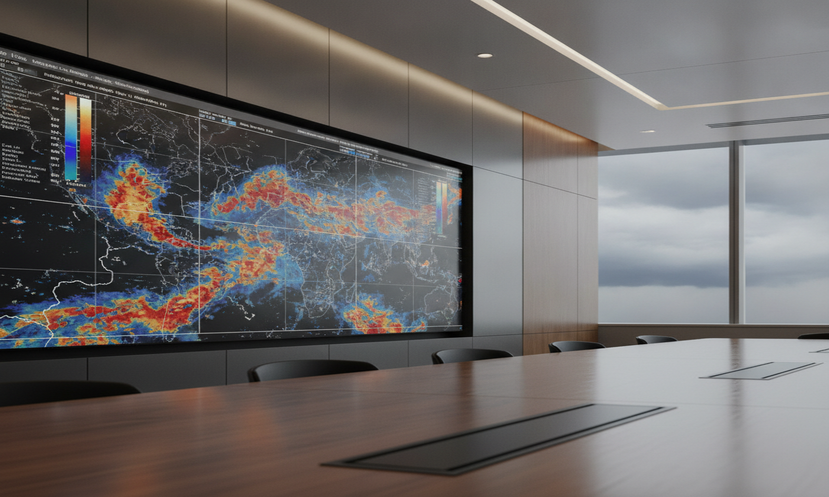
4. NEXRAD Level II Radar Data
NEXRAD Level II radar data can be critical when storm timing, precipitation intensity, hail potential, convective structure, or storm movement is disputed. Radar data can help determine whether precipitation or a thunderstorm cell passed over the loss location during the relevant window.
Radar analysis may be important in:
- Hail claims.
- Wind damage claims.
- Heavy rainfall and flash flooding disputes.
- Snow and mixed-precipitation timelines.
- Lightning and convective storm investigations.
Radar data should not be treated as a simple picture. The analysis should consider radar site distance, beam elevation, beam height above ground level, precipitation type, attenuation, bright banding, velocity sampling, and whether the product being reviewed is reflectivity, velocity, dual-polarization data, or a derived product.
5. NWS Text Products, Storm Reports, and Forecast Discussions
National Weather Service warnings, watches, advisories, forecast discussions, and local storm reports can provide important meteorological context. These products may help establish what hazards were expected, observed, or reported in the broader area.
However, a warning polygon or storm report does not automatically prove conditions at a specific property. These records should be used as supporting context and compared against station observations, radar data, and the specific timeline of the incident.
6. Private Weather Stations
Private weather station data can sometimes help identify local variability, especially where the nearest official station is far away or poorly representative of the site. But private station data should usually be treated as supplemental unless its reliability can be established.
Important questions include:
- Where was the sensor located?
- Was it mounted at a standard height?
- Was it shielded properly?
- Was it calibrated or maintained?
- Was there obstruction from buildings, trees, walls, or pavement?
- Are the timestamps complete and internally consistent?
- Can the data be corroborated by official observations or radar?
Weather Occurrence Is Not the Same as Weather Causation
Direct Answer: Weather occurrence means that a weather event happened. Weather causation analysis asks whether the documented conditions were consistent with the alleged damage, hazard, delay, or injury at the specific location and time.
This distinction is one of the most important concepts in forensic meteorology. A storm may have occurred in the region, but that does not automatically mean the storm caused the claimed damage. A cold morning may have occurred, but that does not automatically prove ice was present at the exact walking surface. Heavy rain may have occurred nearby, but that does not automatically establish flood causation at the property.
A defensible weather analysis should connect the meteorological record to the claimed mechanism. Examples include:
- Wind damage: Were the observed or estimated winds strong enough, from the relevant direction, for a sufficient duration, and consistent with the reported damage pattern?
- Hail damage: Did radar and storm reports support hail at the property, and was the hail size consistent with the claimed damage?
- Slip-and-fall ice: Was there a credible moisture source, subfreezing temperature period, and surface condition sequence consistent with ice formation?
- Flooding: Did rainfall timing, intensity, duration, antecedent conditions, and site drainage support the reported water intrusion or flooding mechanism?
- Construction delay: Did observed weather exceed contract thresholds for the specific trade activity and work window?
For winter cases, how forensic meteorologists reconstruct ice and snow timelines often depends on more than an airport temperature reading. The analysis may require precipitation timing, snow depth, solar exposure, pavement temperature inference, shade, drainage, and meltwater refreezing.
Why Weather Apps Are Usually Not Enough
Direct Answer: Weather apps are not designed to serve as forensic records. They may be useful for general awareness, but they often do not provide the data provenance, station metadata, timestamp precision, quality control, or certification needed in a contested legal or insurance matter.
A weather app may display a temperature, icon, or generic condition summary for a ZIP code. That does not necessarily identify the observing station, observation time, data source, quality-control status, elevation, or distance from the loss site.
Common problems with consumer weather app evidence include:
- Unclear data source.
- Modeled or interpolated values presented like observations.
- ZIP-code level summaries that do not represent the loss site.
- No station metadata.
- No preserved chain of custody.
- No explanation of uncertainty.
- No way to reproduce the exact result later.
In a legal or insurance dispute, the stronger approach is to preserve official records, document the data source, and explain the methodology used to connect the data to the incident location.
Recommended Evidence Hierarchy for Weather Data
Direct Answer: A defensible weather reconstruction should prioritize official observations and archived meteorological datasets before relying on less controlled sources.
| Evidence Level | Weather Data Type | Forensic Use | Primary Limitation |
|---|---|---|---|
| Highest | Certified NCEI records | Formal documentation for claims, expert reports, and legal disputes. | May not fully represent the exact site without spatial analysis. |
| High | ASOS/AWOS, METAR, LCD, ISD | Surface weather timeline for temperature, wind, precipitation, visibility, and sky condition. | Station may be distant or unrepresentative of site conditions. |
| High | NEXRAD Level II radar | Storm timing, storm structure, precipitation coverage, hail potential, and velocity signatures. | Requires expert interpretation and radar geometry review. |
| Medium | NWS warnings, AFDs, LSRs, storm summaries | Context for expected and reported hazards. | May not prove conditions at the exact loss site. |
| Medium to Low | Private weather stations | Neighborhood-scale corroboration. | Often lacks metadata, calibration, siting documentation, and authentication. |
| Lowest if used alone | Weather apps and screenshots | Preliminary lead only. | Often lacks source transparency, reproducibility, and forensic reliability. |
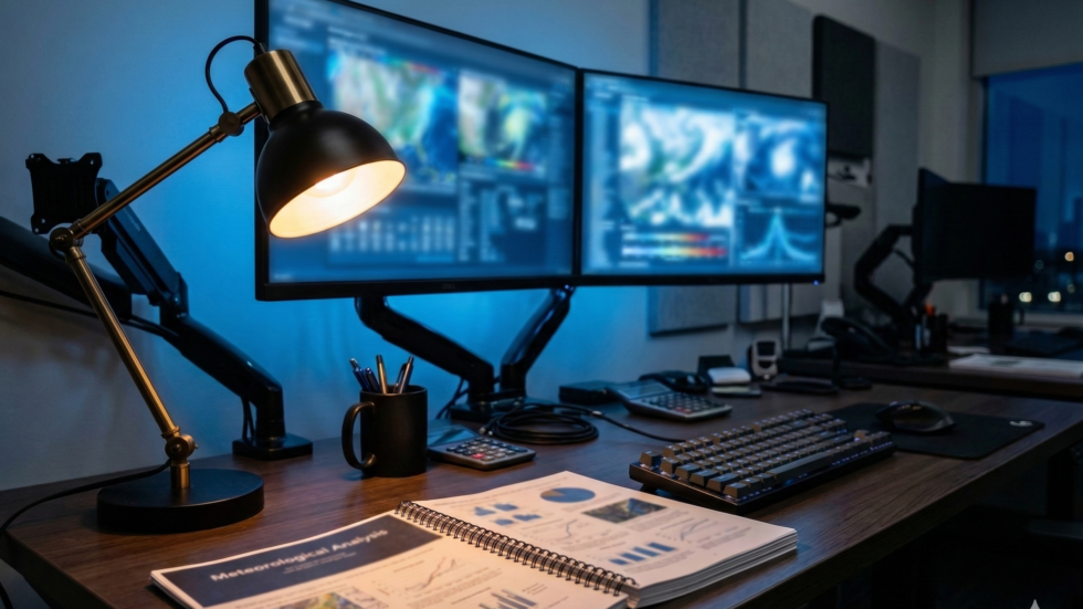
How a Forensic Meteorologist Documents Weather Evidence
Direct Answer: Weather evidence should be documented in a reproducible timeline that identifies the incident location, incident time, data sources, station distances, observation times, radar files, uncertainty, and limitations.
A defensible workflow usually includes the following steps:
- Fix the location. Identify the exact address, coordinates, elevation, and relevant exposure of the loss site.
- Fix the time window. Confirm the incident time, time zone, and any disputed loss window.
- Identify nearby official stations. Review ASOS/AWOS, COOP, mesonet, and other relevant observing stations.
- Evaluate representativeness. Compare distance, elevation, terrain, land use, and exposure between the station and the loss site.
- Download official data. Preserve source records, access dates, file names, and relevant metadata.
- Review radar where needed. Use NEXRAD Level II data for storm timing, coverage, intensity, velocity, and precipitation structure.
- Build a chronological timeline. Separate observed facts from expert interpretation.
- State limitations. Identify gaps, uncertainty, and datasets that could change confidence.
- Preserve chain of custody. Maintain records showing where the data came from and how it was used.
This process is especially important when the opposing side relies on a simplified statement such as “the airport said it was above freezing” or “the weather app showed thunderstorms.” Those statements may be incomplete, misleading, or insufficient without a full meteorological reconstruction.
How Weather Data Supports Different Case Types
Direct Answer: Different disputes require different weather datasets. The correct data depends on the alleged loss mechanism.
Wind Damage Claims
Wind cases may require surface wind observations, peak gusts, wind direction, storm mode, radar velocity data, pressure trends, and local terrain or exposure analysis. The analysis should distinguish between sustained wind, peak gust, convective wind, gradient wind, tornado potential, and site exposure.
Hail Claims
Hail cases may require radar reflectivity, dual-polarization products, storm reports, freezing level context, storm motion, and a comparison between radar-indicated hail potential and the property location. A hail report several miles away does not automatically prove hail impact at the property.
Slip-and-Fall Ice Claims
Winter premises cases may require a timeline of precipitation, air temperature, dew point, wind, cloud cover, snow depth, solar exposure, drainage, shade, and freeze-thaw cycles. A reliable opinion should identify the moisture source and the meteorological process that could have produced ice.
Flooding and Heavy Rainfall Claims
Flood cases may require rainfall duration, rainfall intensity, radar-estimated precipitation, gauge observations, antecedent rainfall, soil moisture context, stream-gage data, and local drainage characteristics. Meteorology can reconstruct rainfall conditions, but engineering or hydrologic conclusions may require a separate qualified expert.
Construction Delay Claims
Construction delay analysis may require daily and hourly weather observations, precipitation thresholds, wind thresholds, temperature limits, snow or ice conditions, and project-specific weather criteria. The meteorological role is to determine whether observed weather met or exceeded the relevant weather thresholds.
Wildfire Weather Claims
Wildfire weather analysis may require wind speed, wind direction, relative humidity, temperature, fuel-moisture proxies, red flag warnings, RAWS data, smoke observations, visibility observations, and satellite imagery. The meteorological role is to reconstruct weather conditions relevant to ignition potential, fire spread, smoke transport, or visibility, not to assign legal fault.
The Daubert and Rule 702 Issue Attorneys Should Not Ignore
Direct Answer: Weather opinions used in litigation should be based on sufficient facts or data, reliable methods, and a clear connection between the method and the disputed facts.
In federal litigation, expert testimony is evaluated under Federal Rule of Evidence 702. The meteorological opinion should not be a conclusion first and a method second. It should be built from records, observations, accepted meteorological principles, and a transparent explanation of uncertainty.
A stronger forensic meteorology report will usually show:
- What records were reviewed.
- Why those records were selected.
- How observation times were converted.
- How far each station was from the incident site.
- Whether the station was meteorologically representative.
- What radar products were reviewed.
- What limitations remain.
- What conclusions are supported and what conclusions are not supported.
This is why unsupported screenshots, generalized storm summaries, and unexplained data pulls can create problems in a disputed claim. The opinion must be reproducible and tied to the facts of the case.
Common Weather Data Mistakes in Insurance and Legal Disputes
Direct Answer: The most common mistakes are using the wrong source, using the wrong station, ignoring time zones, treating modeled data as observed data, and failing to document uncertainty.
- Using ZIP-code weather summaries as site-specific evidence. ZIP-code summaries may not represent the actual loss location.
- Assuming the closest station is the best station. Distance matters, but elevation, terrain, exposure, and storm path may matter more.
- Ignoring UTC and local time conversion. Radar and many archived datasets use UTC, while incident reports usually use local time.
- Confusing precipitation occurrence with surface hazard formation. Rain or snow does not automatically prove ice, flooding, or damage.
- Using private station data without metadata. Sensor siting, calibration, and maintenance can materially affect reliability.
- Failing to preserve source files. A reliable analysis should be reproducible from the archived records.
- Overstating conclusions. A defensible opinion should identify confidence level and limitations.
When Should an Attorney or Adjuster Hire a Forensic Meteorologist?
Direct Answer: A forensic meteorologist should be considered when weather timing, intensity, location, causation, or data reliability is disputed.
Expert review is often useful when:
- The claim depends on the exact timing of rain, snow, wind, hail, fog, or ice.
- The nearest official station may not represent the loss site.
- The dispute involves competing weather narratives.
- The other side relies on weather app screenshots or unsupported summaries.
- Radar interpretation is needed.
- The case may require expert reporting, deposition testimony, or trial testimony.
- The claim involves significant damages or a disputed coverage issue.
A forensic meteorologist can help determine what weather data exists, what it supports, what it does not support, and how confidently the conditions can be reconstructed.
Need a Court-Ready Weather Reconstruction?
Weather and Climate LLC provides forensic meteorology consulting for insurance and legal disputes involving wind, hail, flooding, snow, ice, slip-and-fall claims, wildfire weather, construction delays, and visibility-related incidents.
The analysis is grounded in official records, archived radar data, surface observations, and documented methodology.
Technical Appendix: What Data Should Be Preserved?
Direct Answer: Preserve the source records, metadata, timestamps, and analytical files needed to reproduce the weather reconstruction.
| Dataset | What It Helps Establish | Preservation Note |
|---|---|---|
| NCEI certified records | Official record documentation for legal or claim use. | Preserve order information, station ID, date range, and certification documentation. |
| LCD / LCDv2 | Hourly and daily weather station chronology. | Preserve station name, station ID, month, and full PDF or CSV record. |
| ASOS/AWOS observations | Temperature, dew point, wind, precipitation, visibility, and sky condition. | Preserve raw observations, decoded values, time zone conversion, and station metadata. |
| NEXRAD Level II radar | Storm timing, storm track, intensity, hail potential, and velocity signatures. | Preserve radar site, file names, UTC scan times, products reviewed, and screenshots or exports. |
| NWS warnings and discussions | Forecast and warning context. | Preserve product ID, issuance time, valid time, and affected area. |
| Private station data | Possible neighborhood-scale corroboration. | Preserve sensor metadata, siting photos, maintenance history, and timestamps if available. |
Chain of Custody for Weather Data
Direct Answer: Chain of custody in forensic meteorology means preserving where the data came from, when it was retrieved, what file was reviewed, and how the data was used in the analysis.
A clean weather-data file should include:
- Incident address or coordinates.
- Incident date and local time.
- Time zone and UTC conversion where applicable.
- Station IDs and station distances.
- Data source names.
- Download or retrieval dates.
- Original file names.
- Radar site IDs and scan times.
- Notes distinguishing direct observations from expert interpretation.
- Known limitations and missing data.
This documentation helps attorneys, insurers, and experts evaluate whether the weather opinion can be reproduced and defended.
Frequently Asked Questions
What is the best source of historical weather data for legal disputes?
The best starting point is usually NOAA/NCEI historical weather data, including Climate Data Online, Local Climatological Data, ASOS/AWOS observations, and certified NCEI records when formal documentation is needed.
Can weather app data be used in court or insurance claims?
Weather app data may help identify a preliminary lead, but it is usually weak if used alone. It often lacks station metadata, source transparency, quality-control information, and reproducibility.
Is private weather station data admissible?
Private weather station data may be useful, but its weight depends on authentication, siting, maintenance, calibration, completeness, and corroboration by official records or radar data.
Can NEXRAD radar prove whether a storm crossed a property?
NEXRAD radar can help evaluate storm timing, storm movement, precipitation intensity, hail potential, and velocity signatures near a property. It requires expert interpretation because radar geometry, beam height, distance from the radar, and product type affect the analysis.
Why is the nearest airport not always the best weather station?
The nearest airport may differ from the loss site in elevation, terrain, exposure, land use, drainage, and microclimate. A forensic meteorologist should evaluate whether the station reasonably represents the site conditions.
What weather data is needed for a slip-and-fall ice case?
A slip-and-fall ice case may require precipitation timing, temperature, dew point, wind, cloud cover, snow depth, radar data, solar exposure, shade, drainage, and freeze-thaw analysis. The key issue is whether a credible moisture source and freezing process existed at the relevant time and location.
What weather data is needed for a wind damage claim?
A wind damage claim may require ASOS/AWOS wind observations, peak gusts, wind direction, radar velocity data, storm reports, pressure trends, and an evaluation of exposure and terrain near the property.
When should I hire a forensic meteorologist?
You should consider hiring a forensic meteorologist when the dispute depends on weather timing, intensity, location, causation, radar interpretation, station representativeness, or the reliability of the weather data being used.
About the Author
John Bryant is a forensic meteorologist and expert witness with Weather and Climate LLC. He analyzes historical weather conditions for legal disputes, insurance claims, and weather-related causation questions. His work includes weather reconstruction, radar interpretation, surface observation analysis, expert reporting, and litigation support.