Weather Risk Management: Essential Strategies for Business
| Location | CONUS (Contiguous United States) |
|---|---|
| Time Window | Calendar year 2024 (2024-01-01 to 2024-12-31 / 00:00Z–23:59Z) |
| Wind Example (Gulf Coast Landfall) | 105 kt (approximately 121 mph) sustained at third U.S. landfall near the LA/MS border, Hurricane Katrina 2005 (NHC Tropical Cyclone Report; Florida was first landfall, Buras LA was second); NWS severe thunderstorm wind criterion is 58 mph+ gusts; thousands of severe wind reports are recorded annually in NOAA Storm Data nationwide |
| Max Rain Storm Total (Historical Record, SE Texas) | 44.29 in (1,125 mm) multi-day storm total, NWS gauge, 2 mi SSW of Fannett TX, Tropical Storm Imelda 2019 (NHC report confirms approximately 31 in in 12 hours; full accumulation spanned approximately 48 hours); 2024 record events catalogued in NCEI Storm Events Database |
| Data Sources | NOAA/NCEI Storm Events Database, NWS ASOS/AWOS, NEXRAD WSR-88D, SPC Storm Reports, USGS WDFN/National Water Dashboard |
| Confidence | High: Multiple independent NOAA observation networks; national coverage with >900 ASOS stations and 160 NEXRAD radars |
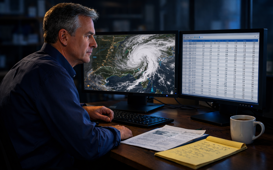
Weather affects every U.S. business. The question is whether you have the data to prove what actually happened, or whether you’re left guessing.
A tornado rakes a warehouse in Tulsa. A nor’easter buries a fleet of delivery trucks in Philadelphia. A hailstorm strips the roof off a distribution center outside Denver. Each event triggers a claim. Each claim triggers a dispute. And in nearly every dispute, the outcome hinges on a single question: exactly what did the weather do, at that location, at that moment?
That question is the domain of forensic meteorology. A certified forensic meteorologist pulls raw station data from NOAA and NCEI archives, cross-checks it against NEXRAD radar, and produces a documented analysis that courts, adjusters, and risk managers can rely on.
This post explains the full picture: from why weather data matters to business strategy, to how a forensic weather consultant builds a court-ready case file.
Why Weather Risk Is a Financial Problem, Not Just an Operations Problem
NOAA reports that 27 billion-dollar weather and climate disasters in 2024 caused $182.7 billion in total damages (CPI-adjusted), ranking 2024 the fourth-costliest year in that dataset. That figure reflects direct damage estimates; indirect impacts such as business interruption, supply chain disruption, and liability exposure are tracked separately by insurers and industry researchers. Industry experience suggests that a minority of commercial claims include a site-specific certified meteorological analysis, leaving significant recovery on the table.
Most risk managers understand weather as an operational concern: staffing decisions, route changes, and production delays. Fewer treat it as a financial documentation problem. That distinction matters enormously when a claim goes sideways.
The core issue: insurance policies cover specific weather perils (wind, hail, flooding, lightning). If you cannot prove the peril occurred at your location at the time of damage, the claim can be denied or reduced. A forensic weather analysis closes that proof gap.
Five ways weather risk becomes a financial liability:
- Underpayment: Adjusters use regional weather summaries, not site-specific ASOS data. The reported wind speed may be 5–15 mph lower than the actual gust at your facility.
- Claim denial: Without documented meteorological causation, a carrier can attribute damage to pre-existing conditions or normal wear.
- Subrogation failures: If a contractor’s negligence combined with a storm to cause damage, you need to separate the weather contribution from the construction defect, or you lose subrogation rights.
- Liability exposure: A slip-and-fall after an ice event requires proof of precipitation timing and air temperatures. Without it, liability assignments are disputed.
- Business interruption disputes: Carriers often challenge the duration of a covered weather event. Documented hourly ASOS records set the clock precisely.
What a Forensic Meteorologist Actually Does
A forensic meteorology expert is not a TV weather presenter. The work is rigorous scientific reconstruction, the same discipline used in federal court, NTSB investigations, and catastrophic loss litigation. The goal is an objective, defensible answer to a factual question about past weather.
Step 1: Site-Specific Data Collection
The analysis begins with the exact GPS coordinates of the loss location and the timestamp of the reported event. The forensic weather consultant retrieves the closest ASOS or AWOS station records from NOAA’s Climate Data Online (CDO) portal, checks data quality flags, and notes any instrumentation gaps.
- ASOS stations can provide 1-minute wind observations where available and archive routine METAR observations hourly, along with special observations (SPECIs) during rapidly changing conditions.
- AWOS stations provide similar data at general aviation airports, often the closest observation point to rural industrial facilities.
- COOP (Cooperative Observer) and mesonet stations fill gaps between ASOS sites, especially in the Southeast and Southern Plains.
- Station distance and terrain between the sensor and the loss site are documented; representativeness is rated Low, Medium, or High.
Regional note: Gulf Coast facilities may have three or four ASOS stations within 20 miles. Front Range Colorado properties may rely on a single station with significant terrain blocking. That representativeness difference must appear in the confidence rating.
Step 2: Radar and Severe Weather Correlation
Surface observations confirm what happened at a point. NEXRAD WSR-88D Level II radar data confirms what was happening across a broader area and often reveals what the nearest ASOS station missed. A forensic meteorologist overlays radar reflectivity and velocity data on the loss site to document whether a tornado, downburst, or squall line was directly overhead during the claimed loss window.
- Level II base reflectivity (dBZ) quantifies precipitation intensity. Very high reflectivity can be consistent with hail, but reflectivity alone is not a reliable hail-size estimator; dual-pol signatures, hail algorithms, and storm thermal structure are needed for stronger inference.
- Dual-pol products (correlation coefficient, differential reflectivity) distinguish hail from rain and debris.
- Velocity data (base velocity, storm relative motion) identifies rotation and wind shear.
- NOAA SPC Storm Data and Local Storm Reports (LSRs) from NWS offices document surveyed damage paths and confirmed tornado tracks.
Step 3: Synthesis, QC, and the Expert Report
All observations are assembled, quality-controlled, and compared. Where multiple independent sources agree, confidence is rated High. Where sources conflict or station coverage is sparse, the expert states that plainly and quantifies uncertainty. The final report answers the causation question directly: what weather phenomenon occurred, at what intensity, at what time, and whether that intensity meets the policy threshold or code trigger.
- NCEI Climatological Data Publications provide monthly extremes as context.
- ASCE 7-22 basic wind speed maps provide design-level parameters for structural loading; these can inform engineering context in structural claims, though applicable policy or code thresholds govern specific claim determinations.
- Reanalysis grids (ERA5, CFSR) are cited as corroboration only, not as primary observation substitutes.
How Businesses Use Weather Data Proactively: A Risk Management Framework
Post-loss forensic analysis is reactive. Smart risk managers also use weather data proactively, before events occur. The following framework applies across industries from logistics and construction to agriculture and energy.
Phase 1: Exposure Mapping
Before you can manage weather risk, you need to know where your assets sit on the risk spectrum. A forensic weather consultant uses NCEI return-period statistics and ASCE 7-22 hazard maps to assign wind, hail, flood, and lightning risk ratings to each facility location.
- Plot every facility on the ASCE 7-22 basic wind speed map (Figure 26.5-1A through 26.5-1D), published by the American Society of Civil Engineers.
- Cross-reference FEMA/NFIP flood zone designations for any property near a 100-year floodplain.
- Use NOAA’s NCEI hail climatology (1955–present) to identify facilities in the “hail alley” corridor from Texas through Nebraska.
- Tag Gulf Coast and Atlantic Coast assets with hurricane category and storm surge zones derived from NOAA/NHC SLOSH modeling (also used by FEMA and emergency managers for evacuation planning).
Phase 2: Threshold-Based Trigger Protocols
Once you know the risk, you build decision rules tied to actual weather thresholds: specific numbers tied to specific data sources.
- Construction sites: Suspend crane operations when NWS forecasts sustained winds exceeding 25 mph or gusts above 35 mph at the nearest ASOS station.
- Logistics/fleet: Reroute or stage vehicles when NEXRAD shows reflectivity above 50 dBZ (heavy rain/hail threshold) along planned corridors.
- Energy/utilities: Pre-position crews when NWS issues a wind advisory or high wind warning for service territory. Typical thresholds are sustained 31–39 mph for advisories and 40+ mph for warnings, but criteria vary by NWS forecast office and region.
- Agriculture/outdoor events: Use hourly ASOS dewpoint and temperature data to trigger automated frost/freeze alerts at 36°F (2.2°C) air temperature.
Phase 3: Post-Event Documentation
When a weather event occurs, immediate data collection is critical. NOAA retains ASOS archives through long-term archival access on CDO, but private weather service data and mesonet records can be purged within weeks. A weather litigation expert advises clients to pull and preserve all relevant data within 30 days of any significant weather event at a facility, regardless of whether a claim has been filed.
- Download the nearest ASOS METAR data from NOAA’s Climate Data Online (CDO): ncei.noaa.gov/cdo-web
- Submit an NCEI data request for archived NEXRAD Level II data at the relevant radar site and time window.
- Screenshot or download any NWS Severe Thunderstorm Warnings, Tornado Warnings, or High Wind Warnings that were active during the event.
- Photograph damage within 24 hours and record GPS coordinates for every photograph.
Industry-Specific Applications of Forensic Weather Analysis
Property and Casualty Insurance Claims
- Causation analysis: Was the wind speed at the property sufficient to cause the observed structural failure? ASCE 7-22 component and cladding tables set the standard threshold.
- Hail size and density: NEXRAD dual-pol data plus SPC LSRs establish whether hail reached the property at damaging sizes (≥1 in / 25 mm diameter).
- Flood source determination: Was water intrusion from surface flooding (covered) or groundwater infiltration (often excluded)? USGS gauge time-series data (via WDFN/NWIS) and RFC multisensory QPE products answer this; USGS StreamStats provides basin delineation and flow-frequency statistics for sites with uncertainty.
- Business interruption period: ASOS hourly data precisely documents the hours a covered weather peril was present, which is critical for BI duration disputes.
Construction and Contractor Liability
- Meteorology accident reconstruction: Was wind speed within project design tolerances when a scaffold collapsed or a crane toppled? ASOS minute data can resolve this to the minute.
- Schedule disputes: Was a weather delay legally defensible under the contract’s force majeure clause? NOAA station data provides the hourly documentation.
- OSHA compliance: Did site conditions meet safe work thresholds? Documented weather data supports or refutes the record.
- Construction defect vs. weather: Separating storm-driven damage from pre-existing construction defects is a core forensic meteorology application in contractor litigation.
Transportation, Logistics, and Accident Reconstruction
- Motor vehicle accidents: A meteorology accident reconstruction expert documents road surface conditions (frozen vs. wet), visibility (fog, heavy rain), and wind gusts at the time and location of a crash using ASOS METAR data.
- Aviation incidents: ASOS and AWOS data at origin, destination, and en route stations establish the meteorological environment for pilot decision-making analysis.
- Marine claims: NWS marine forecasts, NDBC buoy observations, and NOAA tide gauge data document sea state and wind conditions at the time of a maritime incident.
- Slip-and-fall claims: Precipitation type (rain, freezing rain, sleet, snow), accumulation, and temperature records establish whether icing was present and foreseeable at the time of injury.
What to Look for When You Hire a Meteorologist Expert Witness
Not all weather experts are equal. When you hire a meteorologist expert witness, credentials and methodology matter as much as communication skills. Here is what to evaluate before retaining a forensic weather consultant.
Professional Certification
The American Meteorological Society (AMS) Certified Consulting Meteorologist (CCM) designation is a widely recognized professional credential for consulting and expert testimony work. A CCM has passed rigorous peer review of technical competency before an AMS board. AMS also offers other certifications (e.g., Certified Broadcast Meteorologist, Certified Digital Meteorologist). Look for a certified meteorologist witness who holds the CCM or another relevant AMS credential, and verify standing through the AMS directory.
Data Methodology
Ask the expert to describe how they source and QC data. A rigorous forensic weather analysis cites the specific NOAA station ID, the timestamp of each observation in UTC, and the method used to assess representativeness. Experts who rely solely on commercial weather service certificates, without primary NOAA/NCEI data, produce opinions that are vulnerable on cross-examination.
Courtroom and Deposition Experience
Weather expert witness services are only valuable if the expert can hold up under cross-examination. Ask for a list of prior cases and whether reports have been excluded under Daubert challenges. A climate expert witness with extensive deposition experience will write reports anticipating the opposing expert’s arguments.
Understanding Cost: What Forensic Meteorology Services Actually Run
Budget planning for weather expert witness services requires understanding the components of the work. Fees typically range from $200 to $500 per hour, depending on the expert’s credentials, case complexity, and geographic scope.
| Service Component | Typical Hours | Fee Range ($200–$500/hr) |
|---|---|---|
| Initial case review and data retrieval | 2–4 hrs | $600–$1,200 |
| Full weather reconstruction and QC analysis | 6–16 hrs | $1,800–$4,800 |
| Expert report preparation | 4–8 hrs | $1,200–$2,400 |
| Deposition (half or full day) | 4–8 hrs | $1,200–$2,400 |
| Trial testimony (per day) | 8 hrs | $2,400–$4,000 |
For routine single-event insurance claims, total costs typically fall between $3,000 and $8,000. Complex multi-event or multi-site cases, particularly in construction defect litigation or catastrophic property loss, can run $15,000–$40,000 including deposition and trial testimony. For a $500,000 property loss, a $5,000 forensic analysis that prevents a denial or underpayment is an exceptional return.
Common Weather Data Mistakes That Cost Businesses Money
Relying on a weather certificate alone: Generic weather certificates report conditions at the nearest airport, not your property. They do not account for terrain effects, station distance, or instrumentation quality. In contested claims, opposing experts will expose these gaps immediately. Only a full forensic analysis with primary NOAA data withstands scrutiny.
Waiting too long to collect data: NOAA retains ASOS archives through long-term archival access on CDO, but private mesonet operators may purge data in 30–90 days. Photographs age. Witness memories fade. Engage a forensic weather consultant within two weeks of any major weather event at your facilities.
Using model output as primary evidence: Gridded reanalysis products (ERA5, NARR, CFSR) interpolate conditions over large grid cells and cannot resolve sub-kilometer terrain effects. A qualified meteorology expert witness cites models as corroborating evidence only. Under Federal Rule of Evidence 702, the proponent must demonstrate that methods are reliable and reliably applied to the facts; relying on coarse reanalysis grids as primary site-level evidence without validation makes that showing significantly harder.
Ignoring regional climatology context: A 58 mph wind gust is significant in suburban Memphis but not unusual in a Wyoming wind corridor, where gusts regularly exceed 80 mph. Failure to provide climatological context for an observed event undermines causation arguments.
Frequently Asked Questions About Weather Data and Business Risk Management
How does a forensic meteorologist help a business with an insurance claim?
A forensic meteorology expert reconstructs the weather event using NOAA ASOS station data, NEXRAD radar, and NCEI records to document wind speed, rainfall, and storm timing at the exact loss location. That certified weather reconstruction becomes defensible evidence that supports or disputes a claim, often preventing underpayment or bad-faith denial.
What data sources do forensic meteorologists use for business risk analysis?
Primary sources include NOAA/NCEI Climatological Data Publications, NWS ASOS and AWOS surface observations, NEXRAD WSR-88D Level II radar, NOAA Storm Data (SPC reports), USGS streamflow gauges, and RFC quantitative precipitation estimates. Reanalysis grids (ERA5, CFSR) corroborate but do not replace station observations.
What does it cost to hire a meteorologist expert witness?
Forensic meteorologist fees typically range from $200 to $500 per hour depending on case complexity, geographic scope, and expert credentials. A standard weather reconstruction for a single event and location usually requires 8–20 hours of analysis, plus additional time for depositions and trial testimony.
Can weather data actually change the outcome of a business insurance claim?
Yes. Court-quality ASOS and radar data can document whether a covered peril (e.g., straight-line wind exceeding 58 mph) was present at the property at the time of loss, directly resolving causation disputes. Cases involving ambiguous cause-of-loss clauses are particularly affected by defensible meteorological evidence.
What is the difference between a weather report and a forensic meteorology analysis?
A standard weather report is a general summary for a broad area and time range. A forensic meteorology analysis reconstructs specific conditions at an exact GPS location and timestamp, drawing on multiple independent data sources, applying QC checks, and quantifying uncertainty, producing a court-ready expert opinion.
Do regional weather patterns affect how businesses should use weather data for risk management?
Significantly. Gulf Coast businesses face hurricane-force winds and storm surge risk not present on the Front Range of Colorado, where downslope Chinook winds can exceed 100 mph in localized corridors. Risk managers should use ASCE 7-22 region-specific wind speed maps and consult a forensic weather consultant familiar with local climatology.
Key Takeaways and Next Step
- NOAA reports 27 billion-dollar weather and climate disasters caused $182.7 billion in total damages in 2024 (CPI-adjusted), the fourth-costliest year in that dataset. A minority of claims include a site-specific certified meteorological analysis, leaving significant recovery on the table.
- A forensic meteorologist builds site-specific, court-ready weather reconstructions from NOAA ASOS data, NEXRAD radar, NCEI archives, and SPC reports, not generic weather certificates.
- Proactive risk managers use ASCE 7-22 hazard maps and NOAA return-period statistics to map exposure before events occur, then deploy threshold-based decision protocols during severe weather.
If your business is dealing with a disputed weather claim, a pending weather-related lawsuit, or wants to build a stronger pre-loss documentation protocol, request a free case review with John Bryant, AMS-certified forensic meteorologist.
Authoritative Weather Data Resources for Businesses
- NOAA Climate Data Online (CDO): ncei.noaa.gov/cdo-web. Surface observations, ASOS/AWOS records, climatological summaries.
- NOAA Storm Events Database: ncei.noaa.gov/access/stormevents. Official Storm Data record; entries from January 1950 through the latest available month, with event-type-dependent periods of record.
- NOAA SPC Storm Reports: spc.noaa.gov/climo/reports. Daily severe weather reports including tornadoes, large hail, and damaging winds.
- FEMA National Flood Insurance Program: fema.gov/flood-insurance. Flood zone maps and NFIP policy guidance.
- AMS CCM Directory: ametsoc.org. Verify AMS Certified Consulting Meteorologist credentials.
This article is written for informational purposes. It does not constitute legal or financial advice. For legal matters, consult a qualified attorney. For weather-related litigation, contact a certified forensic meteorologist.
Technical Appendix: Methods, Datasets, and QC Protocol
This section provides the methodological detail required for court-ready forensic meteorology reports and for readers evaluating the rigor of any weather reconstruction analysis.
Primary Data Sources and Retrieval Protocol
- NOAA ASOS/AWOS: 1-minute and hourly METAR data retrieved via NOAA Climate Data Online (CDO) web portal (ncei.noaa.gov/cdo-web). Station IDs documented with 4-letter ICAO identifiers (e.g., KMEM for Memphis International). UTC timestamps used for all observations.
- NEXRAD Level II: Retrieved via NOAA Big Data Program on AWS. Note: the original noaa-nexrad-level2 bucket has been deprecated; consult the current AWS Open Data Registry (registry.opendata.aws) and NCEI NEXRAD documentation for the active bucket and access instructions (last verified 2026-02-23). Tools: Python/MetPy, AWIPS2, or GR2Analyst v2. Products analyzed: Base Reflectivity (0.5° tilt), Correlation Coefficient (CC), Differential Reflectivity (ZDR), Storm Relative Velocity (SRV).
- NCEI Storm Events Database: Accessed at ncei.noaa.gov/access/stormevents. Filtered by event type (Thunderstorm Wind, Hail, Tornado, Flash Flood), county, and date range ±24 hours of the claimed event. Note: periods of record vary by event type per NCEI documentation; coverage of all event types is not uniform back to 1950.
- SPC Storm Reports: Daily .csv files from spc.noaa.gov/climo/reports. Used to corroborate surveyed damage paths and LSR observations.
- USGS Water Data for the Nation (WDFN) / National Water Dashboard: Streamflow gauge time-series data for flood causation determinations (USGS WaterWatch retired February 2026; use wdfn.usgs.gov or waterdata.usgs.gov). USGS StreamStats used for basin delineation and flow-frequency statistics. Station IDs documented in USGS NWIS format.
Quality Control (QC) Steps
- Instrumentation check: Review ASOS station metadata for sensor type (RM Young anemometer vs. ultrasonic), mounting height, and any NOTAM/NOTIS maintenance flags during the event window.
- Representativeness assessment: Calculate straight-line distance and terrain relief between station and loss location. Assign representativeness rating: High (<5 miles, similar terrain), Medium (5–15 miles or minor terrain difference), Low (>15 miles or significant terrain/land use contrast).
- Consistency check: Compare surface observations against radar reflectivity and velocity fields at corresponding timestamps. Flag and explain any discrepancies >10 mph between surface wind and radar-estimated low-level shear.
- Uncertainty quantification: Report wind speed uncertainty as ±5 mph for High confidence (dual-source agreement), ±10 mph for Medium, and ±15+ mph for Low. Precipitation uncertainty rated separately.
Limitations
ASOS anemometers are positioned at airport locations and may not represent conditions in urban canyons, forested areas, or sites with significant terrain channeling. Radar beam blockage and range effects reduce accuracy at distances exceeding 150 nautical miles from the radar site. Reanalysis grids have spatial resolutions of approximately 31 km (ERA5) to 38 km (CFSR) and cannot resolve sub-mesoscale features such as microbursts or tornadoes. These limitations are disclosed in every expert report and factored into confidence ratings.
Chain-of-Custody Record
- Article published: 2026-02-23 (UTC)
- NOAA Storm Events Database: Last accessed 2026-02-23 (ncei.noaa.gov/access/stormevents). 2024 data current as of NCEI monthly update cycle.
- NOAA CDO (ASOS records): Last accessed 2026-02-23 (ncei.noaa.gov/cdo-web). Station data QC’d through NOAA automated plausibility flags.
- ASCE 7-22: American Society of Civil Engineers, Minimum Design Loads and Associated Criteria for Buildings and Other Structures, ASCE/SEI 7-22, 2022 edition.
- Reanalysis reference: ERA5, Copernicus Climate Change Service (C3S), ECMWF, 31-km grid. Used for climatological context only; not as primary event evidence.
- Uncertainty note: The $182.7 billion 2024 figure is from the NOAA NCEI Billion-Dollar Weather and Climate Disasters report (2025 update), reflecting CPI-adjusted direct damage estimates for 27 qualifying events; it is not a “business losses” total. Normal survey uncertainty of ±5–10% applies per NCEI’s damage estimation methodology. The statement that “a minority of commercial claims include a certified meteorological analysis” is based on practitioner experience; no peer-reviewed study is cited for this claim and it should be treated as a qualitative industry observation, not a quantified statistic.