
 All Posts


Understanding forensic microburst wind speed is critical for legal and insurance evaluations of storm damage claims and for protecting public safety. Competitors in related fields often rely on clear safety guidance and repeated reminders on microburst recognition, using straightforward explanations to make the risks and responses accessible for any audience.
This article offers a concise analysis of microbursts: what they are, how to recognize them, the associated dangers, comparisons to similar weather events, and best safety practices. Readers can expect guidance rooted in forensic meteorological expertise from John Bryant, supporting legal, insurance, and environmental compliance needs.
Key Takeaways
- Microbursts are highly localized, intense downdrafts from thunderstorms capable of causing severe wind damage
- Both wet and dry microbursts threaten aviation and ground infrastructure
- Forensic analysis distinguishes microburst wind damage from tornadoes using pattern recognition and meteorological review
- The Microburst Wind Potential Index supports post-storm and forensic assessments
- Effective safety measures include monitoring advisories, avoiding outdoor exposure, and preparing emergency plans
Microbursts and Their Meteorological Background
Microbursts are intense downward bursts of wind from thunderstorms, leading to concentrated wind damage over a small area. Understanding their unique triggers and physical characteristics is vital for accurate forensic wind reviews and for public safety planning.
What is a Microburst and How Do They Form?
A microburst results when a strong downdraft, caused by rapidly cooling air within a thunderstorm, accelerates toward the ground and spreads out in all directions upon impact. High instability, dry air layers, or intense rainfall can all contribute to their sudden formation. Unlike tornadoes, microbursts produce straight-line winds, not rotational patterns, making them distinct in both atmospheric mechanics and observed damage.
Types of Microbursts: Wet vs. Dry Downbursts
Microbursts are classified based on moisture content in the downdraft. Wet microbursts occur with heavy precipitation and cool air, typically leaving visible rain shafts. Dry microbursts contain little to no surface precipitation, as rain evaporates before reaching the ground, and often occur in drier regions like the Western United States. Both types carry significant wind damage potential, but dry microbursts are harder to detect with standard radar tools.
Microburst Characteristics and Etymology
Defining features of microbursts include very rapid onset, peak wind speeds often exceeding 70 mph, and damage confined to areas smaller than 2.5 miles in diameter. The term “microburst” was first coined by meteorologist Dr. Ted Fujita, highlighting the small-scale yet high-impact nature of these events. Microbursts deliver straight-line winds powerful enough to uproot trees, shear roofs, and threaten aircraft.
The History and Notable Events of Microbursts
Historical microburst events have shaped meteorological understanding and aviation safety standards. In the late 1970s and 1980s, several high-profile aircraft incidents led to advances in detection technology and procedures. According to a 2024 peer-reviewed study by the National Severe Storms Laboratory, microbursts have been documented as a leading factor in weather-related aviation accidents prior to widespread radar adoption.
Recognizing and Assessing Microburst Damage
After a storm, accurate identification of microburst damage is essential for insurance, legal, and forensic purposes. This section explains the signs and methods experts use to differentiate microburst impacts from other severe weather phenomena.
How to Assess Wind Damage and Recognize Microbursts
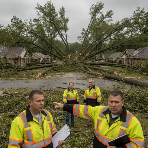
Experts recognize microburst damage by the outward, often starburst, pattern of tree falls and debris, which radiate from a single central point. In contrast, tornado damage commonly displays convergent or rotational signatures. Evaluating wind direction, debris field consistency, and correlating damage with atmospheric data are standard forensic meteorology practices for confirming microburst presence.

The Role of the Microburst Wind Potential Index in Post-Storm Surveys
The Microburst Wind Potential Index (MWPI) helps meteorologists predict areas at risk before storms and verify likely microburst areas during post-event surveys. MWPI integrates temperature, humidity, and atmospheric stability into a quantitative forecast, guiding forensic specialists in pinpointing where the most severe downbursts are probable.
Downbursts, Outflow Boundaries, and Related Weather Phenomena
Microbursts belong to the broader category of downbursts, but their scale and duration set them apart. Downbursts can be either micro (under 2.5 miles) or macro (over 2.5 miles). Outflow boundaries mark the separation between cooled downdraft air and surrounding warm air, often visible as arcs on radar. While squalls are sustained lines of strong winds, and straight-line winds are widespread, microbursts are rapid, highly focused events.
Bulletin: Visual Signs of Microbursts
Identifying a microburst often relies on visual cues and technology. Meteorologists use these observables to confirm a microburst:
- Sudden, intense rainfall immediately following a thunderstorm
- Trees snapped or laid flat in outward-facing patterns
- Sharp, localized changes in wind direction and spread of debris
- Radar signatures detectable through GRLevelX and National Weather Service imagery
Microburst Safety, Aviation Hazards, and Public Response
Microbursts pose extreme hazards for aviation and pose risks to ground structures. Effective detection and public safety strategies save lives and improve post-storm recovery planning.
Why Are Microbursts Dangerous for Aircraft and Ground Infrastructure?
Airplanes, particularly during landing or takeoff, are vulnerable to sudden wind shear from microbursts. Aviation accidents prompted the integration of Doppler radar and onboard wind shear alert systems at major airports. Buildings, power lines, and vehicles are also susceptible to the high-velocity, non-rotational winds found within microbursts.
Practical Safety Tips During Microbursts
Adopting proven safety measures during severe thunderstorm periods helps prevent injury and property loss:
- Monitor weather advisories and thunderstorm warnings from reliable sources
- Avoid outdoor activities when severe weather is forecast
- Secure loose outdoor items and vehicles ahead of storms
- If driving, seek shelter promptly and never attempt to outdrive a visible microburst
- Maintain communication plans and prepare emergency kits for rapid response
According to a 2023 National Transportation Safety Board report, awareness and timely response to microburst warnings can dramatically reduce risk for both aviators and the public.
Step-by-Step Checklist for Microburst Preparedness
Preparedness for microbursts enhances safety for individuals and organizations. Follow these steps:
- Check authoritative weather platforms like NOAA Weather Radio for advisories
- Cancel or reschedule outdoor plans during severe weather alerts
- Remove, tie down, or store loose objects and vehicles before thunderstorms
- Seek the nearest sturdy shelter if a microburst is forecast or observed
- Keep an emergency kit and ensure all household or team members have a communication plan
Conclusion
Proper analysis of forensic microburst wind speed is fundamental for insurance, legal, and public safety professionals. Understanding distinctive microburst signatures enables precise storm impact attribution and safer decision-making. Applying advanced assessment tools and prioritizing proactive safety plans strengthens risk management and response capabilities.
Frequently Asked Questions
How can microbursts be identified in a post-storm survey?
Microbursts are identified by the outward, radial pattern of damage, absence of tornado-like rotation, and by reviewing local atmospheric and radar data with forensic meteorology tools.
What are the main differences between a microburst and a squall?
A microburst delivers a brief, highly concentrated downdraft, leading to radiating wind damage. By contrast, a squall is a larger, more sustained corridor of strong winds that affects a wider area and lasts longer.
Are microbursts equally dangerous in wet and dry forms?
Both wet and dry microbursts can produce destructive winds, but wet microbursts are generally easier to detect due to visible precipitation. Dry microbursts often have little or no surface rain, making them harder to anticipate.
Why should insurance professionals understand microburst damage?
Accurate identification of microburst versus tornado wind damage ensures proper claims handling and resolution. Recognizing the distinct impact pattern is crucial in the investigative process.
What is the Microburst Wind Potential Index (MWPI)?
The MWPI is a scientific model that evaluates atmospheric profiles for the potential and probable strength of microbursts. It provides forecasters and forensic meteorologists with an empirical basis for predicting and verifying microburst events.
Observing outward patterns of wind damage, distinguishing types of downbursts, and utilizing newer detection tools are all central to investigating microburst wind claims. Wet and dry microbursts are equally serious for aviation and public safety. Safety practices include checking warnings, securing property, and sheltering promptly. Forensic wind speed assessment supports legal and insurance outcomes. Guidance is available from John Bryant for those seeking expert analysis.