 All Posts


Indiana Flooding 2026 presented a series of severe challenges for legal, insurance, and environmental compliance professionals. The underlying insight is the need for rigorous, data-driven analysis to navigate emerging claim disputes and liability concerns amid significant weather-driven flood incidents.
This article delivers a detailed exploration of key meteorological factors, modern damage evaluation techniques, and evolving risk considerations in the wake of Indiana’s 2026 flood events. Legal teams and insurers will find in-depth perspectives, procedural clarity, and explanations tied to forensic best practices from John Bryant’s expert authority.
Key Takeaways
- Indiana Flooding 2026 was driven by extreme weather and rapid rainfall accumulation
- Forensic meteorology relies on historical weather data and advanced platforms
- Damage assessments now use drones and automated analysis for accuracy
- Effective risk analysis supports defensible claims and proactive mitigation
- Third-party evidence is recognized in legal and insurance contexts
Indiana Flooding 2026 Overview and Meteorological Context
The extent and severity of Indiana’s 2026 floods stem from significant deviations in precipitation, temperature, and seasonal patterns. For attorneys and insurance specialists, understanding these meteorological drivers is essential for accurate claim scrutiny and liability reviews.
What weather patterns contributed to the 2026 flooding?
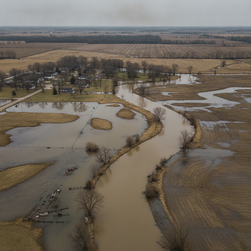
Unusual atmospheric conditions, including sustained moisture influx from the south and stationary storm fronts, triggered repeated intense rainfall across Indiana. Rapid snowmelt combined with saturated soils accelerated run-off, compounding the impact and causing record water levels in several river basins. The sequence of precipitation extremes set the foundation for both urban and rural flooding along with widespread disruption.
How is historical data used in forensic weather analysis?
Meteorological reconstructions for legal cases depend on verified datasets and specialized analysis tools. Historical data from national repositories such as NOAA and GIS-based platforms, like ArcGIS, play a crucial role in event reconstruction, timeline creation, and factual weather verification. By referencing long-term climatological trends and specific storm data, forensic meteorologists can support causation or refute claims based on objective environmental evidence. According to a 2023 Purdue University study, frequency analysis of Midwest flood events has highlighted the growing importance of integrating historic and real-time data for robust forensic outcomes.
What are the typical types of Indiana flood events?
Evaluating Indiana flood risks involves understanding distinct flood event types.
- Flash flooding in urban and rural areas
- River flooding impacting infrastructure and agriculture
- Ice jam flooding during rapid winter thaws
Each of these events presents unique legal and insurance challenges, with varying implications for property, liability, and compliance reviews.
Damage Assessment and Insurance Disputes
Assessing damages in Indiana flooding incidents now involves both traditional and rapidly advancing investigative methods. Clarity in evaluation processes matters both for the accurate quantification of losses and for effective dispute resolution in insurance and legal proceedings.
How is damage evaluated in modern insurance claims?
Precise documentation and evidence gathering are central to credible flood claims. Modern evaluations use a combination of on-site inspections and technology-enhanced methods.
- Photographic and video documentation establishes visual records of affected structures
- Drone surveys access remote or hazardous locations, collecting high-resolution imagery
- Remote-sensing tools create 3D models to track extent and progression of flood impacts
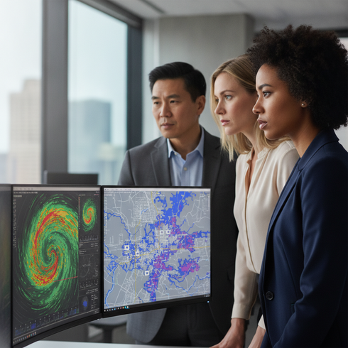
- Software such as ESRI and HailTrace analyze spatial and meteorological correlations
These methods allow insurers and legal experts to compare before-and-after conditions and establish connections to weather events with a greater degree of scientific accuracy.
Which factors complicate claim approval or legal proceedings?
Disputes and delays frequently arise due to complexities inherent to flood-related claims. Policy exclusions, such as those specifying flood versus water damage, require careful interpretation. Timing of loss relative to policy periods, documentation gaps, and ambiguity over cause-of-loss attribution often lead to challenges in both claim approvals and legal proceedings.
What are recent trends in forensic damage documentation?
Recent advances in documentation are shaping more robust claim and litigation support. Drones and satellite imagery now standardize evidence collection while software-driven risk models improve predictive accuracy. According to a 2024 Insurance Information Institute report, claims technology adoption has accelerated, making automated damage quantification and digital claim files a new industry expectation.
Risk Analysis, Legal Implications, and Proactive Strategies
Risk assessment and legal preparedness are evolving in response to heightened flooding risks. Integrated analysis and expert testimony enable more effective compliance strategies, defenses, and proactive risk planning.
How does forensic meteorology support litigation and compliance?
Accurate weather reconstruction and expert testimony provide objective evidence for courts and regulatory bodies. Forensic meteorology leverages timeline analysis, geospatial mapping, and historical comparisons to clarify weather’s role in loss events. These specialized skills are increasingly relied upon to resolve disputes where weather causation is questioned or where explanatory clarity is needed by fact-finders.
What proactive strategies can mitigate future flood risks?
Effective flood risk mitigation combines site assessment, infrastructure adaptation, and compliance with evolving standards. Legal and insurance professionals should advise property owners on drainage improvements, resilient construction, and maintaining up-to-date insurance coverage compliant with flood ordinances. Risk reduction is furthered through ongoing review of building policies, proactive data collection, and regular vulnerability assessments.
What are the main benefits of third-party flood analysis?
Three central benefits come from involving third-party forensic specialists:
- Defensible claims for policyholders and insurers
- Tailored legal advice and compliance strategy
- Enhanced accuracy in historical weather evidence
Engaging outside experts ensures objective, scientifically validated findings that can underpin legal arguments and inform risk management decisions.
Frequently Asked Questions
How does historical weather data strengthen a legal case?
Utilizing archived weather data allows for independent verification of claimed conditions and event details. Objective timing and severity information can support or challenge assertions in litigation, helping clarify questions of liability.
What types of experts review flood claims?
Complex flood claims often require review by forensic meteorologists, environmental consultants, and structural engineers. These experts collectively provide scientific, technical, and practical perspectives necessary for insurance or legal resolution.
Are drone and satellite tools accepted in legal proceedings?
Courts increasingly recognize drone and satellite imagery when the data is authenticated and the platforms are widely accepted. Admissibility improves when such tools are deployed by certified experts with proven track records in forensic analysis.
How is risk modeling used in flood insurance?
Risk modeling synthesizes historical weather records, hydrological patterns, and property-specific data to create predictive scenarios. This approach informs policy underwriting and strengthens dispute resolution with science-based calculations.
Can forensic weather analysis be applied preemptively?
Preemptive forensic analysis identifies site-specific vulnerabilities and supports resilience planning before losses occur. Early involvement can reduce the frequency and severity of future insurance claims and compliance issues.
A comprehensive understanding of Indiana Flooding 2026 requires objective weather reconstruction, expert documentation, and strategic legal risk analysis. Effective damage assessment, trusted third-party evaluation, and proactive planning clarify claims and lead to stronger case outcomes. Contact John Bryant for authoritative expertise in Indiana forensic meteorology and flood litigation support.