Airport Weather Records and the Importance for Court
Airport weather records are admissible in court — but establishing that admissibility, and defending it against a Daubert challenge, requires understanding exactly what ASOS sensors measure, how METAR and SPECI records are authenticated, and what limitations opposing counsel will raise before a judge or jury. These records are government-generated, permanently archived by NOAA NCEI, and available at no cost. What they are not is automatically representative of conditions at an incident site miles from the airport — and that gap is where most weather evidence disputes are won or lost.
This article provides the complete evidentiary framework: what ASOS and METAR records are, which federal rules govern them, what a SPECI is and why it carries additional weight, how far is too far from the incident, how AWOS differs from ASOS in court, and when airport data alone cannot carry the causation burden.
What are airport weather observations?
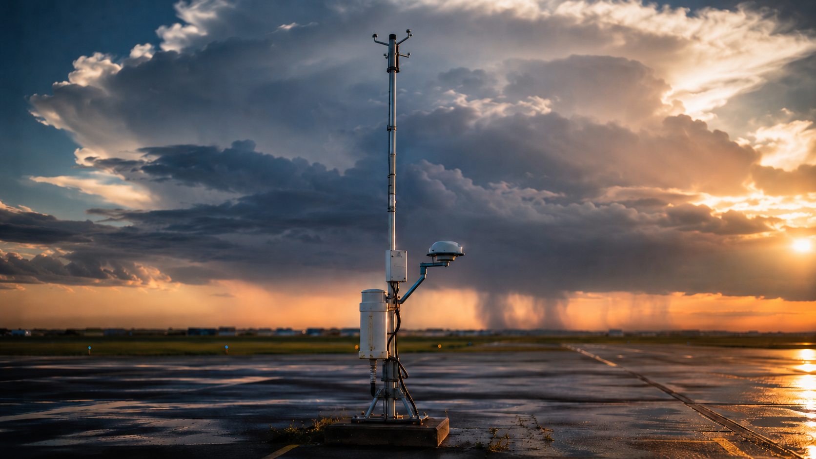
Airport weather observations are surface-level meteorological readings collected by instruments positioned on airport grounds, encoded in METAR format, and permanently archived by NOAA’s National Centers for Environmental Information (NCEI). The United States operates approximately 950 Automated Surface Observing System (ASOS) stations — nearly all at airports — managed jointly by the National Weather Service (NWS), the Federal Aviation Administration (FAA), and the Department of Defense (DoD). Each station generates new readings every minute, 24 hours per day, 365 days per year, with no human intervention required for routine operations.
ASOS deployment began in 1991 as part of a national observational modernization effort. The METAR code format — an international standard used across more than 190 countries and standardized under ICAO Annex 3 — specifies exactly how observations are encoded, transmitted, and archived. That enforced uniformity is a key reason courts trust these records: every sensor, every algorithm, and every transmission protocol follows a documented federal specification, making the data reproducible, independently verifiable, and consistent across thousands of stations and decades of operation.
For attorneys, the practical starting point is the NCEI global hourly archive at ncei.noaa.gov/access/search/data-search/global-hourly. The Integrated Surface Database (ISD) is a multi-source global archive of hourly and synoptic surface observations compiled from more than 100 original data sources, with records extending back to 1901 for some stations and more than 35,000 stations worldwide. ASOS-era airport observations are included within that broader archive; the database is not an ASOS-only product and its coverage predates ASOS deployment by decades.
What federal rules govern airport weather data in litigation?
Three Federal Rules of Evidence work together to put ASOS airport records before a jury. FRE 803(8) exempts public agency records from the hearsay bar when an agency was under a legal duty to observe, record, and maintain those records — a test ASOS data satisfies because the NWS operates under a statutory mandate to collect and archive surface weather observations nationwide. FRE 902(4) allows a certified copy of a public record to be admitted without a live witness to authenticate it, provided the document bears the appropriate government seal. FRE 703 permits a qualified meteorological expert to rely on METAR records in forming an opinion even if those specific records are not themselves in evidence, as long as the underlying data is the type professionals in the field reasonably rely upon.
The December 2023 amendment to Rule 702 clarified and emphasized the court’s existing gatekeeping obligation under Rule 104(a): the proponent must show that all admissibility requirements are met by a more-likely-than-not standard. A forensic meteorologist presenting ASOS-based testimony must be prepared to address the instrument’s known error rate — ±2 knots (approximately ±2.3 mph) for sustained wind, per the official ASOS User’s Guide specification — directly on direct examination. Waiting for cross-examination to disclose that figure weakens the opinion unnecessarily.
How do courts classify ASOS records under the hearsay rule?
Admissibility of ASOS records involves two separate evidentiary questions that must be analyzed independently. The first is hearsay: ASOS METARs are out-of-court statements, but they qualify for the public-records hearsay exception under FRE 803(8)(A)(ii) as records of a public office setting forth matters observed under a legal duty to report. The NWS is statutorily required to observe, encode, transmit, and archive surface weather data — that duty-driven regularity supplies the reliability guarantee the exception requires. The second question is authentication: under FRE 902(4), a certified copy of a public record is self-authenticating and needs no live witness. Rule 902(4) addresses authentication only; it does not independently resolve the hearsay issue. Expert reliance on those materials is a separate FRE 703 question.
Private weather company reports are treated differently. A commercial vendor’s historical weather reconstruction falls under FRE 803(6) (business records exception), which requires proving the record was made at or near the time of the event, by a person with knowledge, in the ordinary course of a regularly conducted business activity, and through a trustworthy process. Courts applying FRE 803(6) to private weather data require more foundational testimony than is needed for NWS/NCEI records. This is one reason forensic meteorologists build opinions on government-archived ASOS data as the primary evidentiary layer, with private or supplementary sources treated as corroborating rather than primary.
What self-authentication pathway applies to NCEI-certified records?
FRE 902(4) provides self-authentication for certified copies of public records. NCEI — the official federal custodian of U.S. weather records — certifies METAR data, 1-minute ASOS observations, and NEXRAD radar images through its certification portal at ncei.noaa.gov/certification. Each certified document bears a Department of Commerce seal and an attestation that the copy is a true and correct reproduction of the federal record. Under FRE 902(4), no additional witness testimony is required to authenticate a document bearing that seal — the certification itself satisfies the authentication requirement.
A few procedural steps prevent wasted orders. NCEI requires attorneys or their experts to preview uncertified data through Climate Data Online before ordering, because orders cannot be canceled once processed. Data gaps caused by station maintenance or equipment failure must be identified at the preview stage. ASOS stations achieve greater than 99% annual uptime, so gaps are uncommon — but a gap during the exact event window can be dispositive, and it must be addressed in the forensic report rather than discovered at trial. Most historical weather data is available at no charge; certification of hard copies carries a processing fee, and PDF delivery typically takes 5 to 10 business days.
What physical sensors does an ASOS station use?
An ASOS installation includes a calibrated sensor suite sited according to the Federal Standard for Siting Meteorological Sensors at Airports (FCM-S4-2019, which updated the original FCM-S4-1994 standard). The core instruments are: an ultrasonic Ice-Free Wind Sensor (IFWS) — specifically the Vaisala WMT-702, which replaced legacy cup-and-vane anemometers nationwide under an NWS modernization program completed September 30, 2023 — at 10 meters above ground level (AGL) for wind direction and speed; a heated tipping-bucket precipitation gauge for liquid precipitation accumulation; a forward-scatter sensor for horizontal visibility; a laser ceilometer for cloud height and sky condition directly overhead; a hygro-thermometer for temperature and dewpoint; and a digital barometer for altimeter setting and sea-level pressure.
The 10-meter anemometer height is the WMO and ICAO standard for surface wind observations, and it is relevant to litigation. Wind speed increases logarithmically with height above the ground surface. Conditions measured at 10 meters AGL are higher than conditions at street level (approximately 2 to 3 meters). When a case turns on whether wind conditions at pedestrian height caused a fall, a structural failure, or a vehicle accident, a forensic meteorologist can calculate the height-adjustment correction using the standard logarithmic wind profile equation, with documented roughness-length values for the terrain type at the incident site.
How does ASOS measure and report wind speed and gusts?
ASOS calculates a 2-minute rolling average of wind direction and speed, refreshed every 5 seconds. That 2-minute average is what appears in the official METAR as the “sustained” wind. For the METAR gust field, ASOS reports a gust when the highest 5-second average wind speed within the past minute exceeds the current 2-minute average by 5 knots or more and the sustained speed is at least 9 knots. Separately, ASOS appends a peak wind remark to the METAR — formatted as PK WND 32028/1428 (peak wind from 320 degrees at 28 knots observed at 14:28Z) — recording the highest gust detected since the last scheduled hourly METAR. The METAR gust field and the peak wind remark are two distinct data elements; attorneys and experts should request both from the certified NCEI record.
The practical implication for litigation is significant. An event featuring brief, extreme gusts on a light-wind background — for example, a fast-moving downburst on a calm afternoon — may not register a gust in the METAR record at all if the sustained 2-minute average remained below 9 knots during the observation period. The 1-minute ASOS dataset captures continuous peak-gust values that the hourly METAR does not, making it the correct data source for any case where the exact timing and intensity of a short-duration gust event is disputed. When reporting wind in a METAR, a gust entry looks like: 27015G27KT — wind from 270 degrees true at 15 knots, gusting to 27 knots.
What does ASOS not measure?
ASOS has documented sensor limitations that experienced opposing experts consistently raise in weather litigation. Current ASOS documentation identifies the All Weather Precipitation Accumulation Gauge (AWPAG) as the modern precipitation-accumulation instrument, using a weighing principle that works for all forms of precipitation; the earlier heated tipping-bucket technology is described in the context of legacy ASOS development. Regardless of gauge type, amounts too small to register are recorded only as “Trace” (T) or may go unreported. Very light drizzle or mist below the present-weather sensor’s detection threshold may not appear in the accumulation record, even if visible precipitation was reaching the surface. The present-weather identifier uses a fall-rate algorithm that can misclassify freezing rain as liquid rain when temperatures hover near 32 degrees Fahrenheit. The laser ceilometer reports sky condition only directly overhead — a thunderstorm approaching laterally may not appear in the ceiling data until the storm is nearly overhead the station, creating a timing gap that can shift the apparent onset of severe conditions by 10 to 20 minutes in some cases.
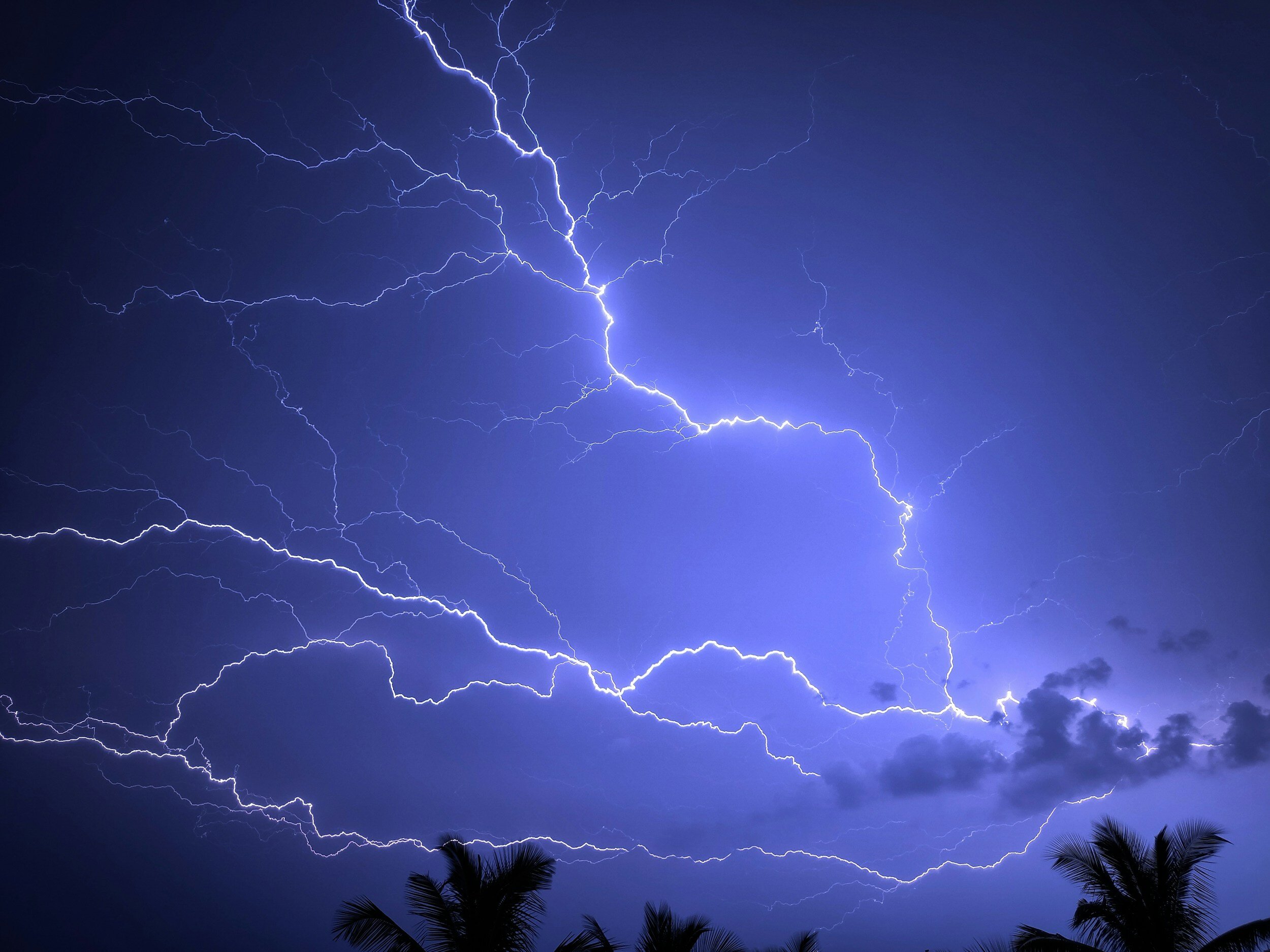
Stand-alone automated ASOS service has recognized limitations for certain phenomena: snow depth on the ground (measured by COOP human observers, not ASOS); precipitation-type discrimination near 32 degrees Fahrenheit; and hail size. However, selected ASOS sites use automated lightning-detection inputs — the ASOS Lightning Sensor (ALS) or FAA ALDARS — so lightning reporting capability is not categorically absent. At service levels that include human augmentation, observers can add hail occurrence, thunderstorm and lightning-location remarks, and other phenomena the automated sensors miss. The primary indicator that a report has been augmented by a human observer is the absence of the AUTO modifier: when AUTO is present, the report is fully automated with no human intervention; when AUTO is absent from an ASOS report, a human observer has augmented or backed up the observation. Identifying the station’s service level and the presence or absence of AUTO during the relevant window is a required step in every complete forensic review.
What is a METAR and what does it contain?
METAR (known in the U.S. as “Aviation Routine Weather Report” per the FAA; designated internationally by the WMO as “Aerodrome Routine Meteorological Report”) is the international standard format for hourly surface weather observations, issued once per hour at the top of each hour by every certificated airport observation station. A U.S. METAR string encodes: the 4-letter ICAO station identifier; the observation time in UTC; wind direction (degrees true) and 2-minute average speed in knots; visibility in statute miles; present weather phenomena (rain, snow, fog, thunderstorm, etc.); sky condition by cloud layer and ceiling height; surface temperature and dewpoint in Celsius; altimeter setting in inches of mercury; and a remarks section with additional sensor outputs and event flags.
UTC timestamps are critical for litigation work. The entire U.S. weather archive is stored in Coordinated Universal Time (UTC), not local time. Memphis, Tennessee, for example, is UTC-6 during Central Standard Time and UTC-5 during Central Daylight Time. A METAR stamped 1953Z on a summer day corresponds to 2:53 PM CDT. Every forensic report must document the UTC-to-local time conversion explicitly and identify whether standard or daylight time was in effect at the date of the incident. A single-hour error in that conversion can undermine an otherwise solid causation opinion if opposing counsel identifies the discrepancy at deposition.
What is a SPECI and why does it carry more evidentiary weight than a routine METAR?
A SPECI (Aviation Selected Special Weather Report) is an unscheduled METAR issued immediately when a significant weather change crosses a defined threshold — not at the scheduled top of the hour. SPECI format is identical to METAR. The difference is timing: a SPECI fires within minutes of the qualifying event, while the next routine METAR may be 50-plus minutes away. That real-time responsiveness makes SPECI records more valuable than routine METARs in any case where the exact onset time of severe weather is in dispute.
Consider a slip-and-fall where the plaintiff claims a sudden rainstorm created a hazardous parking lot surface. A SPECI showing heavy precipitation onset at 14:32Z — combined with building surveillance video showing a fall at 14:41Z — produces a 9-minute precipitation exposure window that a jury can evaluate without any additional interpretation. The absence of a SPECI during that window may support an inference that the station did not report an FAA-defined special-observation trigger — but that inference must be tied to the full official SPECI criteria and the station’s service level, augmentation status, and data completeness. A simplified or incomplete trigger list cannot support a broad “nothing happened” conclusion. SPECI records are archived alongside routine METARs in the same NCEI global hourly dataset and are included automatically in certified data orders that cover the relevant time window.
What triggers a SPECI report?
SPECI criteria are defined in FAA Order JO 7900.5E and apply at all certificated airport observation stations. The report must be issued as soon as possible after any qualifying weather event is observed. Understanding the thresholds helps attorneys assess whether a SPECI should exist for a given incident time — and what it means legally if one does not. The triggering criteria most relevant to civil litigation are summarized below.
| SPECI Trigger Category | Threshold | Litigation Significance |
|---|---|---|
| Wind shift | Direction shift 45+ degrees within 15 minutes; speed 10+ knots throughout the shift | Sudden-onset wind damage or vehicle accident causation |
| Thunderstorm onset or cessation | Any thunderstorm at or near the station | Establishes exact storm arrival time for property damage claims |
| Visibility reduction | Crosses 3, 2, 1, or 1/2 statute mile thresholds | Low-visibility roadway, workplace, or aviation accidents |
| Ceiling change | Forms or crosses 3,000 / 1,500 / 1,000 / 500 ft AGL | Rooftop operations, crane safety, and worksite visibility disputes |
| Precipitation onset or intensity change | Heavy rain, snow, or freezing precipitation begins, ends, or changes intensity | Slip-and-fall, flash flood, and construction damage timing |
| Hail or ice pellets | Any occurrence at the station | Hail damage authentication; vehicle, roof, and property claims |
| RVR (Runway Visual Range) | Crosses 2,400 ft threshold | Aviation accident visibility disputes; fog/smoke causation |
| Squalls | Any occurrence | Sudden-onset marine or coastal wind-event causation |
| Tornado / funnel cloud / waterspout | Any observation at or near station | Structural damage and wrongful-death causation |
| Volcanic eruption / aircraft mishap / other critical conditions | Upon notification or observation; per agency designation | Confirms comprehensive SPECI criteria extend beyond weather alone |
How far from the incident can an airport station be and remain representative?
No statute establishes a maximum allowable distance between an airport observation station and an incident site. The operative legal standard is representativeness: does the station’s reading reflect atmospheric conditions at the loss location at the time of the event? That question is answered by methodology, not by a fixed mileage rule, and it must be addressed explicitly in any forensic meteorology report intended to survive Daubert scrutiny.
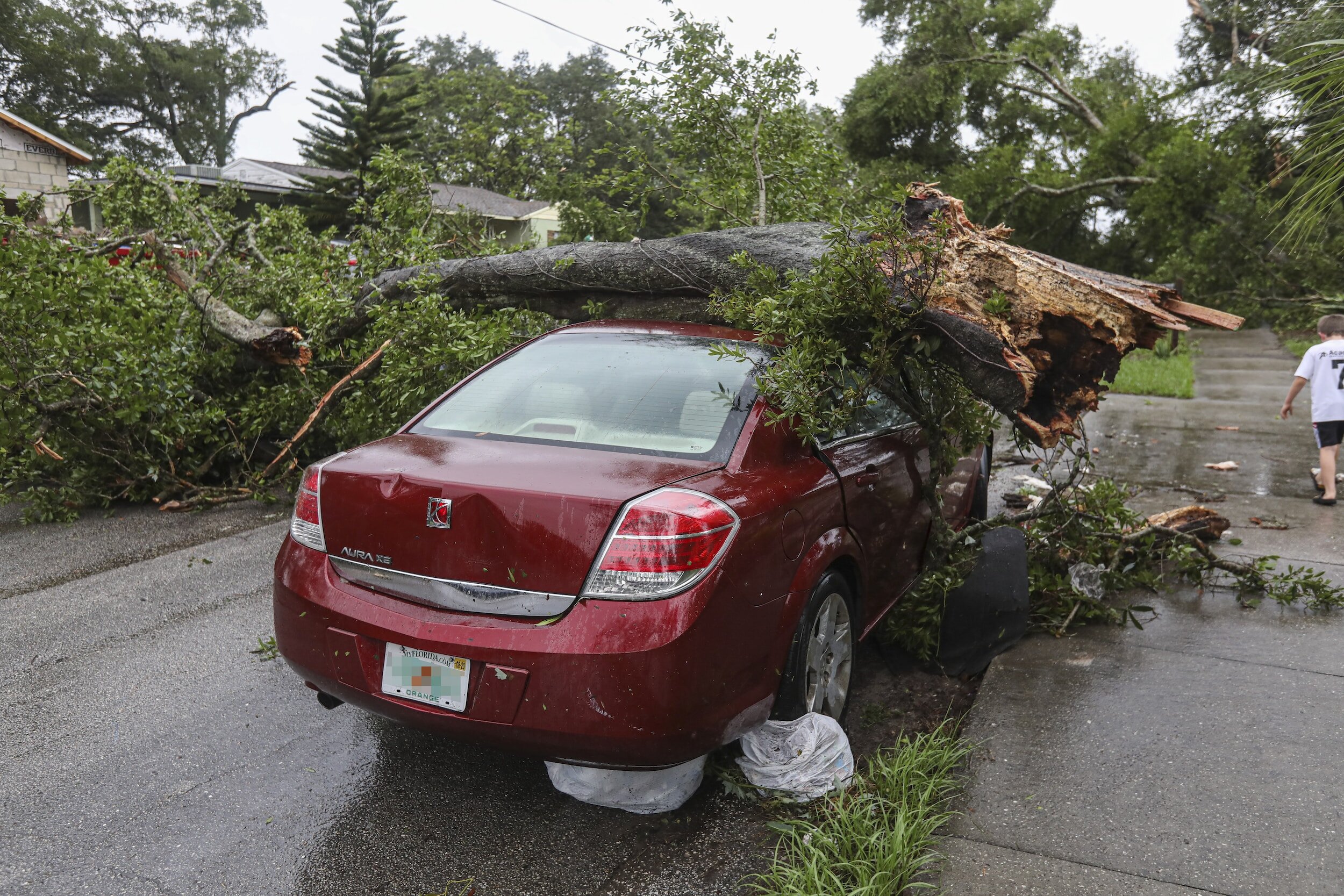
As a practical matter, the answer depends heavily on the type of weather event and the terrain between the station and the site. In flat, open terrain during a large-scale synoptic event — a frontal passage, a winter storm, or a widespread wind event — a single ASOS station can reasonably represent conditions within 15 to 20 miles or more, because these systems are horizontally uniform over those distances. For convective events — thunderstorms, microbursts, and isolated wind shear — the spatial variability is extreme. Two ASOS stations 5 miles apart can show dramatically different readings during a convective outbreak, with one station recording 60 mph gusts while the other records calm conditions. Temperature, dewpoint, and precipitation totals are the most distance-sensitive variables in any weather type; wind speed and direction from a large organized system are the least sensitive.
A forensic meteorologist documents representativeness through multiple independent data sources: nearby mesonet stations, NEXRAD Level II radar coverage, NWS Public Storm Reports, local fire and emergency dispatch records, and damage surveys. Convergence among independent sources spanning the gap between the airport and the incident site strengthens the representativeness opinion substantially and reduces the surface area available for a Daubert challenge.
How does AWOS differ from ASOS in a legal setting?
AWOS (Automated Weather Observing System) stations are state-owned or locally owned, procured with FAA Airport Improvement Program funding, and operated to meet FAA equipment standards — but they are not part of the federal NWS network. That distinction affects authentication. ASOS records are federal public records held by a federal agency with a statutory duty to collect them, and NCEI is their custodian. AWOS records are also public records, but their custodian is typically a state aviation authority or local airport operator. Authentication under FRE 902(4) requires identifying the correct record custodian and obtaining certification from that government entity — not from NCEI.
Technically, FAA AWOS systems are capability-tiered and the capabilities assigned to each level in prior drafts of this article were incorrect. The correct FAA hierarchy is: AWOS-A reports altimeter setting only; AWOS-AV adds visibility; AWOS-1 typically adds wind, temperature, dewpoint, and density altitude; AWOS-2 adds a visibility sensor; AWOS-3 adds cloud/ceiling; AWOS-3P adds precipitation identification; AWOS-3PT and AWOS-3T add thunderstorm and lightning capability; and AWOS-4 includes precipitation occurrence, type, and accumulation; freezing rain; thunderstorm; and runway-surface sensors. An attorney requesting weather data from a small general-aviation airport must confirm the AWOS variant before assuming the data includes wind, visibility, or precipitation — an AWOS-A unit provides none of those. Confirming the AWOS model type before relying on data from any non-ASOS station is a required step in every forensic review.
The table below compares ASOS, AWOS, and COOP (Cooperative Observer Network) stations across the attributes most relevant to weather litigation.
| Attribute | ASOS | AWOS | COOP (Cooperative Observer) |
|---|---|---|---|
| Operator | NWS / FAA / DoD | State aviation authority or local airport | NWS volunteer observer network |
| Observation frequency | 1-minute continuous; METAR hourly | 20-second to 1-minute; METAR hourly (AWOS-3) | Daily (some hourly); precipitation 24-hour totals |
| Wind measurement height | 10 m AGL (WMO/ICAO standard) | Typically 10 m; varies by installation | Not routinely measured |
| FRE hearsay category | Public record — FRE 803(8) | Public record — FRE 803(8) | Public record — FRE 803(8) |
| Self-authentication | FRE 902(4) via NCEI certification | FRE 902(4) via state / local custodian certification | FRE 902(4) via NCEI (GHCN-Daily) certification |
| SPECI capability | Yes — immediate threshold-driven reports | Limited at AWOS-1 and AWOS-2; available at AWOS-3 | No |
| Station count (CONUS) | ~950 | ~1,500+ (unverified; confirm with current FAA records) | More than 8,700 volunteers (NWS COOP overview) |
What does 1-minute ASOS data add to hourly METAR records?
The routine hourly METAR is a single snapshot — one 2-minute average wind reading at the top of the hour, one visibility reading, one precipitation accumulation total. In convective events, atmospheric conditions can shift violently in five minutes or fewer. A storm cell that dropped 1.2 inches of rain in 20 minutes might appear as unremarkable totals split across two adjacent hourly METARs, neither of which individually suggests severe conditions. The 1-minute ASOS observation dataset resolves this problem by providing continuous wind direction, wind speed, peak gust, altimeter pressure, and precipitation accumulation for every minute of every day at every ASOS station.
The 1-minute data is archived in NCEI’s Integrated Surface Database (ISD) alongside the hourly METAR records and is available at no cost from the same portal: ncei.noaa.gov/access/search/data-search/global-hourly. ASOS is the principal U.S. airport observing system associated with standardized 1-minute observation products; AWOS capabilities and dissemination vary by installation and should be evaluated system-by-system before relying on any AWOS station for minute-resolution data. For litigation cases where the plaintiff or claimant alleges sudden-onset severe weather — a microburst, a rapid hail event, or a flash rain flood — the 1-minute ASOS dataset is the preferred primary data source over the hourly METAR. A forensic meteorologist can certify the complete chain of custody from the NCEI download through quality-controlled analysis to the final forensic report.
How do you order certified NOAA weather records for trial?
Certified copies of ASOS and METAR records for court use are ordered through NCEI’s certification portal at ncei.noaa.gov/certification. The portal accepts orders for Local Climatological Data (LCD), Global Hourly ISD records, 1-minute ASOS records, and NEXRAD Level II and Level III radar images. Before placing an order, verify data availability by previewing records through Climate Data Online — NCEI explicitly states that certified orders cannot be canceled once processed, and gaps caused by station downtime must be identified at the preview stage.
Confirm the correct ICAO station identifier before ordering. Memphis International Airport, for example, is KMEM; Nashville International Airport is KBNA; the Memphis NWS Forecast Office is KNQA. Using the wrong identifier is a common ordering error that wastes the certification processing time.
The ordering sequence follows five steps:
- Navigate to ncei.noaa.gov/certification and review the product guide to confirm the correct data type for your case.
- Preview uncertified records through Climate Data Online to verify completeness for the station, date, and UTC time range needed.
- Click the “Order Certified Copies” link on the data page to add the product to the NCEI online shopping cart.
- Submit the order. Most historical data carries no charge; hard-copy certification bears a processing fee.
- Retain the delivery confirmation email and any metadata about the NCEI database version — both establish the government-custodian chain for FRE 902(4) purposes.
What ASOS limitations will opposing counsel raise?
Experienced weather experts and opposing attorneys attack airport data on three grounds: siting, timing, and representativeness. The siting argument is that ASOS instruments are designed to serve aviation safety — they are optimized for runway and touchdown-zone conditions, not for the urban block, industrial facility, or rural property where the incident occurred. Airport terrain tends to be flat, open, and free of obstructions; many loss sites are surrounded by buildings, trees, or terrain features that accelerate, decelerate, or redirect wind. The timing argument is that the hourly METAR simply missed a short-duration event that peaked and ended between observation cycles — the 1-minute dataset is the answer to this challenge, provided it supports the proponent’s theory.
Representativeness challenges focus on distance and intervening terrain, and they tend to be most effective in cases involving localized convective weather. The opposing expert’s standard approach is to identify a second station closer to the incident site that recorded lower intensity conditions, then argue that the discrepancy between the two stations proves the airport was not representative. The response to this argument requires documenting why the closer station is methodologically inferior — whether because of calibration history, AWOS model limitations, sensor siting deficiencies, or absence from quality-controlled government archives. A forensic meteorologist who has already addressed these points affirmatively in the written report forces the opposing expert to rebut a documented methodology rather than simply raising doubt.
When is airport data alone insufficient to establish causation?
Four case types regularly require supplemental evidence beyond the nearest airport observation. The first is localized convective weather. A pop-up thunderstorm cell can drop baseball-sized hail over a 2-mile footprint while the airport 6 miles away records only light rain. In those cases, NEXRAD dual-polarization radar variables — specifically Differential Reflectivity (ZDR), Correlation Coefficient (CC/ρHV), and Specific Differential Phase (KDP) — provide the only objective record of the storm’s hail signature directly over the loss site. Airport data does not fill that gap.
The second case type is microburst and downburst events, which can produce surface wind speeds 40 knots or more above the ambient airport sustained reading. Documenting a microburst requires Velocity Azimuth Display (VAD) wind profiles from WSR-88D velocity data and often requires NEXRAD Level II archive files from the nearest radar site — for example, KNQA for the Mid-South — rather than the airport surface record alone.
The third case type is freezing precipitation. ASOS can misclassify freezing rain as liquid rain when near-freezing temperatures are present and no human augmentation is available. Confirming the freezing level requires upper-air sounding data from the nearest rawindsonde station — for example, WMO station 72340 at Jackson, Mississippi — as well as NWS surface analysis charts and area mesonet temperature profiles. The fourth case type is rainfall-driven flooding: ASOS measures precipitation only at the airport point location. NEXRAD Stage IV QPE (Quantitative Precipitation Estimate) — a multi-sensor mosaic produced by NWS River Forecast Centers — is the correct data source for spatially distributed precipitation totals needed to model runoff and establish flash-flood timing over a watershed.
How does a forensic meteorologist present ASOS data under FRE 702?
Under the December 2023 amendment to FRE 702, the proponent must show by a preponderance of the evidence that the expert applied a reliable methodology reliably to sufficient facts. For ASOS-based testimony, the written forensic report must address five specific points: (1) which station was selected and why it is the best available proxy for the incident location — including a documented station selection rationale that considers every station within a reasonable radius; (2) the station’s data completeness for the target period, including identification of any gaps or quality-control flags; (3) the sensor’s known accuracy limits (±2 knots for sustained wind, per the ASOS User’s Guide specification); (4) the distance, direction, and intervening terrain between the station and the incident site; and (5) what corroborating independent datasets support or qualify the airport reading.
The chain of custody is documented as a sequence from raw government archive through analysis to opinion: NCEI download with access date and station identifier, quality-control review, unit conversion with documented factor (knots to mph: multiply by 1.15078), UTC-to-local time conversion with documented offset, and final summary of conditions. That paper trail — showing exactly where the data came from, how it was processed, and what it means for the specific facts of the case — is what survives Daubert and reaches the jury as credible, auditable science. See the companion article on historical wind speed data sources for a full data retrieval guide.
What damages cases most commonly rely on airport observations?
Airport weather observations appear in weather litigation across every civil practice area. In property damage claims from wind, hail, and tornado events, ASOS records provide the primary event timeline — including whether sustained winds crossed contractual policy thresholds, which are typically set at 25 mph, 40 mph, or 58 mph in standard commercial property policies, or whether conditions met severe thunderstorm criteria under NWS definitions. In slip-and-fall and premises liability cases, METAR and SPECI records establish precipitation onset time, air temperature at or below freezing, and visibility at the exact time of the reported fall. In wrongful death and personal injury cases involving roadway accidents or worksite conditions, ASOS data establishes wind speed, precipitation type, temperature, and visibility — all four variables that bear on the reasonableness of continuing operations during the event.
Aviation accident litigation is the one context where airport observations are used almost universally without a representativeness challenge, because the incident occurred at or near the same station that generated the record. In construction contract disputes, attorneys use ASOS records to document cumulative adverse weather days that excuse delay under standard force-majeure and weather-day provisions. In insurance subrogation, carriers use ASOS data to anchor the forensic meteorologist’s event chronology, establishing whether a weather occurrence meets the policy’s definitional trigger for coverage. Across all of these case types, the ASOS record is the starting point — not the ending point — for a complete forensic weather analysis. See the full guide on proving weather conditions in court for the broader evidentiary framework.
Methods and Sources
Government Datasets and Archives
- NOAA NCEI Global Hourly Integrated Surface Database (ISD) — ASOS and AWOS METAR archive, 1973–present: ncei.noaa.gov/access/search/data-search/global-hourly
- NOAA NCEI Data Certification Portal — certified copies of public weather records for court use: ncei.noaa.gov/certification
- NOAA NCEI Climate Data Online (CDO) — data preview tool before ordering certified copies: ncei.noaa.gov/cdo-web/
- NWS ASOS Wind Sensor Technical Documentation — sensor range, accuracy, and algorithm specifications: weather.gov/asos/WindSensor.html
- NOAA NCEI METAR/TAF FAQ: ncei.noaa.gov
- NWS/FAA/DoD ASOS User’s Guide — NWS, 1998; official technical specification for sensor performance and METAR encoding algorithms
- Federal Standard for Siting Meteorological Sensors at Airports (FCM-S4-2019, updated from FCM-S4-1994) — governs ASOS sensor placement at all NWS-operated stations
- FAA Order JO 7900.5E, with Change 1 (2021) — defines SPECI issuance criteria and surface weather observation practices at certificated airports
Legal Standards and Case Law
- Federal Rules of Evidence 803(6), 803(8), 902(4), 703: law.cornell.edu/rules/fre
- Federal Rule of Evidence 702, as amended December 1, 2023 — preponderance burden on proponent for expert admissibility
- Daubert v. Merrell Dow Pharmaceuticals, Inc., 509 U.S. 579 (1993) — four-part gatekeeping test for scientific expert testimony
- Kumho Tire Co. v. Carmichael, 526 U.S. 137 (1999) — extends Daubert gatekeeping to technical and specialized knowledge
Technical Standards
- ICAO Annex 3 — international standard for aviation meteorological services, including METAR and SPECI code formats
- WMO-No. 8, Guide to Instruments and Methods of Observation — wind measurement standards including 10-meter AGL anemometer height specification
Disclaimer: This article is informational and is not legal advice. No attorney-client relationship is created by reading this content. Consult a licensed attorney for advice specific to your case.