Dust Storm Meteorologist Expert Witness for Accident Litigation
A dust storm meteorologist expert witness helps attorneys, insurers, claims professionals, and litigation teams evaluate what the reliable weather record supports at the incident location, during the relevant time window, and along the roadway or property where the loss occurred. Dust storm accident cases rarely turn on whether blowing dust occurred somewhere in the region — the forensic question is more specific: what did the weather evidence establish at the specific site, and what did it fail to establish?
ENGAGE WITH A DUST STORM EXPERT METEOROLOGIST
Weather and Climate Consulting LLC provides forensic meteorology analysis for dust storm accidents, highway pileups, trucking claims, visibility disputes, property damage matters, and weather-related litigation nationwide. This work may include review of ASOS, AWOS, METAR, SPECI, NWS warning products, GOES satellite imagery, WSR-88D radar data, Road Weather Information System data, roadway camera footage, and case-specific incident evidence.
This article explains what a forensic meteorologist can evaluate in a dust storm case, what the data can and cannot establish, and when attorneys should retain a weather expert. It does not provide legal opinions, engineering opinions, accident reconstruction opinions, medical opinions, or policy interpretation. Liability, negligence, admissibility, comparative fault, and standard-of-care issues require case-specific legal analysis by qualified counsel.

Need a Dust Storm Meteorologist Expert Witness?
Weather and Climate Consulting LLC can review the incident date, time, location, claimed visibility conditions, NWS warnings, radar, satellite imagery, roadway sensor data, and available evidence to determine what the meteorological record supports and what limitations apply.
Contact Weather and Climate Consulting LLC for a confidential dust storm case review.
Key Facts for Attorneys Handling Dust Storm Accident Cases
| Issue | Why It Matters | Key Limitation | Relevant Weather Evidence |
|---|---|---|---|
| Was visibility reduced at the incident site? | May affect attorney evaluation of perception, reaction time, warning context, and accident sequence. | Airport visibility may not represent a roadway, field, construction site, or specific mile marker. | METAR, SPECI, ASOS, AWOS, RWIS, DOT cameras, photographs, video, law enforcement reports. |
| When did conditions deteriorate? | Timing may be relevant to notice, warning, dispatch, traffic management, and crash-sequence questions. | Dust plumes may pass between standard observation intervals. | GOES imagery, WSR-88D radar, RWIS, NWS warning records, Local Storm Reports, roadway cameras. |
| Was an NWS warning or advisory in effect? | May provide meteorological context for hazard recognition and warning-time analysis. | A warning polygon does not prove exact visibility at a specific roadway point or prove driver receipt. | NWS Dust Storm Warning, Blowing Dust Warning, Dust Advisory, Blowing Dust Advisory, Area Forecast Discussion, Special Weather Statement. |
| Did the nearest airport observation miss the event? | This is a common dispute when one party relies on a single METAR observation. | Dust storm boundaries can be sharp and localized, especially with outflow-driven haboobs. | Multiple METAR stations, station distance, plume path, RWIS, radar, satellite, site evidence. |
| Can exact visibility be reconstructed? | Attorneys often want a specific number for reports, deposition, mediation, or trial. | Exact driver-level visibility at a single mile marker and minute is often not measurable from archived data alone. | Expert synthesis of direct observations, measured visibility, camera evidence, radar, satellite, and uncertainty range. |
Direct Answer: Can a Dust Storm Meteorologist Expert Witness Reconstruct Visibility?
In many cases, yes, with important qualifications. A dust storm meteorologist expert witness can often develop a defensible characterization of visibility conditions at or near the time and location of an accident by integrating multiple independent weather and site-specific records. That analysis may evaluate whether visibility was reduced, whether a dust plume affected the corridor, when conditions likely deteriorated, how quickly the plume moved, whether NWS warnings were active, and whether the claimed conditions are consistent with the meteorological record.
The analysis is not the same as declaring liability or determining legal causation. A meteorologist should distinguish direct observations, measured visibility, interpolations, assumptions, and expert inferences. Exact visibility at a single highway mile marker at a single minute is often not knowable unless strong site-specific evidence exists. A reliable opinion should state what the evidence supports, what remains uncertain, and what cannot be concluded.
Why Dust Storm Weather Evidence Matters in Litigation
Dust storm cases can involve severe visibility reductions, rapid onset, multi-vehicle impacts, trucking claims, highway operations, construction activity, agricultural land disturbance, or property damage. Weather evidence may help attorneys evaluate whether the meteorological record supports the alleged conditions and whether a particular data source is representative of the incident site.
A dust storm meteorologist expert witness may be retained by plaintiff counsel, defense counsel, insurance carriers, trucking defense teams, governmental entities, or claims professionals. The expert’s role is to explain the weather evidence objectively. The expert should not decide who was negligent, whether a driver acted reasonably, whether a roadway should have been closed, whether a warning was legally adequate, or whether a policy provision applies.
In accident litigation, forensic meteorology may help evaluate:
- site-specific visibility near the incident time;
- timing of dust plume onset and dissipation;
- whether airport observations were representative of the roadway;
- whether NWS warnings, advisories, or statements were in effect;
- whether radar or satellite imagery supports plume movement near the corridor;
- whether RWIS, DOT camera, dashcam, or law enforcement evidence should be preserved;
- what uncertainties should be disclosed in an expert report.
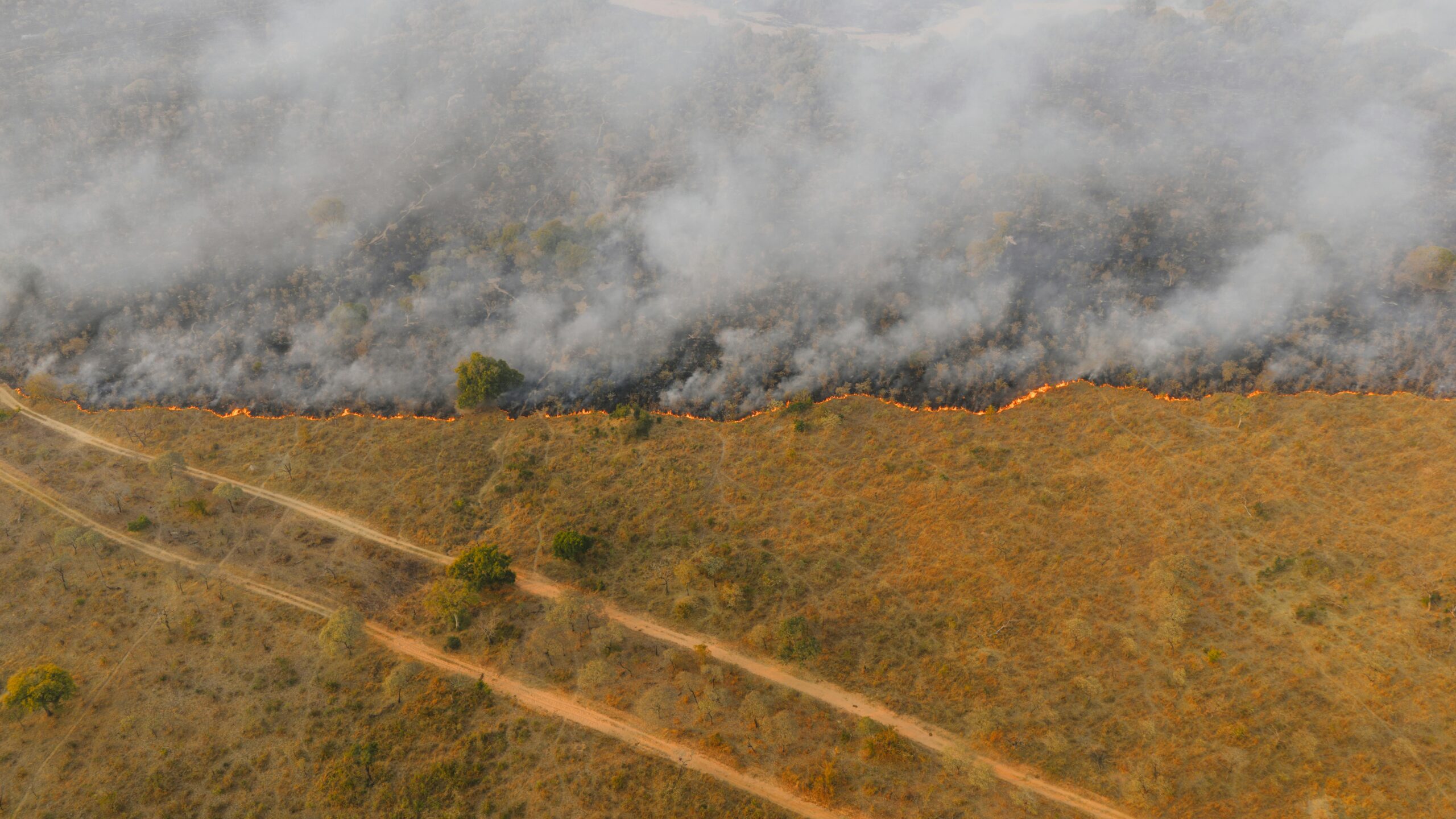
Dust Storms, Blowing Dust, and Haboobs: Why the Distinction Matters
The National Weather Service glossary describes a dust storm as a severe weather condition characterized by strong winds and dust-filled air over an extensive area. NWS hazard products use specific visibility thresholds. At the advisory level, a Blowing Dust Advisory is used when widespread, synoptically driven blowing dust reduces visibility to 1 mile or less but greater than 1/4 mile, with winds of 25 mph or greater usually required; a Dust Advisory is used for convectively driven dust at the same visibility range. Synoptically driven advisory-level events are typically longer-lived and more geographically widespread than convectively driven events. At the warning level, NWS issues two distinct products: a Blowing Dust Warning for synoptically driven events that reduce visibility to 1/4 mile or less, and a Dust Storm Warning for convectively driven events at the same threshold — both typically requiring winds of 25 mph or greater, though wind speed thresholds may vary by NWS forecast office, with some offices requiring 30 mph or higher for warning-level products. Beyond the convective/synoptic split, these warning products differ in geographic scope and duration: the Blowing Dust Warning is typically issued for widespread, longer-lived synoptic events generally persisting more than 90 minutes, while the Dust Storm Warning is reserved for localized, shorter-duration convective haboobs and triggers Wireless Emergency Alerts (WEA). Both the product criteria and these scope and duration differences are forensically relevant. In Plains states and parts of the Pacific Northwest, the operative warning-level product is frequently a Blowing Dust Warning rather than a Dust Storm Warning. Conflating the two products — or omitting the Blowing Dust Warning from the hazard record review — can affect how warning context is characterized in expert testimony and case documents.
These thresholds are important, but they should not be treated as automatic proof of conditions at a specific roadway point. A warning or advisory may provide strong meteorological context, yet the expert still needs to evaluate station distance, timing, plume path, sensor limitations, terrain, land use, and direct site evidence.
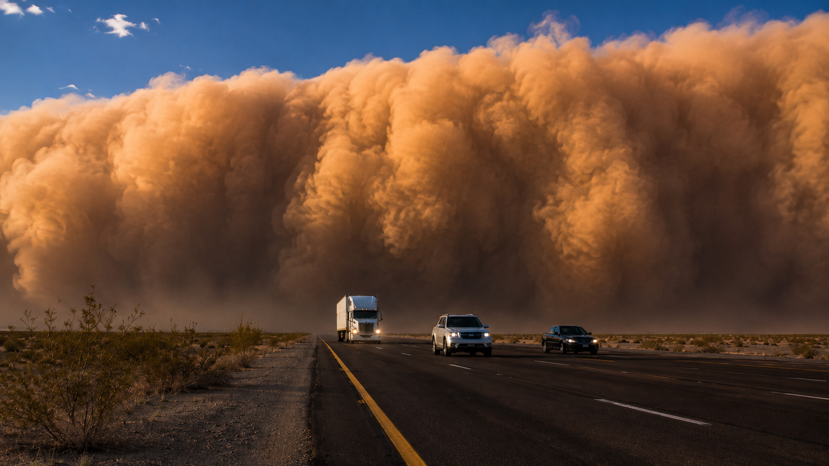
Haboobs and Rapid Visibility Loss
A haboob is a dust storm associated with strong convective or synoptic-scale winds that loft loose surface soil into a dense, fast-moving wall of particulate matter. In the U.S. Desert Southwest, haboobs are most commonly generated by thunderstorm outflow winds — dense cold air descending from a collapsing storm cell and spreading outward near the surface. However, dust storms can also be generated by cold frontal passages and strong synoptic-scale winds, particularly in Plains states and other regions outside the Desert Southwest, without involving thunderstorm outflow. These synoptically driven dust storms are distinct from haboobs under standard NWS and AMS meteorological definitions. This distinction has direct forensic relevance: thunderstorm-outflow haboobs typically fall under the NWS Dust Storm Warning criterion, while synoptically driven dust storms in the same visibility range fall under the Blowing Dust Warning criterion. The NWS notes that dust storms can arrive suddenly as an advancing wall of dust and debris, creating hazardous driving conditions and chain-collision risk. See the NWS safety page on Dust Storms and Haboobs.
For litigation, the key point is timing. A haboob may affect a roadway rapidly, while an airport several miles away remains outside the most severe plume. Whether a specific accident involved a haboob, synoptic blowing dust, localized fugitive dust, or a combination of conditions requires case-specific reconstruction.
What a Dust Storm Meteorologist Expert Witness Can Evaluate
A forensic meteorologist may help answer weather-focused questions such as:
- Were meteorological conditions favorable for blowing dust or a dust storm?
- Was a Dust Storm Warning, Blowing Dust Warning, Dust Advisory, Blowing Dust Advisory, Special Weather Statement, or relevant Area Forecast Discussion in effect?
- Did surface observations document reduced visibility, strong winds, blowing dust, dust storm codes, or wind shifts?
- Were the nearest ASOS or AWOS observations representative of the incident site?
- Did GOES satellite imagery show a dust plume moving toward or across the incident corridor?
- Did WSR-88D radar data support an outflow boundary, plume signature, or convective trigger?
- Did RWIS, DOT camera, roadway sensor, dashcam, surveillance, or law enforcement evidence corroborate reduced visibility?
- What uncertainty remains after reviewing all available evidence?
A meteorologist should not answer legal questions such as who is liable, whether a party breached a duty, whether a driver acted reasonably, whether governmental immunity applies, or whether a policy exclusion controls. Those are legal determinations for counsel and the court.
Evidence Hierarchy in Dust Storm Visibility Reconstruction
Not all weather records carry equal forensic weight. A reliable dust storm reconstruction should prioritize evidence based on proximity, measurement type, timing, and representativeness.
- 1Direct incident-site evidence. Dashcam video, surveillance video, roadway camera footage, photographs, law enforcement observations, EMS observations, dispatch logs, and contemporaneous witness statements may provide direct evidence of conditions at or near the roadway.
- 2Roadway-specific sensors and cameras. RWIS or Environmental Sensor Station data near the corridor may be highly probative because it may measure visibility, wind, precipitation, pavement condition, or camera imagery closer to the incident site than an airport.
- 3Nearby ASOS, AWOS, METAR, SPECI, and mesonet observations. These provide measured weather conditions, but the expert must evaluate distance, terrain, plume path, observation interval, and station representativeness.
- 4NWS Local Storm Reports, warnings, advisories, and statements. These records may support timing, hazard context, and reports of dust impacts, but a warning polygon is not a site-specific visibility measurement.
- 5GOES satellite imagery. Satellite imagery may show plume extent, movement, and approximate timing during daylight or favorable conditions, but it does not directly measure surface visibility.
- 6WSR-88D radar data. Radar may support outflow boundary analysis or dust-plume detection under favorable circumstances, but it does not directly measure driver-level visibility.
- 7Forecast products and Area Forecast Discussions. These may be useful for meteorological context and warning-time analysis, but forecasts are not proof of actual site conditions.
- 8Model guidance and broad regional weather summaries. These are generally supporting context only and should not replace observations or site-specific evidence.
Weather Records and Evidence an Expert May Review
| Evidence Type | Forensic Use | Key Limitation |
|---|---|---|
| ASOS / METAR / SPECI | Visibility, wind, pressure, present weather, remarks, special observations. | Single airport point; may not represent a roadway miles away. |
| AWOS | Airport weather observations where ASOS may not be available. | AWOS units are operated and maintained primarily by state and local governments and other non-federal entities under FAA certification — not by the FAA directly, which operates only a minority of systems. AWOS generally reports at 20-minute intervals and, unlike ASOS, does not provide special observations for rapidly changing weather conditions. Note that some AWOS units also transmit a 1-minute updated voice broadcast on the aviation advisory frequency; however, this broadcast is not the same as the archived METAR record and is typically not recoverable in litigation unless separately preserved at the time of the incident. |
| One-minute or five-minute ASOS data | Higher-frequency support for rapidly changing visibility, wind shifts, and gusts where available. | Still an airport point observation; data availability varies. |
| RWIS / ESS / DOT sensors | Roadway-specific visibility, wind, pavement, precipitation, or camera evidence. | Coverage and retention vary by state agency; early preservation is important. |
| NWS warnings, advisories, statements, and AFDs | Hazard context, issuance time, expiration time, warning area, forecast reasoning. | Does not prove exact site visibility or warning receipt by a driver. |
| NWS Local Storm Reports | Reported occurrence, approximate timing, location, and impacts. | Dependent on human reporting density and report quality. |
| GOES satellite imagery | Dust plume extent, motion, and approximate arrival timing. | Cannot directly confirm surface visibility at a specific roadway point. |
| WSR-88D radar | Outflow boundary, storm context, and possible dust plume signatures under favorable conditions. | Radar beam height, range, scan elevation, and target type affect interpretation. |
| Dashcam, roadway camera, photographs, and law enforcement records | Direct evidence of visibility, dust wall arrival, traffic behavior, and scene conditions. | Needs time synchronization, authenticity review, location confirmation, and context. |
Why Airport Observations May Not Represent the Incident Site
Attorneys often start with the nearest airport METAR. That record can be useful, but it may not be determinative in a dust storm case. Dust plume boundaries can be sharp. Conditions may transition from unrestricted visibility to near zero over a short distance. An airport 10, 20, or 30 miles from the incident site may report clear visibility while a localized dust plume affects a highway corridor.
The NCEI ASOS/AWOS page explains that ASOS is a joint NWS, FAA, and DOD program with more than 900 U.S. sites collecting observations continually. Unlike ASOS, AWOS units are primarily operated and maintained by state and local governments and other non-federal entities under FAA certification — not by the FAA directly, which operates only a minority of units. AWOS generally reports at 20-minute intervals and does not provide special observations for rapidly changing weather conditions.
That distinction matters in forensic reconstruction. A rapidly moving dust plume may cross a roadway between observation intervals. A missing dust remark in a METAR does not automatically establish that no dust storm occurred at the incident site. A responsible analysis should evaluate multiple stations, station siting, distance, topography, plume movement, observation intervals, and roadway-specific data where available.
Radar and Satellite Evidence in Dust Storm Reconstruction
WSR-88D Radar
Archived NEXRAD data may support dust storm reconstruction when interpreted carefully. NCEI describes the NEXRAD system describing 160 operational NEXRAD systems deployed throughout the United States and at selected overseas locations — high-resolution S-band Doppler radars jointly operated by NWS, FAA, and the U.S. Air Force. NCEI provides access to archived Level-II data and Level-III products. Level-II data include reflectivity, mean radial velocity, spectrum width, and dual-polarization quantities such as differential reflectivity, correlation coefficient, and differential phase.
In some dust events, dual-polarization products may help identify plume characteristics or distinguish non-precipitation targets from precipitation. Radar should not be treated as a direct visibility measurement. Beam height, distance from the radar, scan angle, volume scan timing, radar mode, atmospheric conditions, and dust depth all affect whether a plume is detectable.
GOES Satellite Imagery
GOES satellite imagery may show plume motion, timing, and spatial extent. The GOES-R program describes the Advanced Baseline Imager as the primary imaging instrument on the GOES-R Series, with 16 spectral bands. In Mode 6, ABI provides full disk imagery every 10 minutes, CONUS or PACUS imagery every five minutes, In Mode 6, ABI scans two separate mesoscale domains every 60 seconds by default. A 30-second cadence is achievable for a single domain by redirecting both mesoscale scan slots to the same geographic location — an operational decision made by NOAA, not an automatic or default configuration. This distinction matters when evaluating the actual temporal resolution of satellite evidence available for a specific incident corridor at a given time.
Satellite imagery is often valuable in large dust plume events, especially during daylight. It still does not directly measure surface visibility at a specific highway location. A visible plume edge is not the same as the boundary of zero visibility at driver eye level.
Methodology and Data Handling in Dust Storm Expert Analysis
A defensible forensic meteorology analysis should be transparent, repeatable, and clear about limitations. In dust storm matters, methodology often includes:
- 1Define the incident location. Confirm mile marker, GPS coordinates, road orientation, travel direction, elevation, nearby terrain, land use, and surrounding dust sources.
- 2Define the relevant time window. Confirm local time, UTC conversion, time zone, daylight saving status, crash sequence, police report times, dispatch times, and any camera timestamps.
- 3Preserve time-sensitive records. Identify RWIS, DOT camera, 911, dispatch, dashcam, surveillance, telematics, and agency records that may be overwritten.
- 4Identify surface stations. Review ASOS, AWOS, mesonet, cooperative, and nearby station data. Evaluate station distance, elevation, siting, and representativeness.
- 5Review NWS products. Assess warnings, advisories, Special Weather Statements, Local Storm Reports, Area Forecast Discussions, and relevant forecast context.
- 6Analyze radar and satellite data. Review WSR-88D Level-II/III products, GOES visible/infrared imagery, scan timing, beam height, plume motion, and environmental context.
- 7Integrate roadway and site evidence. Compare weather data with direct evidence such as photos, videos, law enforcement observations, DOT records, and witness accounts.
- 8Disclose limitations. Separate measured facts, expert inferences, assumptions, and uncertainty ranges. Avoid overstating precision.
This type of structured methodology can help support the reliability of a dust storm meteorologist expert witness under Daubert, FRE 702, and state-law equivalents, while remaining within the meteorologist’s scientific role.
Data Limitations in Dust Storm Accident Reconstruction
Dust storm reconstruction is evidence-driven. Some limitations are common:
- Exact visibility at a single mile marker and minute may not be measurable.
- Airport observations are point observations, not corridor-wide measurements.
- AWOS reporting intervals may miss rapidly changing visibility conditions.
- GOES imagery can show plume movement but not driver-level visibility.
- WSR-88D radar may overshoot shallow dust near the surface, especially at longer ranges.
- NWS warnings and advisories provide hazard context but do not prove site-specific conditions.
- RWIS and DOT camera records may have short retention windows.
- Witness reports may be important but are not the same as calibrated weather observations.
A strong expert report should not hide these limitations. It should explain how they affect confidence in the reconstruction.
Common Attorney Mistakes in Dust Storm Weather Cases
- Relying on one airport METAR. The nearest airport may not be representative of the incident site.
- Treating a warning polygon as proof. A Dust Storm Warning may support hazard context, but it does not prove exact visibility at a roadway point.
- Treating absence of a warning as absence of hazard. Warnings are not perfect records of every affected location.
- Using weather app screenshots as evidence. Weather apps often use gridded or estimated data and are not substitutes for official weather records and expert analysis.
- Failing to preserve RWIS and camera data early. Roadway data and video may be overwritten before litigation begins.
- Overclaiming exact visibility. A defensible opinion should avoid false precision unless strong site-specific evidence supports it.
- Asking the meteorologist to provide legal conclusions. Meteorological findings should support counsel’s case evaluation, not replace legal analysis.
Records to Preserve Immediately After a Dust Storm Accident
Some of the most useful evidence in a dust storm accident case may not remain available indefinitely. Attorneys and claims professionals should consider preservation requests for:
- RWIS / Environmental Sensor Station data;
- DOT traffic camera footage and still images;
- 911, dispatch, highway patrol, and emergency management logs;
- law enforcement photographs, body-camera footage, and scene observations;
- dashcam, fleet camera, and commercial vehicle telematics;
- nearby business, construction site, or property surveillance footage;
- ASOS, AWOS, METAR, SPECI, and one-minute ASOS data;
- NWS warnings, advisories, Local Storm Reports, and Area Forecast Discussions;
- GOES satellite imagery and WSR-88D radar data;
- road closure records, variable message sign logs, and traffic-management records.
The FHWA Road Weather Management FAQ describes RWIS as a system composed of Environmental Sensor Stations, communications, and central systems used to collect and disseminate road weather information. FHWA notes that road weather data may include atmospheric information such as visibility distance, wind speed and direction, precipitation type and rate, and pavement data such as pavement temperature and pavement condition.
Hypothetical Example: Conflicting Dust Storm Records
The following example is hypothetical. It does not represent a real case, real parties, or verified weather data.
A multi-vehicle collision occurs on a rural interstate during the afternoon. Several drivers report that a wall of dust reduced visibility to near zero within seconds. The nearest airport, 24 miles away, reports unrestricted visibility near the top of the hour. One party argues that the airport record disproves the dust storm allegation.
A forensic review identifies an NWS Dust Storm Warning covering the relevant corridor, GOES imagery showing a dust plume moving toward the area, WSR-88D data supporting an outflow boundary, and a state DOT roadway sensor 9 miles from the crash site showing a rapid wind shift and visibility reduction. The expert concludes that the airport record is not representative of the incident corridor during the relevant window and that the broader meteorological record is consistent with rapidly developing dust storm conditions near the crash location. The expert does not opine on negligence, liability, or comparative fault.
Retain a Dust Storm Meteorologist Expert Witness
Weather and Climate Consulting LLC provides forensic meteorology analysis for attorneys, insurers, claims professionals, and litigation teams handling dust storm accidents, visibility disputes, trucking claims, and weather-related litigation nationwide.
Contact Weather and Climate Consulting LLC to discuss your dust storm case.
Frequently Asked Questions About Dust Storm Meteorologist Expert Witnesses
What can a dust storm meteorologist expert witness determine?
A dust storm meteorologist expert witness can evaluate whether the weather record supports blowing dust, reduced visibility, strong winds, outflow boundaries, warning products, plume motion, and site-specific conditions near the incident time and location. The expert should also explain uncertainty and identify what the data cannot establish.
Can an airport observation prove conditions at the accident site?
Not by itself. An ASOS or AWOS observation records conditions at a fixed airport location. It may be useful, but a dust plume can affect a highway corridor while bypassing the airport. The station must be evaluated for distance, siting, elevation, plume path, observation interval, and representativeness.
Can a Dust Storm Warning prove visibility at the crash location?
No. A Dust Storm Warning may establish that NWS identified a hazardous dust event within a warning area and time window, but it does not prove exact visibility at a specific mile marker. It should be evaluated with surface observations, RWIS data, radar, satellite imagery, reports, and direct site evidence.
Can radar or satellite prove a dust storm caused a crash?
Radar and satellite imagery may support dust plume timing, movement, and environmental context, but neither directly measures driver-level visibility at a specific roadway point. A meteorologist should integrate radar and satellite with surface observations, RWIS, camera evidence, and incident records.
How quickly should attorneys preserve dust storm weather evidence?
As soon as possible. NOAA and NCEI records are generally archived, but DOT camera footage, RWIS data, dispatch logs, commercial vehicle video, and agency records may be overwritten or retained for only a limited period depending on the agency or company.
What information should I send for a dust storm case review?
Send the incident date, time, time zone, crash location or mile marker, police report, claimed visibility conditions, photos, video, dashcam footage, known NWS warnings, roadway camera information, DOT/RWIS records if available, and any expert disclosure or report deadline.
When to Retain a Dust Storm Meteorologist Expert Witness
Attorneys should consider retaining a dust storm meteorologist expert witness when a case involves disputed visibility, conflicting weather records, reliance on a single airport observation, NWS warning issues, roadway sensor data, trucking claims, multi-vehicle collisions, governmental response questions, or property damage tied to blowing dust.
Early retention may help preserve time-sensitive records and prevent weak weather assumptions from shaping the case. A forensic meteorologist can help counsel understand what the weather evidence supports, what it does not support, and which records may need to be requested before they are no longer available.
Retain a Dust Storm Meteorologist Expert Witness
Weather and Climate Consulting LLC provides forensic meteorology analysis for attorneys, insurers, claims professionals, and litigation teams handling dust storm accidents, visibility disputes, trucking claims, and weather-related litigation nationwide.
Contact Weather and Climate Consulting LLC to discuss your dust storm case.
Internal Resources for Attorneys
The following Weather and Climate Consulting LLC resources may help attorneys and claims professionals evaluate weather evidence in litigation:
- What Is a Forensic Weather Expert Witness?
- What Is Forensic Meteorology?
- Meteorologist Expert Witness for Motor Vehicle Accidents
- Driver Visibility Expert Witness for Weather Vehicle Accidents
- Weather Evidence Guide for Legal Cases
- How to Prove Weather Conditions in Court
- Accurate Weather Data for Insurance and Legal Disputes
- Storm Timing Insurance Claims: Weather Records Attorneys Should Review
Conclusion
Dust storm accident cases require site-specific weather reconstruction. A single airport observation, warning polygon, news report, or weather app screenshot is rarely enough to characterize visibility at a roadway location. A defensible analysis should integrate direct site evidence, roadway sensors, ASOS/AWOS observations, NWS products, radar, satellite imagery, and documented methodology.
A dust storm meteorologist expert witness can help attorneys determine what the weather evidence supports, what remains uncertain, and what limitations should be disclosed. The strongest forensic opinions avoid legal conclusions, avoid false precision, and clearly separate measured weather evidence from expert inference.