Washington State Weather Expert Witness: Forensic Meteorologist John Bryant
BOTTOM LINE UP FRONT
A forensic meteorologist reconstructs Washington State weather conditions for civil litigation using NOAA-archived observations, NEXRAD Level II radar, and Washington mesonet data. Hourly rates run $200-$500 depending on case complexity and credentials. Pacific Northwest weather requires regional fluency: the Puget Sound Convergence Zone can deposit 2 or more inches of precipitation within a 10-mile corridor while surrounding areas stay dry; Cascade orographic gradients produce 100-inch annual precipitation differences across 30 miles; the Fraser River outflow drives sub-freezing Arctic air through western lowlands, producing widespread black ice at air temperatures that read above 32°F at Sea-Tac. Washington state courts evaluate expert testimony under Washington Evidence Rule (ER) 702 and the Frye-Reed standard as refined in State v. Cauthron, 120 Wn.2d 879 (1993), and Anderson v. Akzo Nobel Coatings, Inc., 172 Wn.2d 593 (2011); federal courts in the Western and Eastern Districts apply Daubert.
Washington Forensic Meteorology: Quick Reference
| Service Area | Washington statewide, Puget Sound lowlands, Cascade Range, Olympic Peninsula, Columbia Basin, Spokane Plateau, Yakima Valley, Columbia Gorge (WA side) |
| Evidentiary Framework | Washington ER 702; Frye standard per State v. Cauthron, 120 Wn.2d 879 (1993); Anderson v. Akzo Nobel Coatings, Inc., 172 Wn.2d 593 (2011); federal courts (W.D. Wash. / E.D. Wash.) apply Daubert |
| Primary Data Sources | NOAA NCEI archive – NWS Seattle (SEW), Spokane (OTX), Portland (PQR) – ASOS/AWOS network – WSU AgWeatherNet mesonet – NEXRAD WSR-88D (KATX, KOTX, KRTX) |
| Hourly Rate Range | $200-$500/hour (research, deposition, trial; tier varies by complexity) |
| Typical Case Types | Slip-and-fall (black ice/freezing rain), vehicle accidents (fog/hydroplaning), wind damage, flooding, construction delay, wildfire, wrongful death |
| Regional Specialization | Pacific marine layer, Cascade orographics, Puget Sound Convergence Zone, Fraser River outflow events, Columbia Basin gap winds, Eastern WA continental extremes |
| Turnaround | Preliminary review within 48 hours; full report 7-10 business days |
Why Washington Attorneys Hire a Regional Forensic Meteorologist
Washington weather creates liability questions that generic, app-based data cannot resolve. A forensic meteorologist with Pacific Northwest fluency reconstructs conditions at the exact time and place in dispute – using primary federal archives, not interpolated model grids. The difference between a defensible reconstruction and a screenshot from a phone app often determines whether a case settles or proceeds to trial.
John Bryant is an AMS- and EPA-certified forensic meteorologist and expert witness based in Memphis, Tennessee, specializing in weather reconstruction for slip-and-fall, wind, hail, wildfire, and ice-storm litigation.
Washington’s geography compresses extraordinary climate diversity into a single state. West of the Cascades, the Pacific marine layer controls everything: sea-surface temperatures in Puget Sound hovering between 48 and 54°F, onshore flow depositing approximately 37 to 39 inches of annual precipitation on the Seattle metro (with wetter foothill locations receiving significantly more), and convergence zones capable of targeting a 10-mile swath of King or Snohomish County with two or more inches of rainfall or heavy snow while neighboring counties report clear skies. East of the Cascades, the Columbia Basin operates as a continental climate in miniature – summer highs near 105°F at the Tri-Cities, winter lows well below zero in the Spokane Valley, and diurnal temperature swings exceeding 40°F in a single day.
Consumer weather apps interpolate from distant model grids; they do not capture these microclimates. A defensible weather reconstruction for Washington courts begins with site-specific station data: Seattle-Tacoma International (KSEA), Boeing Field (KBFI), Paine Field/Everett (KPAE), Spokane International (KGEG), Yakima Air Terminal (KYKM), Pasco (KPSC), Olympia (KOLM), and Bellingham International (KBLI), plus dozens of cooperative observer (COOP) and WSU AgWeatherNet mesonet sites. The difference matters. A plaintiff claims she slipped on ice at 7:45 AM in a Kirkland parking lot. The defendant’s phone app shows 35°F; the KSEA ASOS METAR for 1545Z shows 33°F with freezing drizzle (-FZDZ) coded on the surface observation, and the KPAE observation 13 miles north shows 30°F. That temperature gradient, archived in a federal database with quality flags and sensor metadata, is the difference between a defensible reconstruction and a screenshot.
A retained forensic meteorologist also supplies the piece attorneys can rarely build alone: chain-of-custody documentation for every data point, retrieval timestamp, source archive, query parameters, and, on request, file-level checksums. Without that scaffolding, individual weather records sit on the same evidentiary footing as a forwarded text message.
Evidence and Methods: How Weather Reconstruction Works
ASOS, AWOS, COOP, and Washington Mesonet Networks
Automated Surface Observing System (ASOS) and Automated Weather Observing System (AWOS) stations form the spine of forensic surface analysis. Washington hosts more than 40 ASOS/AWOS sites at FAA-jurisdiction airports plus NWS-maintained installations. METAR observations are archived in the NOAA NCEI Integrated Surface Database (ISD) with UTC timestamps and per-element quality control flags.
Worked example – slip-and-fall in a Bellevue parking garage, 0630 PST on January 13, 2025. The expert pulls METAR data from KSEA (Seattle-Tacoma International, 12 miles southwest) and KBFI (Boeing Field, 8 miles west):
KSEA 131430Z 00000KT 4SM -FZDZ BR OVC004 01/01 A2991
Decoded: calm wind; visibility 4 statute miles in light freezing drizzle and mist; overcast ceiling 400 ft; temperature 1°C; dew point 1°C; altimeter 29.91 inHg. Every field is a verifiable, archived data point with documented sensor metadata. The freezing drizzle code (-FZDZ) establishes active ice-crystal deposition on pavement surfaces at the observation time.
The WSU AgWeatherNet mesonet, operated by Washington State University, fills rural gaps and records parameters airports do not – soil moisture, leaf wetness, solar radiation, and crop-canopy temperature. For agricultural, forestry, or premises cases in Eastern Washington far from airports, these 180-plus stations supply the hyperlocal data NWS sites cannot. NWS Cooperative Observer (COOP) sites add daily precipitation and temperature records dating back decades.
NEXRAD WSR-88D Radar Coverage
Washington is covered by NEXRAD sites KATX (Camano Island/Seattle), KOTX (Spokane), and KRTX (Portland, covering the Columbia Gorge and southwest Washington) within or immediately adjacent to the state, plus KLGX (Langley Hill, serving the Washington coast and Olympic Peninsula). WSR-88D radars complete a volume scan every 4 to 6 minutes in precipitation mode and operate in dual-polarimetric configuration, providing base reflectivity (Z), base velocity (V), differential reflectivity (ZDR), correlation coefficient (ρHV), and specific differential phase (KDP). Level II archive data is preserved at NCEI.
For a hydroplaning crash on I-5 near Federal Way at 1420 PST on November 20, 2024, KATX returned 45-55 dBZ reflectivity over the crash site at 2218Z. Applying the stratiform Z-R relationship, the instantaneous rate falls in the 0.8-1.4 in/hr range. Where standing water on the pavement is in question, the expert combines that rate with antecedent precipitation totals, WSDOT pavement design specifications, and surface drainage characteristics – none of which a weather-app screenshot can supply.
Synoptic and Upper-Air Context
Surface observations alone rarely explain a Pacific Northwest event. Washington weather is driven by Pacific storm tracks, the Cascade barrier, and episodic Arctic intrusions through the Fraser River valley or over the Okanogan Highlands. Upper-air soundings from Quillayute (UIL, WMO 72797) on the Olympic Peninsula anchor the vertical profile. Reanalysis products – NAM, RAP, HRRR – fill spatial and temporal gaps. NOAA Weather Prediction Center surface analyses and SPC mesoscale archives provide the synoptic narrative.
Western Washington ice events have a textbook setup: warm, moist Pacific air aloft (850-mb temperatures above 0°C) overrunning a shallow Arctic cold pool driven in from British Columbia by Fraser River outflow, with subfreezing air pooling in the Puget Sound lowlands at depths of 500 to 1,000 ft. The December 2006 Hanukkah Eve windstorm is the benchmark for western Washington wind reconstruction: peak gusts of 69 mph at Sea-Tac and 70-100+ mph at elevated and inland sites across the western lowlands generated the largest modern power outage in Washington state history, with approximately 1.5 million customers in Washington losing power. The January 2012 convergence zone snow event deposited 8 to 12 inches of snow across a 15-mile corridor in Snohomish and King Counties while areas 10 miles north and south received rain – an illustration of why single-station analysis fails in convergence-zone cases.
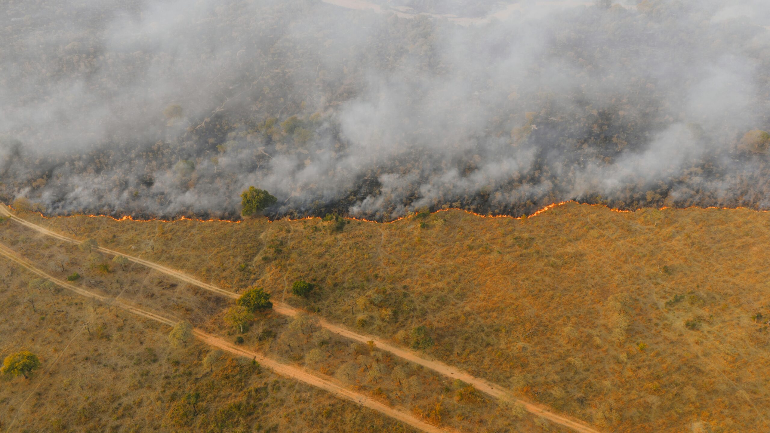
Wildfire and smoke litigation requires a different toolkit: Energy Release Component (ERC), Haines Index, and Keetch-Byram Drought Index (KBDI), combined with sustained wind, relative humidity, and National Lightning Detection Network (NLDN) strike data. The August-September 2020 wildfire season in Eastern Washington recorded sustained east-to-southeast winds of 30-50 mph, relative humidity below 10%, and ERC values at or above the 97th percentile of the historical distribution – a combination directly attributable to an anomalous synoptic ridge over the Pacific Northwest.
Chain of Custody and Data Provenance
Every data file pulled for a Washington case is logged with the retrieval timestamp, the source archive URL, the query parameters, and, on request, an MD5 or SHA-256 checksum. A typical provenance line reads: “KSEA METAR retrieved from NOAA NCEI Climate Data Online interface on 2025-03-10 at 1622 UTC; date range 2025-01-01 through 2025-01-31; format CSV; MD5 = 4c7a2f1b9e3d5c8a6f0e2b7d4a9c1f3e.” Quality control follows ISD QC procedures: missing values coded -9999, suspect values flagged against climatology and adjacent stations, sensor maintenance histories pulled where available. For Puget Sound coastal stations, known siting concerns – salt-spray contamination of anemometers and marine-fog interference with optical sensors – are disclosed and corroborated against neighboring sites.
For current forecasts and warnings, see the NOAA National Weather Service Seattle office: https://www.weather.gov/sew
For Eastern Washington, see the NOAA National Weather Service Spokane office: https://www.weather.gov/otx
Washington’s Four Weather Regimes: Forensic Implications
1. Puget Sound Convergence Zone and Marine Intrusions
The Olympic Mountains deflect onshore Pacific flow into two branches that reconverge over Puget Sound, producing a zone of enhanced lift and precipitation. On active days, the PSCZ can deliver 2 to 4 inches of rain or the equivalent in snow within a corridor 10 to 20 miles wide while areas 15 miles to the north or south remain dry. Premises liability cases involving parking-lot ice or slip-and-fall incidents in King or Snohomish County frequently hinge on whether the incident site fell inside or outside the active convergence zone – a determination that requires multi-station ASOS analysis and KATX Level II radar, not a single airport observation.
The forensic toolkit for PSCZ cases draws on KSEA (Seattle-Tacoma), KBFI (Boeing Field), KPAE (Everett/Paine Field), KRNT (Renton Municipal), and KSMP (Stampede Pass at 3,671 ft) to bracket the zone’s vertical and horizontal extent. GOES-18 satellite imagery captures the cloud-top temperature signature of the convergence circulation.
2. Cascade Orographic and Pass Weather
Seattle-Tacoma International receives roughly 38 inches of precipitation annually. Paradise Ranger Station on Mount Rainier at 5,400 ft holds the world record for greatest annual snowfall measured at a single site – 1,122 inches in 1971-72. Construction-delay, ski-area liability, and avalanche claims require elevation-adjusted analysis; surface observations from valley airports do not represent pass-level or ridge-line conditions. The expert pulls SNOTEL data from the NRCS National Water and Climate Center (Paradise, Stampede Pass, Blewett Pass, Loup Loup), PRISM gridded climate normals, and pass-level observations from Stevens Pass, Snoqualmie Pass, and White Pass. Temperature lapse rates and freeze-thaw counts are computed for the site elevation, not the valley floor.
Motor vehicle accident cases on US-2 over Stevens Pass, I-90 over Snoqualmie Pass, and US-12 over White Pass require understanding of orographic snow bands, elevation-dependent freezing levels, and the timing of WSDOT sanding and plowing operations relative to ASOS-documented precipitation onset.
3. Eastern Washington Continental and Columbia Basin Wind Events
Spokane, Yakima, Kennewick, and Wenatchee operate under a continental climate regime. Summer temperatures exceed 105°F in the Columbia Basin; winter minimums drop below -20°F in the Okanogan Highlands. Diurnal temperature swings routinely exceed 40°F. The Columbia Basin also channels strong pressure-gradient winds from west-to-east gaps in the Cascade Range, producing sustained 40-60 mph gusts along the I-82 corridor between Yakima and the Tri-Cities.
Wind-damage reconstruction in Eastern Washington draws on KGEG (Spokane International), KYKM (Yakima Air Terminal), KPSC (Tri-Cities/Pasco), and KEAT (Wenatchee), plus WSU AgWeatherNet stations covering the agricultural landscape between airports. A claimed roof failure in the Tri-Cities on March 3, 2025, with KPSC ASOS reporting southwest winds gusting to 54 kt at 2130Z, is then weighed against ASCE 7-22 design wind speeds for the relevant Risk Category and the building’s construction-vintage code.
4. Fraser River Outflow and Arctic Intrusions
The most consequential ice events in western Washington arrive not from Pacific moisture but from Arctic air funneled southward through the Fraser River valley in British Columbia and across the Strait of Georgia. This shallow cold air – often only 1,000 to 2,000 ft deep – flows into Bellingham, Skagit, and Whatcom counties and pushes south through the Puget Trough. Surface temperatures at ground level drop to 25-28°F while KSEA may still report 33-34°F, because the airport sits slightly above the cold-air pool’s depth. Premises liability cases along Interstate 5 north of Everett and in the Bellingham corridor frequently involve this layering effect.
Forensic analysis of Fraser outflow events requires integrating surface observations from KBLI (Bellingham), KAWO (Arlington Municipal, Snohomish County), Environment Canada AWOS sites near Abbotsford (CYXX), and rawinsonde sounding data from Quillayute (UIL) to document the cold-pool depth and lateral extent. The difference between 28°F at pavement level and 34°F at airport sensor height is the difference between black ice and wet pavement – and the difference between liability and no liability for a property owner.
Washington’s Evidentiary Framework for Expert Testimony
Washington state courts do not apply the federal Daubert test. Admissibility of scientific and technical expert testimony in Washington state proceedings is governed by Washington Evidence Rule (ER) 702 and the Frye general-acceptance standard as adopted and refined by the Washington Supreme Court. The foundational state decision is State v. Cauthron, 120 Wn.2d 879, 888, 846 P.2d 502 (1993), in which the court applied the Frye test to ask whether the scientific community generally accepts the methodology at issue. The Washington Supreme Court extended Frye analysis to civil cases in Anderson v. Akzo Nobel Coatings, Inc., 172 Wn.2d 593, 260 P.3d 857 (2011), confirming that Frye applies to novel scientific evidence in tort matters. Federal courts in the Western District of Washington (Seattle) and the Eastern District of Washington (Spokane and Yakima) apply the three-part Daubert framework – relevance, reliability, and fit – under Federal Rule of Evidence 702 as amended.
The Frye-Reed inquiry focuses on general acceptance, not a mechanical checklist. Washington courts ask whether the relevant scientific community has accepted the technique as reliable. For atmospheric science, the answer is straightforwardly affirmative: surface observation, NEXRAD radar interrogation, rawinsonde sounding analysis, and historical climatology are described in peer-reviewed literature including the AMS journals Weather and Forecasting, Journal of Applied Meteorology and Climatology, and the Bulletin of the American Meteorological Society; codified in NWS Technical Procedures Bulletins; and routinely accepted by both Washington state and federal courts.
Under Daubert in federal court, the relevant factors for forensic meteorology include: (1) testability – NOAA data queries are reproducible by independent experts; (2) peer review – reconstruction methodology is published in AMS literature; (3) known error rates – ASOS temperature ±0.5°C, wind speed ±1 kt, precipitation gauges ±10-20% (higher for frozen precipitation); (4) governing standards – NWS observation protocols and WMO guidance govern data collection; and (5) general acceptance – forensic meteorology has been recognized as a discipline since the 1980s. Whether any specific opinion satisfies Frye or Daubert in a given Washington case is for the trial court to determine.
Cost Structure for Washington Engagements
Tier 1: Basic Analysis ($200-$300/hr)
Straightforward facts with nearby airport coverage. Includes NCEI data retrieval, written weather summary, and a short opinion letter. Suitable for slip-and-fall cases with documented snow or freezing rain, vehicle accidents with airport-confirmed fog, and construction delays with daily precipitation records. Typical total: $3,000-$5,000 (15-20 hours).
Tier 2: Complex Analysis ($300-$400/hr)
Cases requiring radar interrogation, mesoscale interpretation, mesonet or SNOTEL integration, convergence zone analysis, or deposition support. Wind-damage reconstruction in the Columbia Gorge (Washington side), PSCZ snow or freezing-rain cases, coastal-fog accident analysis, and atmospheric river flood cases typically fall in this tier. Typical total: $8,000-$15,000 (30-40 hours).
Tier 3: Trial Testimony ($400-$500/hr)
Deposition, trial appearance, demonstrative exhibit production, and rebuttal of opposing experts. Reserved for high-value premises, wrongful death, complex construction, and mass-tort atmospheric exposure cases. Typical total: $20,000-$40,000 for a full trial engagement including rebuttal and exhibits.
Additional cost items: travel mileage reimbursed at the prevailing IRS standard business rate (72.5 cents per mile for 2026), deposition attendance (half-day minimum), trial time (full-day minimum plus preparation), and exhibit production (radar loops, surface analyses, animations). Rush turnaround within 48 hours adds a 50% surcharge. Retainers typically equal 10-20 billable hours, with monthly invoicing thereafter.
Practical Implications for Washington Counsel
Engage early. Many data streams are time-sensitive. NWS Level II radar archives at full resolution at NCEI, but some private sensor networks overwrite within days. WSDOT roadway camera footage and pavement temperature data retention is finite – commonly 30 to 60 days. Earlier engagement preserves the strongest evidentiary picture.
Secure site-specific sources. Airport observations may not represent conditions 5-15 miles away, especially when Puget Sound convergence zones, cold-air pooling, or marine-fog incursions are involved. Beyond ASOS/AWOS, identify nearby AgWeatherNet stations, SNOTEL sites, COOP observers, USGS stream gauges, and any municipal or WSDOT weather networks operating in the incident vicinity.
Account for microclimate uncertainty. Reconstruction has inherent error. A station five miles away under different terrain or elevation may not have experienced identical conditions. The expert quantifies that uncertainty and reports it explicitly – high confidence (two or more independent sources agreeing within sensor error), medium (partial agreement or moderate spatial extrapolation), low (sparse data or reliance on model output).
Expect opposing experts. In contested Washington cases, opposing counsel will often retain a competing meteorologist. Methodological disagreement is normal – differences in spatial extrapolation, quality-control handling of suspect values, and climatological framing. Transparent data sourcing and disclosed assumptions are the durable answer under both Frye and Daubert.
Regional fluency matters. A Gulf Coast hurricane specialist is not, by default, a Puget Sound convergence-zone specialist. When vetting a candidate weather expert witness for Washington cases, ask about Fraser River outflow events, Cascade pass observations, SNOTEL workflow, AgWeatherNet familiarity, and prior testimony in Washington courts.
Applications by Practice Area
Premises Liability: Slip-and-Fall Weather Expert Washington Cases
Reconstruct ice formation timing relative to business operating hours and documented maintenance activity. Distinguish freezing rain, refrozen meltwater, frost deposition, and black ice using ASOS surface temperature, dew point, and antecedent precipitation data. Compare onset against any NWS Winter Weather Advisory, Ice Storm Warning, or Special Weather Statement in effect. In convergence-zone cases, map the active precipitation footprint against the incident address using KATX Level II reflectivity at the relevant observation time.
Motor Vehicle Accidents
Visibility reconstruction (fog, dense precipitation, blowing snow); rainfall-rate calculation and hydroplaning analysis from KATX or KOTX radar reflectivity; wind reconstruction for truck rollover and trailer-sway events on I-90 and SR-14; surface temperature analysis for bridge-deck ice formation on Cascade pass crossings and Columbia River bridges. RCW 46.37.020 requires headlights whenever persons and vehicles on the highway are not clearly discernible at a distance of 1,000 feet ahead due to rain or other unfavorable atmospheric conditions; forensic visibility reconstruction ties directly to that statutory threshold.
Construction Defect and Delay
Workable-day calculation against rain, snow, temperature, and wind thresholds specified in the contract’s force majeure clause or the project schedule. Cold-weather concreting analysis under ACI 306 (“Guide to Cold Weather Concreting”), which treats cold weather as conditions where air temperature has fallen to or is expected to fall below 40°F during the protection period, with recommended minimum fresh-concrete placement temperature of approximately 55°F for thin sections and protection maintained until in-place strength reaches roughly 500 psi. Roofing-work stoppages are evaluated against manufacturer wind-speed specifications. Excavation and foundation delays draw on soil temperature, antecedent precipitation, and frost-depth data from SNOTEL and AgWeatherNet.
Property Damage: Wind, Hail, Flood
Peak wind reconstruction against ASCE 7-22 design thresholds and prior code editions. Hail-size estimation from dual-polarimetric NEXRAD signatures (ZDR, ρHV) and the MESH algorithm, ground-truthed against rain-gauge reports and NWS local storm reports. Flood reconstruction using KATX/KOTX radar QPE, NOAA Atlas 14 return-period precipitation, USGS NWIS stream gauges (Washington has more than 500 active gauge sites), and National Water Model output.
Wildfire and Smoke Damage
Eastern Washington wildfire events require fire-weather reconstruction: sustained wind direction and speed from KGEG, KPSC, and AgWeatherNet; relative humidity at the time of origin or spread; ERC and KBDI from RAWS sites operated by the USFS and BLM. NOAA HMS (Hazard Mapping System) documents smoke extent and fire detections from GOES-16/18; HYSPLIT trajectory modeling traces smoke transport for air-quality and smoke-damage cases. Reconstruction distinguishes the meteorologist’s role – establishing conditions – from the fire investigator’s role in causation.
Frequently Asked Questions: Washington State Weather Expert Witness
What qualifications should a Washington weather expert witness have?
A qualified Washington weather expert witness should hold at minimum a bachelor’s degree in meteorology, atmospheric science, or a closely related field from an accredited program. Professional credentials carry weight under ER 702 and the Frye-Reed framework: American Meteorological Society (AMS) certifications, National Weather Association (NWA) Seals of Approval, and EPA-related certifications where applicable. Regional fluency matters – prior work with Pacific Northwest patterns (marine layers, convergence zones, orographic precipitation, Fraser outflow events) and familiarity with Washington-specific data sources, including AgWeatherNet, SNOTEL, and WSDOT roadway weather, should be verified before retention.
How much does it cost to hire a weather expert witness for a Washington case?
Hourly rates range from $200 to $500 depending on credentials and the complexity of the work. Basic analyses run $200-$300/hr. Complex work requiring radar interrogation, convergence zone analysis, or mesonet integration runs $300-$400/hr. Deposition and trial testimony is typically $400-$500/hr. Total budgets generally fall between $3,000 (basic) and $40,000 (full trial engagement including rebuttal and exhibits).
Can smartphone weather-app data be relied on in Washington litigation?
Smartphone apps and personal-station aggregators generally lack the quality-control and chain-of-custody documentation that Washington’s ER 702 analysis under Frye-Reed expects – and that federal courts require under Daubert. Apps interpolate from gridded model output or distant airport data, round values, and rarely document sensor calibration or maintenance. NOAA-archived ASOS/AWOS, COOP, and mesonet data, with documented quality flags and known sensor error budgets, are the more defensible foundation. Whether any specific data source is admissible in a given case is for the trial court to determine.
How far can airport weather data be extrapolated for Washington incidents?
Within roughly 5-10 miles over flat terrain at similar elevation, station observations are generally robust. Beyond that, terrain, elevation, and microclimate effects increase uncertainty sharply. In western Washington, Puget Sound convergence zones, urban heat islands, and cold-air pooling produce real differences over short horizontal distances. In the Cascades, a 1,000-ft elevation change typically corresponds to a 3-4°F temperature change and a potential precipitation-type transition. The forensic answer is multiple stations, mesoscale analysis, and explicit uncertainty quantification.
Does Washington require weather experts to hold a state license?
Washington does not maintain a state licensing board for forensic meteorology. Voluntary credentials – AMS certifications, NWA Seals, EPA-related certifications, and degrees from accredited atmospheric science programs – are the recognized markers of competency. Washington courts evaluate qualifications under ER 702 based on knowledge, skill, experience, training, and education; the Frye inquiry then asks whether the methodology is generally accepted in the scientific community.
When should I hire a weather expert witness for a Washington case?
Whenever weather is a material element of liability, causation, or damages. Common scenarios: slip-and-fall with black ice or freezing rain, vehicle accidents in fog or heavy precipitation, wind damage to structures, construction delay or defect claims tied to weather windows, wrongful death where conditions are in dispute, Eastern Washington wildfire and smoke damage, and product or pavement failures tied to thermal cycles. A short scoping call is usually enough to determine whether reconstruction will support, undermine, or simply clarify the case theory.
Three Mistakes That Weaken Washington Weather Cases
Waiting too long to secure data. Weather data is perishable. NWS Level II radar archives at full resolution at NCEI, but WSDOT camera footage and private station data may overwrite within days. Washington State Patrol incident data and pavement-temperature logs have finite retention windows. Secure data within the first week of the incident.
Relying on unverified sources. Crowd-sourced personal weather stations, Wikipedia climate summaries, and amateur archives lack the quality control of NCEI-archived federal observations. Use NOAA-archived sources, certified stations, and documented networks such as AgWeatherNet and SNOTEL. Courts in both the Western and Eastern Districts of Washington have excluded weather testimony relying solely on commercial weather websites or uncalibrated personal stations.
Ignoring microclimate and elevation. Assuming KSEA represents conditions in Issaquah, Federal Way, or the Snoqualmie Valley overlooks real terrain effects. A 500-ft elevation change can correspond to a 1.5-3°F temperature change – and the difference between rain and freezing rain. A Puget Sound convergence zone can deposit 3 inches of snow on Auburn while the SeaTac tarmac is wet. Site-specific analysis, not single-station extrapolation, is the standard.
Technical Appendix: Methods, Stations, and Archives
Washington NWS Forecast Offices: Seattle (SEW) covering western Washington including the Olympic Peninsula and Puget Sound lowlands; Spokane (OTX) covering eastern Washington, the Columbia Basin, and the Spokane Plateau; Portland (PQR) covering southwest Washington including the Columbia Gorge (WA side) and Clark County.
Washington NEXRAD Sites: KATX (Camano Island/Seattle), KOTX (Spokane), KLGX (Langley Hill, coastal Washington). Adjacent coverage: KRTX (Portland, OR), KCBX (Boise, ID), KPDT (Pendleton, OR).
Key Washington ASOS/AWOS Identifiers: KSEA (Seattle-Tacoma Intl), KBFI (Boeing Field), KPAE (Paine Field/Everett), KTCM (McChord Field/Tacoma), KRNT (Renton Municipal), KAWO (Arlington Municipal, Snohomish County), KOLM (Olympia), KBLI (Bellingham Intl), KTIW (Tacoma Narrows), KGEG (Spokane Intl), KSKA (Fairchild AFB/Spokane), KYKM (Yakima Air Terminal), KPSC (Tri-Cities/Pasco), KEAT (Pangborn/Wenatchee), KSMP (Stampede Pass, 3,671 ft), KELN (Bowers Field/Ellensburg). Auburn Municipal Airport uses FAA identifier S50 (no ICAO code).
Upper-Air Soundings: Quillayute (UIL, WMO 72797), Olympic Peninsula. University of Wyoming sounding archive: weather.uwyo.edu/upperair/sounding.html
Archive URLs:
- NOAA NCEI Climate Data Online: www.ncei.noaa.gov/cdo-web/
- NCEI Integrated Surface Database: www.ncei.noaa.gov/products/land-based-station/integrated-surface-database
- NCEI NEXRAD Level II archive: www.ncei.noaa.gov/products/radar/next-generation-weather-radar
- NWS storm reports (Iowa Environmental Mesonet): mesonet.agron.iastate.edu/lsr/
- WSU AgWeatherNet: weather.wsu.edu
- NRCS SNOTEL: www.nrcs.usda.gov/resources/data-and-reports/snow-and-precipitation
- USGS NWIS stream gauges: waterdata.usgs.gov/nwis
- NOAA Atlas 14 precipitation frequency: hdsc.nws.noaa.gov/hdsc/pfds/
- NDBC marine buoy data: www.ndbc.noaa.gov
- Environment Canada AWOS (Abbotsford CYXX): climate.weather.gc.ca
Sensor uncertainty (NWS / WMO published): ASOS temperature ±0.5°C; wind speed ±1 kt; precipitation gauges ±10-20% (higher for solid precipitation); radar QPE ±30-50%; reanalysis precipitation ±20-40%; reanalysis 2-m temperature ±2-5°F.
Confidence reporting convention: High = two or more independent sources agreeing within stated sensor uncertainty, well-sited instruments, minimal extrapolation. Medium = partial agreement, minor siting concerns, or 5-15 mile extrapolation. Low = sparse data, single source, or substantial reliance on model output.
Seven-Step Chain-of-Custody (Proof of Work)
- Define scope – incident date, time (with Pacific Standard or Pacific Daylight time zone documented in UTC), latitude/longitude, parameters in question.
- Inventory candidate stations – ASOS/AWOS, COOP, AgWeatherNet, SNOTEL, NDBC buoys, Environment Canada sites (for Fraser outflow cases) within the relevant radius.
- Retrieve raw data – pull from NCEI / NDBC / NRCS with timestamped query logs and archive URLs.
- Quality control – apply ISD QC, flag suspect values, cross-check adjacent stations, review NWS and FAA maintenance logs.
- Spatial and vertical adjustment – lapse-rate corrections, IDW or kriging where appropriate, sounding interpolation for Cascade elevation cases.
- Cross-corroboration – radar QPE vs. gauge totals, GOES-18 satellite imagery vs. surface observations, multiple stations vs. single source.
- Uncertainty quantification and reporting – explicit confidence levels, sensitivity analysis, full provenance documentation.
Key Takeaways for Washington Attorneys
- Washington state courts evaluate expert testimony under ER 702 and the Frye-Reed general-acceptance standard; federal courts in the Western and Eastern Districts apply Daubert.
- The Puget Sound Convergence Zone, Cascade orographic gradient, Fraser River outflow events, and Eastern Washington continental extremes each require region-specific, multi-station analysis.
- NOAA NCEI, NWS, WSU AgWeatherNet, SNOTEL, and NDBC buoy data are the defensible base; app-based or single-station data is not.
- Hourly rates run $200-$500 depending on complexity; full trial engagements typically $20,000-$40,000.
- Engage within days of the incident – WSDOT camera footage, private station data, and time-sensitive radar archives can age out of availability quickly.
- Every record retrieved should carry full chain-of-custody: retrieval timestamp, archive URL, query parameters, optional checksums.
- John Bryant is an AMS- and EPA-certified forensic meteorologist and expert witness based in Memphis, Tennessee, specializing in weather reconstruction for slip-and-fall, wind, hail, wildfire, and ice-storm litigation.
Need a Weather Expert Witness for a Washington State Case?
Free initial case review. John H. Bryant, triple-certified forensic meteorologist (AMS – NWA – EPA), 30+ years of weather analysis and expert testimony for plaintiff and defense.
About the Author
John Bryant is a distinguished forensic meteorologist with 30+ years of specialized experience in weather analysis and reconstruction, as well as expert witness testimony. He holds the rare global distinction of triple certification by the American Meteorological Society (AMS), the National Weather Association (NWA), and the Environmental Protection Agency (EPA). He is recognized as one of the few meteorologists worldwide to hold all three certifications concurrently, a credential that underscores his expertise in forensic weather reconstruction and regulatory compliance.
Mr. Bryant provides authoritative expert testimony and forensic weather reconstruction for high-stakes litigation on behalf of both defense and plaintiff. He has created meteorological reports used to support legal arguments at deposition and trial, and he has served as a pivotal expert in wrongful death and personal injury cases on both sides, where his foundational meteorological analysis shaped legal strategies and case outcomes. His expert report in a two-million-dollar case involving extreme weather conditions resulted in a favorable settlement for the client.
He consults closely with legal teams to translate complex atmospheric data into clear, accessible narratives that help judges and juries understand how weather conditions affected specific facts in a case. Mr. Bryant holds a B.S. in Geosciences with an emphasis in Meteorology and Atmospheric Science from Mississippi State University. He previously served as Chief Meteorologist at an ABC affiliate station in Memphis for over a decade, where he directed a professional meteorological team and worked with regional emergency management services during severe weather events. He has also collaborated with a NOAA team to audit and refine AI-driven weather models, conducting rigorous assessments of predictive technologies for weather-sensitive sectors.
The author of this article is not an attorney. This content is intended as an educational resource describing forensic meteorology methods and Washington State’s evidentiary framework. Nothing in this article constitutes a legal opinion or a prediction about admissibility in any specific matter. For legal advice, consult a qualified Washington attorney.