When Should Attorneys Hire a Forensic Meteorologist?
Last Reviewed: | Methodology current as of
By John H. Bryant, Forensic Meteorologist and Expert Witness
What Is the Core Question That Determines Whether a Case Needs a Weather Expert?
The determinative question is this: are the weather conditions at the specific incident location and time genuinely disputed between the parties? When the answer is yes, the case commonly warrants at least a preliminary meteorological review. Full retention depends on the disputed weather element, case value, procedural posture, and whether expert testimony will assist the trier of fact. When the answer is no, the weather is probably peripheral, and the case will resolve on other facts.
That single question is the entire triage framework in compressed form. The rest of this article unpacks it as a practical checklist that any attorney can run through during initial case intake, before any budget is committed to retaining an expert.
The distinction matters for reasons beyond budget allocation. Retaining a forensic meteorologist on every weather-adjacent case wastes resources on cases where weather is a stipulated background fact. Failing to retain one on cases where weather is the controlling causation fact creates a gap that opposing counsel will exploit at deposition or trial. The goal is precise triage: identify which category a case falls into, and act accordingly.
For purposes of this framework, a case falls into one of three categories:
- Central: The outcome of liability, causation, or damages turns directly on what the weather was at a specific place and time. Expert retention is indicated.
- Peripheral: Weather plays a background role; both parties generally agree on the conditions, and the dispute concerns conduct, maintenance, or design rather than atmospheric science. Expert retention is usually not indicated.
- Undetermined: Insufficient information exists to classify the case without preliminary data review. A short preliminary consultation or limited data review can often clarify whether full retention is warranted before any engagement commitment is made.
Which Case Types Most Often Require a Forensic Meteorologist?
Weather is a central factor in several recurring categories of civil litigation. The table below maps common case types to the weather element typically in dispute, along with a centrality rating intended as practical screening guidance rather than a statistical classification of litigation outcomes.
Table 1. Case types, disputed weather elements, and screening-level centrality ratings for forensic meteorology. Ratings are practical guidance; they do not represent a statistical analysis of litigation outcomes.
| Case Type | Disputed Weather Element | Centrality | Primary Weather Data Sources |
|---|---|---|---|
| Hail property damage | Hail size, occurrence time, location | HIGH | WSR-88D base radar and dual-pol where available, MRMS MESH derived product, NCEI Storm Events/Storm Data, NWS LSRs, CoCoRaHS ground reports, site evidence |
| Severe-convective-storm (SCS) wind damage | Peak gust speed, storm path, timing | HIGH | ASOS/AWOS observations, NCEI Storm Events/Storm Data, NEXRAD velocity products, SPC preliminary reports |
| Slip-and-fall (ice, rain) | Air temperature, dew point/wet-bulb context, precipitation type and timing; pavement temperature where separately documented | HIGH | METAR/SPECI, NCEI LCD/ISD, and ASOS 1-minute data via NCEI and Iowa Environmental Mesonet; cooperative and mesonet observations where quality-controlled; NWS/WPC surface analyses |
| Flood and flash-flood injury | Rainfall rate and accumulation, NWS warning timing; flood depth where supported by gauge, survey, or hydraulic evidence | HIGH | Stage IV QPE, USGS NWIS gauges, NOAA Atlas 14 |
| Vehicle accident (fog, ice, rain) | Visibility, air temperature, dew point, precipitation type and timing | MEDIUM | METAR/SPECI, NCEI LCD/ISD, ASOS 1-min data, NWS/WPC surface analyses |
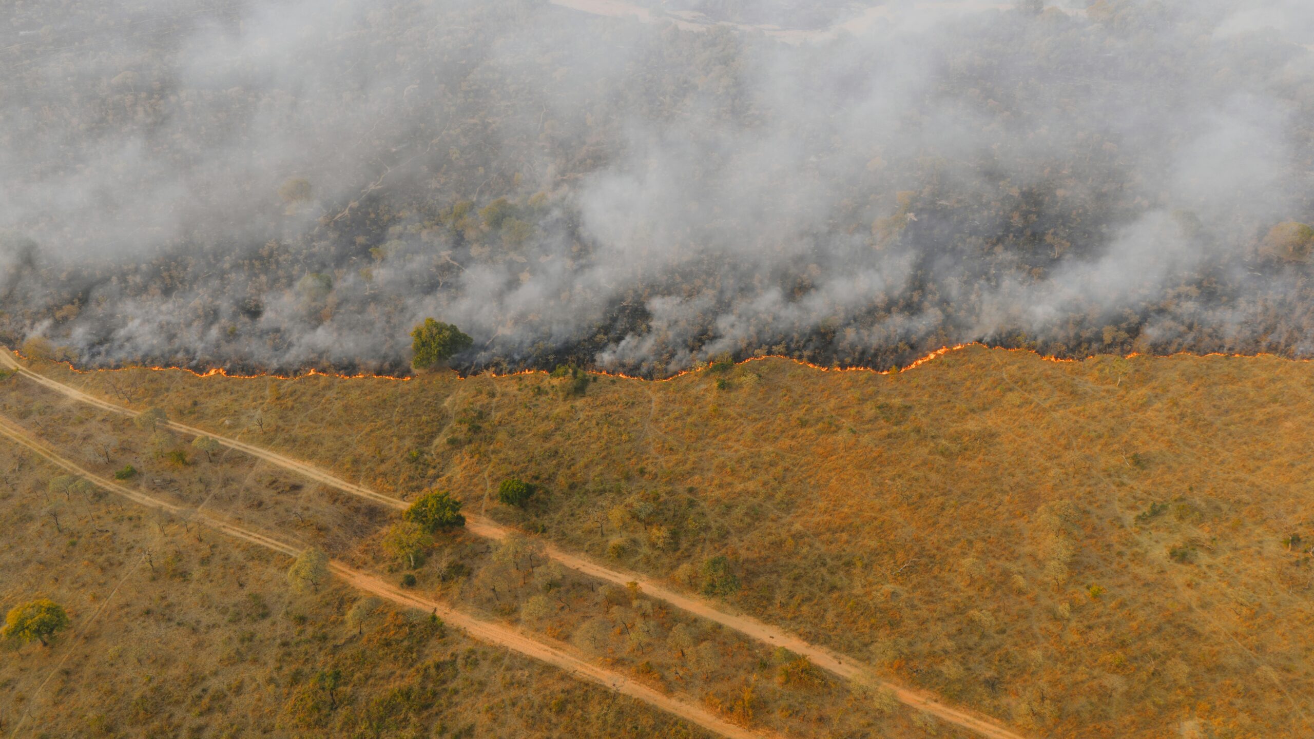
| Wildfire subrogation | Wind speed, direction, relative humidity at ignition | MEDIUM | RAWS network, ASOS, NEXRAD, NFDRS fire weather |
| Construction delay dispute | Precipitation days, temperature thresholds for work stoppage | MEDIUM | NOAA NCEI Local Climatological Data, CoCoRaHS |
| Business interruption | Covered weather peril timing and intensity, warning issuance timing, and documented physical weather impacts; utility outage and access records may provide supporting non-meteorological evidence | VARIES | NWS Local Storm Reports, NCEI Storm Events Database |
Case types rated HIGH commonly warrant a preliminary weather review when the timing, location, intensity, or causation of the weather event is disputed. A forensic meteorologist should document qualifications, data sources reviewed, principles and methods applied, and the application of those methods to the case facts, to support admissibility analysis under Federal Rule of Evidence 702 as amended December 1, 2023, and the gatekeeping standard of Daubert v. Merrell Dow Pharmaceuticals, Inc., 509 U.S. 579 (1993). Cases rated MEDIUM often warrant attorney screening and may warrant a preliminary meteorological review when the weather element is disputed or tied to liability, causation, coverage, or notice.
What Are the Five Screening Questions Every Attorney Should Ask?
These five questions help counsel decide whether a limited preliminary review is warranted before commissioning a full expert report. There is no fixed numeric threshold. Any single issue involving a disputed weather condition, a specific threshold relevant to coverage or liability, an opposing weather report, or time-sensitive evidence can justify contacting a forensic meteorologist for an initial evaluation.
- Are the weather conditions at the specific site and time genuinely disputed?
The carrier says “no severe weather occurred at the loss location.” The claimant says “it was hailing and the roof is destroyed.” A forensic meteorologist evaluates the available radar, surface, warning, and ground-report data and provides an opinion with documented limitations and uncertainty. This is the foundational question. If both sides agree on what the weather was, the case may resolve on conduct rather than atmospheric science. - Does the outcome of the case turn on a specific atmospheric threshold?
Many legal and policy questions turn on whether weather met a defined threshold. Some claim evaluations and engineering assessments use hail-size reference points, but coverage depends on the specific policy language and whether hail caused direct physical damage. The NWS issues a Severe Thunderstorm Warning when thunderstorms are expected to produce winds of 58 mph (50 knots) or higher and/or hail 1.00 inch in diameter or larger. Hydrologic analyses often use precipitation-frequency estimates, such as NOAA Atlas 14, as inputs, but FEMA floodplain mapping is ultimately based on 1-percent-annual-chance base-flood estimates derived from hydraulic and hydrologic modeling, not on precipitation return periods alone. If liability, causation, or damages require demonstrating that weather met or exceeded a defined meteorological threshold, a forensic meteorologist is needed to make that demonstration with documented methodology. - Has opposing counsel already retained a weather expert or cited vendor weather data?
If the defense has filed a meteorologist’s report, or the carrier’s denial letter cites a private vendor weather report or gridded weather product to support its “no severe weather” position, counsel for the party receiving the report should consider retaining a qualified forensic meteorologist to conduct a technical review or rebuttal analysis. Uncontested expert weather reports carry significant weight with adjusters, mediators, and juries. A technical rebuttal analysis is often one of the most cost-effective applications of forensic meteorology in litigation because it targets the specific claims in the opposing report rather than commissioning a full-scope analysis from scratch. - Is there any documented weather event tied to the incident location?
A National Weather Service Severe Thunderstorm Warning or Tornado Warning covering the incident location, a Local Storm Report based on reports received and disseminated by the relevant NWS Weather Forecast Office, a tornado damage survey, or an entry in the NOAA NCEI Storm Events Database near the loss location are all screening flags that warrant site-specific analysis. Many of these records are publicly archived, but availability, completeness, and archive location vary by product, office, date, and event type. A nearby entry does not by itself establish that the reported hazard affected the specific loss location or caused the claimed damage. - Is any relevant evidence time-sensitive?
The NCEI NEXRAD Level II archive at NOAA NCEI includes WSR-88D base data beginning in 1991, with start dates varying by radar site; dual-polarization base moments are available only after dual-pol deployment at the relevant radar site, which began nationally around 2011. Archived radar records are generally accessible, but private weather station records, on-site damage photographs, eyewitness observations, contractor assessments, and local nonfederal records are perishable. A forensic meteorologist retained within 30 to 60 days of an incident can identify and preserve this time-sensitive evidence before it is overwritten or remediated.
What Does Weather as a Central Fact Look Like in Actual Litigation?
Weather becomes a central factor when atmospheric conditions at a specific point in space and time determine the answer to a legal question. Three case archetypes illustrate the difference between peripheral and central weather, and show what a forensic meteorologist contributes in each.
How Does Hail Size Become a Controlling Fact in a Property Damage Claim?
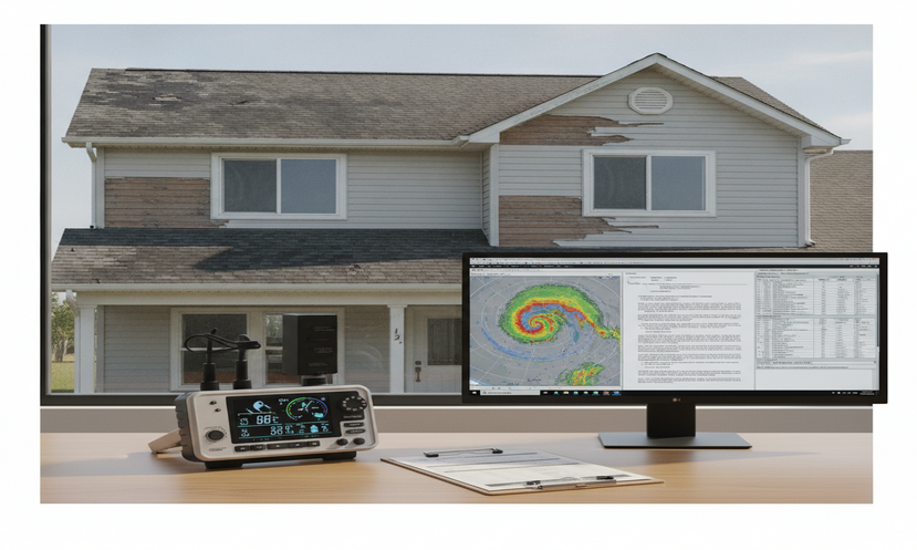
Hail damage claims often involve a dispute about whether hail of sufficient size, timing, and storm-path consistency affected the property on the claimed date. Some engineering assessments and carrier guidelines reference hail-size benchmarks, but coverage turns on the policy language and whether hail caused direct physical loss. When a carrier denies a claim citing “no hail of sufficient size,” the factual question is whether hail consistent with the observed or claimed damage actually occurred at the loss location.
A forensic meteorologist evaluates hail potential using WSR-88D base reflectivity, velocity context, and dual-polarization variables: ZDR (differential reflectivity, which helps characterize particle shape; hail often produces ZDR near 0 dB because tumbling hailstones appear nearly spherical to the radar), CC/ρHV (correlation coefficient, which helps identify mixed hydrometeor types and variable particle shapes), and KDP (specific differential phase). Derived hail products such as MRMS MESH, which estimates hail size from radar reflectivity properties above the environmental 0°C level, supplement but do not replace the base-data analysis. Dual-polarization variables can help identify hail and rain/hail mixtures, but they do not determine exact hail size at the ground; a defensible opinion integrates radar sampling geometry, beam height, environmental thermodynamics, storm motion, NWS reports, nearby CoCoRaHS point observations, site evidence, and stated uncertainty. When radar diagnostics, NWS reports, and ground observations are mutually consistent, the cumulative opinion is stronger than a single-source assertion; each source and its limitations should still be documented.
When Does a Slip-and-Fall Case Require Weather Reconstruction?
Premises liability cases involving ice or freezing rain typically present several meteorological questions: whether precipitation occurred, its type and timing; whether air temperature, dew point, wet-bulb conditions, and any available pavement or ground temperature data supported ice formation or persistence; and how long those conditions existed at the incident location. Notice is a legal issue; the meteorologist’s role is to document the atmospheric record that is relevant to when and how long hazardous conditions may have existed.
ASOS is a joint program of the National Weather Service, Federal Aviation Administration, and Department of Defense. ASOS stations report temperature, dew point, precipitation type, and visibility; NCEI archives these observations through its LCD, ISD, and separate 1-minute ASOS datasets. Iowa Environmental Mesonet provides convenient, processed access to many ASOS observations, but the official archive should be cited from NCEI when available. A forensic meteorologist retrieves the nearest applicable ASOS record, evaluates station siting, distance, exposure, and data quality, and documents the atmospheric sequence relevant to the incident. A properly documented ASOS-based analysis can support Rule 702 reliability if the expert explains the data source, station representativeness, limitations, and application of the method to the incident location and time.
How Does Flood Timing Affect Wrongful Death Litigation?
Flash flood wrongful death cases often pivot on three questions: Were flood conditions foreseeable at the specific location based on the precipitation event underway? Did the National Weather Service issue a Flash Flood Warning covering the incident location before the fatal event? Did the rate of water rise give adequate time for the responsible party to warn, evacuate, or close the affected area?
A forensic meteorologist retrieves Stage IV quantitative precipitation estimates from the NCEP/EMC Stage IV archive. Stage IV is a national multi-sensor precipitation analysis on an approximately 4-km grid, created at NCEP/EMC by mosaicking River Forecast Center analyses that blend radar and gauge information. Hourly, 6-hourly, and 24-hourly accumulations are available. That QPE record is cross-referenced against USGS National Water Information System (NWIS) stream gauge data. Where an appropriate gauge exists, NWIS records can document the hydrologic response at that gauge location and may help infer timing at the incident site, subject to the watershed position, gauge spacing, data completeness, and hydraulic conditions at the relevant reach. NWS archived warning products, accessible through the Iowa Environmental Mesonet’s AFOS archive at mesonet.agron.iastate.edu, provide the issuance times and affected areas for Flash Flood Warnings and related updates. Flash Flood Watches are broader preparedness products and should not be equated with proof that flash flooding was occurring at the incident site. Together, these data streams inform opinions about rainfall timing, warning timing, and hydrologic response, subject to QPE uncertainty, gauge location, and watershed scale.
What Data Can a Forensic Meteorologist Access That Attorneys Cannot Interpret Alone?
Most of the weather data archives used in forensic meteorology are publicly accessible, though retrieval can require technical familiarity with data formats, access tools, and quality-control procedures. The value of a forensic meteorologist is not merely retrieving data; it is selecting the appropriate datasets, evaluating their quality and representativeness, interpreting them correctly, and documenting a reproducible method that courts can evaluate under Federal Rule of Evidence 702 and the Daubert gatekeeping standard.
The table below summarizes commonly used weather data sources, including federal archives, university-hosted access portals, and volunteer observation networks, along with their primary litigation applications.
Table 2. Commonly used weather data sources in forensic meteorology litigation support, with access locations and primary applications. Includes federal archives, university portals, and volunteer networks.
| Data Source | What It Contains | Archive Location |
|---|---|---|
| NEXRAD Level II (WSR-88D) | WSR-88D Level II base data: reflectivity, mean radial velocity, and spectrum width; after dual-polarization deployment at the relevant radar site (operational deployment began ~2011), base dual-pol moments such as ZDR, CC/ρHV, and differential phase are available. MESH is a derived MRMS product, not a Level II base product. Archive available at NCEI beginning in 1991, with coverage varying by radar site. | ncei.noaa.gov/products/radar |
| ASOS 1-Minute Data / METAR / NCEI ISD | Temperature, dew point, wind speed and direction, precipitation type, visibility; NWS/FAA/DOD joint program. NCEI archives via LCD, ISD, and separate 1-minute datasets; IEM provides processed access to many records | ncei.noaa.gov (LCD, ISD, ASOS 1-min); IEM ASOS is a processed access portal |
| NCEI Storm Events Database | Records entered by NWS and used for NOAA Storm Data; information sourced from damage surveys, emergency managers, law enforcement, cooperative observers, SKYWARN spotters, media, and other sources; values may be measured, estimated, surveyed, or reported; searchable by date, county, and event type | ncei.noaa.gov/stormevents/ |
| CoCoRaHS Network | Volunteer observer precipitation and hail reports; useful for localized ground observations and hail-pad records where observer coverage exists; not a gridded product | cocorahs.org |
| USGS NWIS Stream Gauges | Real-time and historical stage and discharge at USGS monitoring locations; useful for documenting hydrologic response and rate-of-rise at or near a gauge, subject to gauge location, datum, watershed position, and hydraulic representativeness | waterdata.usgs.gov/nwis |
| Stage IV QPE (NCEP/EMC) | National multi-sensor precipitation analysis on an approximately 4-km grid, created at NCEP/EMC by mosaicking RFC Stage III analyses that blend radar and gauge data; hourly, 6-hourly, and 24-hourly accumulations available | data.eol.ucar.edu (UCAR/EOL Stage IV QPE collection) |
| NOAA Atlas 14 | Precipitation-frequency estimates and confidence intervals for specified durations and recurrence intervals; useful for rainfall-threshold analysis, but not a direct definition of the 1-percent-annual-chance flood or FEMA floodplain boundary | hdsc.nws.noaa.gov/pfds/ |
| NWS Archived Products (AFOS) | Archived NWS text products including many warnings, advisories, Local Storm Reports, area forecast discussions, and special weather statements, depending on product availability and archive completeness; issuance timestamps are relevant to notice and foreseeability arguments | mesonet.agron.iastate.edu/wx/afos/ |
The expert’s method is what courts scrutinize at admissibility hearings. Courts may consider factors such as testing, peer review, error rate, applicable standards, and general acceptance in the relevant scientific community, but the Rule 702 analysis focuses on sufficient facts or data, reliable principles and methods, and reliable application to the case. A forensic meteorologist should document the data sources reviewed, the method applied, the limitations of each source, and the basis for the opinion. Rule 702, as amended December 1, 2023, requires the proponent to show these elements are more likely than not satisfied.
How Does Early Retention Change Discovery and Litigation Strategy?
Early retention changes three things that late retention cannot fix: evidence preservation, discovery scope, and case posture before mediation. A forensic meteorologist retained within 30 days of an incident operates at a fundamentally different evidentiary advantage than one retained 18 months later, after a lawsuit is filed and discovery has closed.
What Categories of Weather Evidence Are Perishable?
The following categories of evidence may deteriorate, be altered, or become difficult to obtain as time passes. A forensic meteorologist who reviews the case early identifies and preserves each of them.
- Private weather station records: Personal weather station records may have uncertain retention, metadata, calibration, siting, and quality-control histories. A forensic meteorologist who identifies a potentially relevant private station early can evaluate its representativeness, including siting, exposure, sensor quality, and consistency with official observations, and help counsel determine whether to request and preserve the record. Distance alone does not establish usability.
- On-site damage documentation: Property owners, insurers, and contractors may begin remediation before litigation is filed, potentially altering hail impact patterns, water-ingress evidence, tree-fall orientation, or wind-damage indicators. Photographs taken before remediation, when evaluated with radar storm motion and site-specific observations, can support the meteorological timing and plausibility of the claimed weather cause; structural causation may require separate engineering or damage-assessment expertise.
- Contemporaneous witness observations: Eyewitness memory of specific meteorological conditions, including the sound of large hail on a metal roof, the timing of power outages relative to the storm passage, or the depth of standing water in a particular location, degrades with time. Early identification of witnesses who posted real-time weather observations on social media, filed insurance claim photos, or called 911 during the event creates a contemporaneous record that deposition testimony alone cannot replicate.
- NWS field damage surveys: After significant tornado or severe thunderstorm events, NWS offices conduct field surveys and publish EF-scale tornado track maps or straight-line wind event assessments. These surveys are permanent public records. Published NWS surveys, LSRs, Storm Data entries, and any available damage assessment team records should be requested through appropriate public-records channels promptly after the event.
- Utility and traffic records: Power outage timestamps, traffic signal failure logs, and municipal storm drain activation records are maintained by local entities under varying retention schedules. A forensic meteorologist can identify potentially relevant records so counsel can issue timely preservation notices.
How Does a Pre-Discovery Weather Analysis Shape Discovery Requests?
A forensic meteorologist who reviews a case before discovery opens can identify three pieces of information that directly control discovery strategy. First, the specific NWS Weather Forecast Office (WFO) with jurisdiction over the incident location, which determines which archived warning products, LSRs, and damage surveys are relevant. Second, the WSR-88D radar station providing primary coverage, for example KNQA for the greater Memphis area, KTLX for Oklahoma City, or KLIX for the New Orleans metropolitan area, which determines which radar volumes and elevation scans should be reviewed, and how range, beam height, beam width, terrain, and sampling geometry affect interpretation near the ground. Third, the most representative ASOS/AWOS station, considering distance, elevation, exposure, siting, terrain, and the meteorological variable at issue, which determines whether surface observation data can be defensibly applied to the incident location.
That intelligence drives targeted discovery requests for the opposing party’s expert materials, any automated vendor reports the carrier relied on in its denial letter, including the input data, interpolation or modeling method, validation, uncertainty, and whether the underlying methodology can be examined in discovery, and any internal weather data the property owner, building manager, construction contractor, or transportation company maintained for the date of loss.
Early retention also shapes mediation posture in a concrete way. When a forensic meteorologist delivers a documented preliminary weather narrative before a mediation conference, the carrier or opposing party cannot rely on vague characterizations of the event. Specific, sourced values from documented data, for example a peak gust recorded at the relevant ASOS station confirmed by NEXRAD velocity products consistent with the storm passage, or nearby hail reports from NWS and CoCoRaHS that are temporally and spatially consistent with the claimed loss, shift the settlement conversation in a way that unsupported characterizations cannot. Any specific values cited in the analysis must be tied to a cited station, product, date, and event.
What Indicators Suggest Weather Is Peripheral Rather Than Central?
Not every weather-adjacent case justifies a forensic meteorology engagement. Peripheral weather indicators signal that the case will resolve on conduct, maintenance, design, or causation factors unrelated to atmospheric science. Identifying these indicators early saves expert budget for cases where it creates genuine leverage.
The following conditions collectively suggest that weather is peripheral to the case:
- Both parties agree on the general weather conditions. For example, both sides stipulate that it was raining, and the dispute is entirely about whether the property owner maintained adequate drainage, not about the rainfall rate or whether the rain was foreseeable.
- No NWS Severe Thunderstorm Warning, Tornado Warning, Flash Flood Warning, or Winter Storm Warning covered the incident location on the date of loss. Absence of a warning does not rule out hazardous or legally relevant weather at the incident location; localized icing, non-severe wind, heavy rainfall, fog, and other hazardous conditions can occur below warning thresholds or in areas with limited observation coverage.
- A search of the NOAA NCEI Storm Events Database for the relevant county, nearby counties, date, and event type returns no relevant entries. Radius or proximity searches should be treated as screening tools only and adjusted to the hazard type and geography.
- The weather element involved is routine, non-severe precipitation (a light drizzle, a moderate rain shower in a climatologically expected pattern) and the dispute is about a property owner’s failure to maintain drainage systems, repair a known defect, or provide adequate slip-resistant surfaces, rather than about whether an extraordinary atmospheric event occurred.
- The absence of an opposing weather expert or weather-data citation in a denial letter is a litigation-context factor, not a meteorological indicator. Centrality should be evaluated based on whether timing, location, intensity, threshold, causation, or notice depends on disputed weather facts.
- The case value does not support the proportionate cost of expert retention. Counsel should request a written fee schedule and scope-specific budget estimate before engagement. Even in lower-value cases, a short introductory screening call can clarify whether expert investment is warranted before committing to full retention.
One caution applies to this list: the absence of a Storm Events Database entry does not prove that severe weather did not occur. NWS storm reports are observation-dependent, and significant events in rural or low-population-density areas are routinely under-reported. A forensic meteorologist can examine the radar archive for the date in question and determine independently whether the data supports a severe weather conclusion, even when no formal LSR or Storm Events entry exists for the specific location.
What Does Initial Forensic Meteorology Engagement Cost and Include?
Forensic meteorologist rates vary by expert, event complexity, data archives required, report scope, deposition and testimony role, and jurisdiction. Introductory screening calls may be offered at no charge. Written preliminary analyses, data retrieval, and expert opinions are billed under a written fee schedule. Counsel should request the fee schedule and a scope-specific budget estimate before engagement.
A preliminary case evaluation may include the following deliverables, depending on scope and budget, before any full expert report is commissioned:
- Case eligibility assessment: A written determination of whether weather functions as central, peripheral, or undetermined in the specific case, with identification of the specific data sources reviewed, the weather elements documented or absent, and the gaps in the evidentiary record that a full analysis would address.
- Data inventory: A listing of the archived datasets retrieved during the preliminary review, including ASOS station identifiers (ICAO codes such as
KMEMorKBNA), WSR-88D radar stations providing primary and secondary coverage, and any NCEI Storm Events Database entries, CoCoRaHS observer reports, or NWS Local Storm Reports that corroborate or contradict the claimed weather event. - Evidence preservation memo: A written memo to counsel identifying any time-sensitive evidence that requires immediate action, including private weather station records at risk of overwrite, on-site damage documentation at risk of remediation, and any field surveys or supplemental agency records that should be requested promptly.
- Preliminary weather narrative: A factual, attorney-ready summary of documented atmospheric conditions at the incident location and time, drawn from archived public datasets, official federal records where available, and relevant site-specific records, suitable for inclusion in demand correspondence, mediation briefs, or insurance coverage letters. This document explicitly is not a full expert report and does not constitute deposition-ready analysis. It is a preliminary evidentiary framework that informs full engagement decisions.
The preliminary engagement defines scope for a full expert report, identifies the data sources that will anchor opinions, and gives both the attorney and the expert an opportunity to assess whether the atmospheric record supports the client’s claimed factual narrative before full expert retention budget is committed.
What Questions Should Attorneys Ask When Vetting a Forensic Meteorologist?
Not all meteorologists have forensic training, prior expert witness experience, or the credentialing structure that supports cross-examination in a Daubert jurisdiction. Attorneys should ask the following questions before retaining any weather expert, regardless of the source through which the expert was identified.
- What professional certifications does the expert hold, and by which organizations? The AMS designation indicates that AMS has evaluated the individual’s meteorological background, specialized knowledge, professional experience, character, and adherence to professional standards. The National Weather Association offers Broadcast and Digital Seals of Approval. Holding recognized credentials from multiple meteorological or regulatory professional bodies can indicate breadth of expertise; counsel should ask the expert to explain what each credential requires and how it applies to the work in the case.
- Has the expert testified in federal court under the Daubert standard, and in how many cases? Testimony experience under Daubert v. Merrell Dow Pharmaceuticals, Inc., 509 U.S. 579 (1993), is directly relevant to the reliability and methodology questions a judge will ask at a Daubert hearing. Request the expert’s prior testimony list, ask about Daubert challenges to the expert’s prior opinions, and ask for copies of any orders on admissibility.
- Which primary weather data sources does the expert rely on, and which are official federal archives, university-hosted portals, volunteer networks, or vendor sources? Publicly available datasets from NOAA/NCEI, NWS, USGS NWIS, and CoCoRaHS are generally more transparent than proprietary vendor outputs. Each source still requires documentation of methodology, QC procedures, representativeness, and limitations. Private vendor reports should be evaluated for input data, interpolation or model methodology, validation, uncertainty quantification, and whether the underlying method can be examined in discovery.
- Can the expert explain NEXRAD dual-pol variables and hail reconstruction methodology in lay terms? A forensic meteorologist should be able to explain how reflectivity, velocity context, ZDR, CC/ρHV, KDP, beam height, melting-layer height, storm motion, MRMS MESH, and ground reports are interpreted together, and why no single radar variable determines exact hail size at the ground. Ask the expert to walk through the methodology and its limitations in plain English before you retain.
- Does the expert work for both plaintiff and defense? A balanced plaintiff/defense practice may reduce perceived side-selection bias, but methodological independence is demonstrated by transparent methods, consistent analytical standards, and opinions that follow the data regardless of the retaining party. Ask for examples of cases where the expert’s findings did not support the retaining party’s position.
- How does the expert quantify uncertainty in past-weather reconstruction? Experts who claim unwarranted certainty about historical weather conditions invite reliability challenges under Rule 702. Credible forensic meteorology opinions state confidence, acknowledge uncertainty and data limitations, and clearly delineate what the atmospheric record supports and what it does not. Ask for an example of how the expert has documented uncertainty in a prior report.
Methods and Sources
The data sources and legal references cited in this article are publicly accessible or publicly documented. Federal archives are distinguished from university-hosted access portals and volunteer observation networks where relevant. URLs should be verified immediately before publication and periodically reviewed for broken links or changed archive locations. Legal citations reflect statutes and case law as of the date shown.
- NOAA National Centers for Environmental Information (NCEI), NEXRAD Level II Radar Archive (WSR-88D base data beginning in 1991, start date varies by radar site): ncei.noaa.gov/products/radar
- NOAA NCEI Storm Events Database: records entered by NWS and used to create NOAA Storm Data; values and narratives depend on source reports, surveys, and NWS event documentation: ncei.noaa.gov/stormevents/
- Iowa Environmental Mesonet (IEM), ASOS 1-Minute Data Archive: mesonet.agron.iastate.edu/ASOS/
- Iowa Environmental Mesonet (IEM), NWS Archived Text Products (AFOS): mesonet.agron.iastate.edu/wx/afos/
- Community Collaborative Rain, Hail and Snow Network (CoCoRaHS), National Hail and Precipitation Observer Reports: cocorahs.org
- USGS National Water Information System (NWIS), Real-Time and Historical Stream Gauge Data: waterdata.usgs.gov/nwis
- NOAA Hydrometeorological Design Studies Center, NOAA Atlas 14 Precipitation Frequency Estimates (return periods 2-year through 1000-year): hdsc.nws.noaa.gov/hdsc/pfds/
- NCEP/EMC Stage IV Multi-Sensor Quantitative Precipitation Estimates (approximately 4-km grid), via UCAR/EOL Stage IV archive: data.eol.ucar.edu
- Federal Rule of Evidence 702, as amended effective December 1, 2023 (expert testimony admissibility standard): law.cornell.edu/rules/fre/rule_702
- Daubert v. Merrell Dow Pharmaceuticals, Inc., 509 U.S. 579 (1993) (federal standard for scientific expert admissibility)
- NWS Severe Thunderstorm Warning criteria: thunderstorm winds of 58 mph (50 knots) or higher and/or hail 1.00 inch in diameter or larger, per NWS warning criteria (weather.gov/car/Warning_Criteria)
- American Meteorological Society AMS Certified Meteorologist (CCM) Program: ametsoc.org CCM program page
- National Weather Association Seal of Approval: nwas.org/seal-of-approval/ (confirm exact credential held before publication)
This article is informational and is not legal advice. For legal guidance specific to your jurisdiction and case facts, consult a licensed attorney.