 All Posts


The Hawk Fire is an active wildfire near Reno, Nevada, resulting in evacuations, multi-agency responses, and ongoing threats to communities and natural resources. Real-time tracking of changes in acreage, agency coordination, and public alerts is critical for legal, insurance, and environmental professionals.
This article provides an expert-led review of Hawk Fire’s current status, containment progress, and the impacts on residents, claims, and compliance. All incident analysis is informed by the forensic meteorology experience at Weather & Climate Expert, with service tailored for attorneys, insurers, and stakeholders.
Key Takeaways
- Hawk Fire is a major Reno Nevada wildfire requiring ongoing incident tracking
- Rapid progression has prompted evacuations and road closures
- Containment efforts are approaching completion with inter-agency coordination
- Community and habitat impacts are significant for legal and insurance cases
- Up-to-date mapping and forensic meteorology support informed analysis
Incident Overview and Current Status
Understanding incident details, fire progression, and the scope of the Hawk Fire is critical for risk assessment and claims documentation. This section examines origins, scale, and a timeline of key changes.
What is the Hawk Fire and how did it start?
The Hawk Fire ignited near Reno, Nevada, with initial reports suggesting human activity as the likely cause. Investigations have traced ignition to negligence in an area known for high wildfire risk, but the precise origin is still under review. Law enforcement collaborates with fire investigations through on-site analysis and witness interviews, following standard protocols for major Nevada wildfires.
What is the current status and scope of the Hawk Fire?
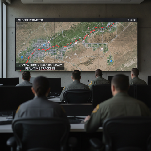
The Hawk Fire has burned several thousand acres, with containment recently approaching 98 percent. The affected fire perimeter stretches near the Reno city limits and into neighboring rural zones, showing rapid growth over the first 48 hours and tapering as suppression succeeded. Containment lines have held as coordinated agency work reduced the fire’s spread.
How has the Hawk Fire progressed over time?
Since ignition, the Hawk Fire expanded quickly under dry, windy conditions, triggering evacuation alerts and a swift multi-agency response. Key milestones included the initial explosion to 2,500 acres, city-adjacent rural evacuations, and the recent report of 98 percent containment. According to a 2024 NOAA wildfire incident tracking analysis, structured and timed updates play a vital role in wildfire response management.
Impact, Evacuations, and Community Alerts
Attention to evacuation orders, property impacts, and alerts is essential for resident safety and legal-claims processes. The following sections provide a targeted update for affected communities, authorities, and compliance professionals.
Who has been evacuated, and how are residents affected?
Evacuation orders have covered residential sectors north and east of Reno, with impacts on rural communities adjacent to the Hawk Fire’s perimeter. Return protocols are based on containment benchmarks, official all-clear notifications, and utility restoration in affected corridors. Communities have reported school and service closures, air quality advisories, and restricted access, complicating daily life and raising issues for property owners and critical infrastructure operators.
What are the key community alerts and road closures?
Managing community alerts and ensuring road safety are priorities as the Hawk Fire evolves. Official notifications use multiple platforms for timely and accurate updates.
- Key roads, including main corridors connecting northern Reno and outlying communities, are closed for fire line protection
- GIS-based dashboards facilitate real-time perimeter and closure mapping
- Emergency alert systems (EAS) broadcast evacuation and re-entry orders
- WordPress and similar CMS platforms distribute rapid public safety messages
- Local law enforcement maintains checkpoint presence for compliance and safety
How has the wildfire affected wildlife and natural habitats?
The Reno area faces increased risk to sensitive habitats as the Hawk Fire’s perimeter advances into undeveloped land. Area wildlife and ecosystems have been disrupted by both fire and smoke. Restoration plans include scheduled habitat assessment and rehabilitation, in line with guidance from environmental authorities. According to a 2023 University of Nevada wildfire mitigation study, prompt intervention is critical for limiting post-fire erosion and supporting habitat recovery.
Primary Evacuation Orders and Affected Areas
Recent announcements prioritize evacuation for the following high-risk zones due to their proximity and vulnerability:
- Northern and eastern sectors near Reno city limits
- Rural communities adjacent to fire perimeter
- Schools and healthcare facilities in designated evacuation corridors
- Areas with reported structural damage and high community risk
- Sensitive environmental and wildlife habitats
Containment Efforts and Agency Response
Comprehensive agency coordination, robust suppression tactics, and careful monitoring define the current response. This section details inter-agency cooperation, tactical containment, and meteorological influences shaping Hawk Fire operations.
Which agencies are leading the response and what resources are committed?
The Hawk Fire response is directed by a unified command, including state and federal fire agencies, local emergency services, and support from the Nevada Division of Emergency Management. Resource assignments are managed systematically to prevent personnel fatigue and optimize asset deployment. Agency coordination determines allocation of engines, aerial resources, dozer teams, and logistical support, which is fundamental to containment planning.
What is the status of suppression, containment, and repair efforts?
Containment lines have successfully held, with tactical burns and direct line construction reinforcing defensive positions. Suppression tactics include aerial water drops, hand crews, and monitoring of hot spots. As containment has reached 98 percent, transition to suppression repair is underway, including soil stabilization and infrastructure testing to facilitate safe re-entry and recovery efforts.
How are weather conditions and forecasts affecting the firefighting response?
Weather variables such as wind shifts, humidity, and short-term drought conditions have steered suppression strategies. Meteorological monitoring tools, including mobile weather stations and forecast modeling, give real-time guidance on tactical decisions. Direct consultation with forensic meteorology informs safety parameters and project developments, optimizing resource deployment based on predicted fire behavior.

Fast Facts: Resources, Timelines, and Environmental Considerations
Legal and insurance professionals require quick access to verified incident facts throughout the Hawk Fire response. The most essential data includes:
- Incident #116444, referenced in both state and federal reporting systems
- Timeline covering ignition, containment growth, major evacuation events, and the recovery phase
- Fire perimeter mapping, updated through GIS overlays for legal documentation
- Suppression and repair planning that extends beyond containment for compliance and claims review
Conclusion
Active monitoring of the Hawk Fire, dynamic alerts, and rigorous inter-agency cooperation establish a crucial foundation for legal, insurance, and compliance work. The value of verified meteorological reporting and expert analysis supports evidence-based decisions in both short-term responses and long-term recovery. For ongoing guidance and authoritative weather reconstruction, consult Weather & Climate Expert.
Frequently Asked Questions
What are the main legal considerations for wildfire-related insurance claims?
Legal teams and insurance professionals should gather complete records of fire progression, document all property and structural damage, and reference official incident maps. Comprehensive documentation and prompt retrieval of certified agency reports streamline claim submission and facilitate dispute resolution if required.
How do current weather conditions influence the Hawk Fire’s behavior?
Wind patterns, temperature fluctuations, and humidity levels significantly impact fire spread, suppression tactics, and evacuation zones. Close monitoring of meteorological reports and real-time updates is essential throughout wildfire incidents.
What agencies are supporting evacuation and road closure notifications?
Local authorities, such as county offices and first response crews, coordinate with the Nevada Division of Emergency Management and federal partners. GIS dashboards and emergency alert services are vital for maintaining situational awareness and public safety updates.
Will repair, recovery, and environmental monitoring continue after containment?
Post-containment plans call for site safety checks, environmental assessments, and phased repair programs. Structural review, habitat restoration, and continuous monitoring remain priorities for all affected parties and areas.
How can legal teams obtain verified, up-to-date Hawk Fire maps and reports?
Verified maps and incident reports are accessible through official state and federal incident dashboards. Additionally, forensic meteorology services offer up-to-date mapping and detailed compliance documentation for legal casework and claims review.
Ongoing incident tracking, near-complete Hawk Fire containment, and evolving community impact remain critical for insurance, legal, and environmental review. Forensic meteorology insights and structured documentation support evidence-based recovery and planning, led by John Bryant.